Lake
Superior, June 2014
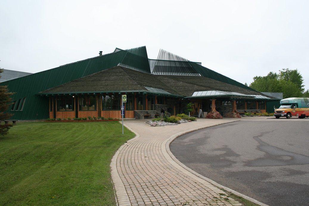
Northern Great Lakes Visitor's Center
(Click on Images for Larger Picture)
|
We
took a trip in June this year to the South and North
Shore of Lake Superior, and joining us was part of
our family. We had been wanting to get some of
our family up to this area and share some of the
wonderful places and things to do. Our first
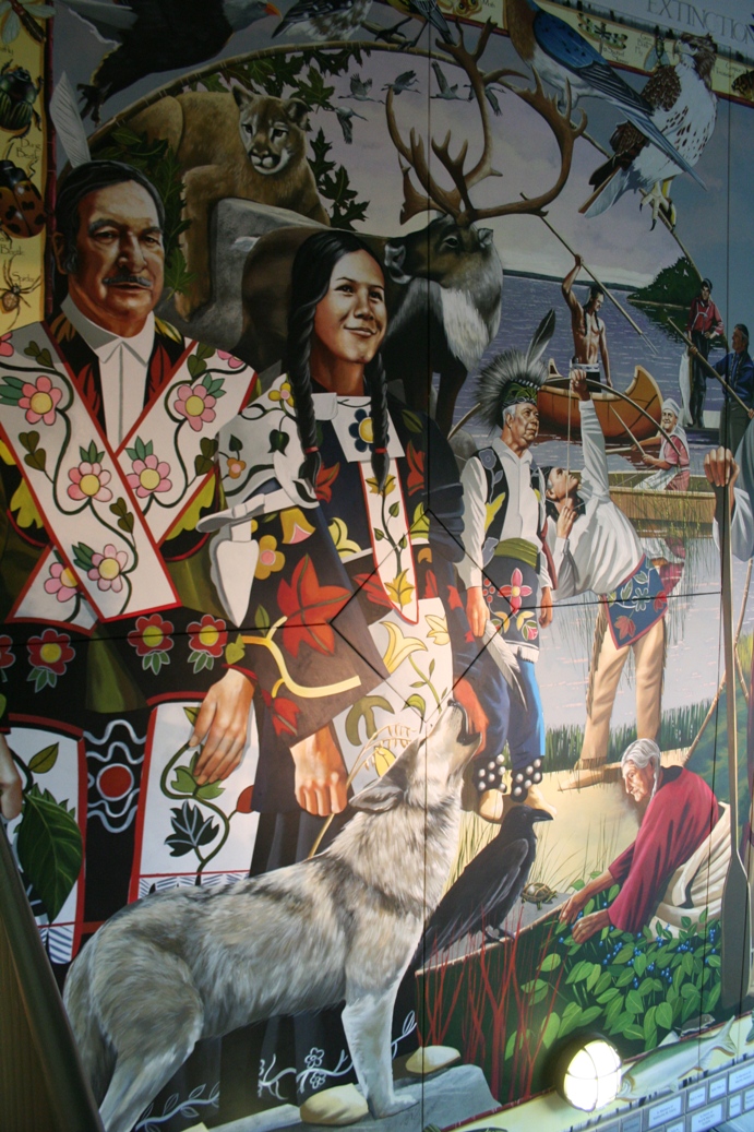
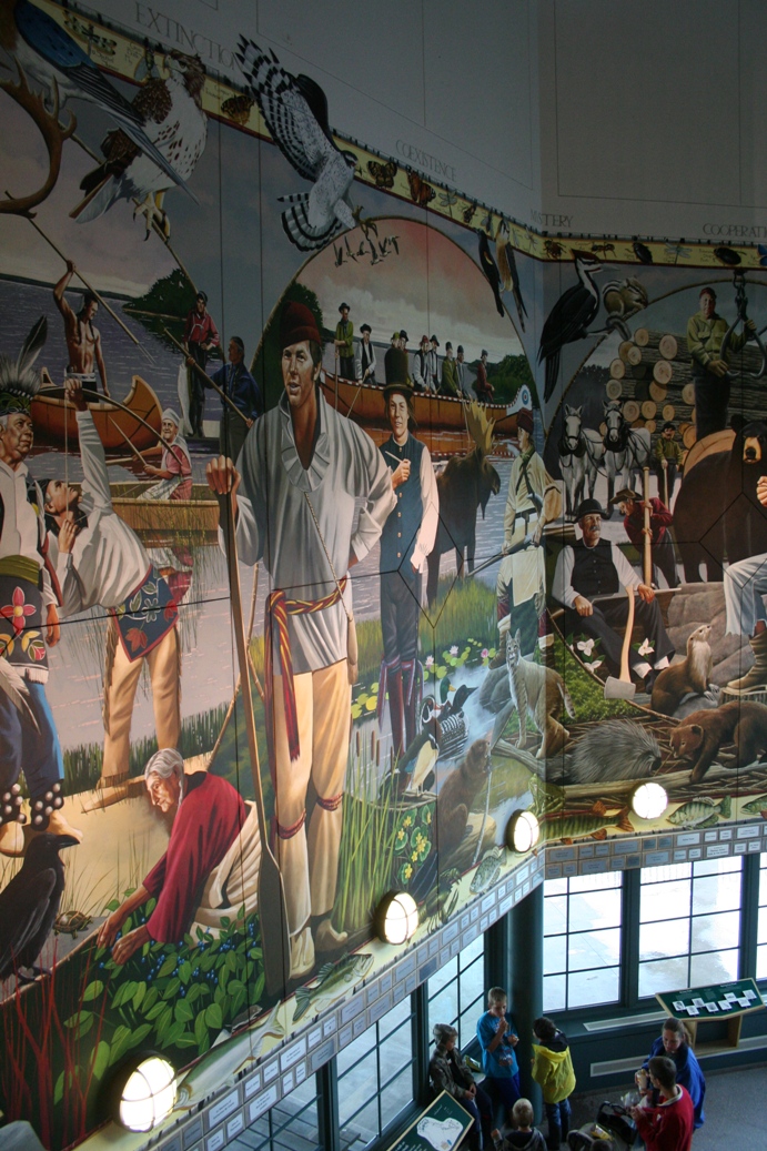
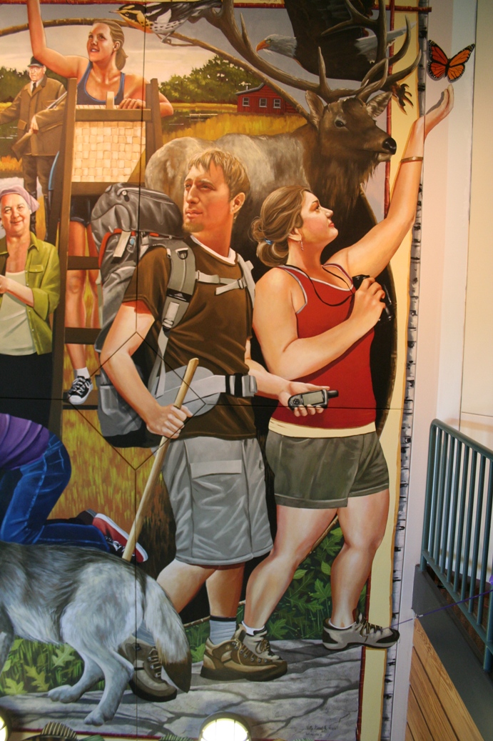
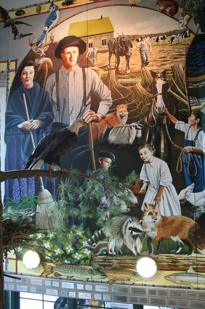
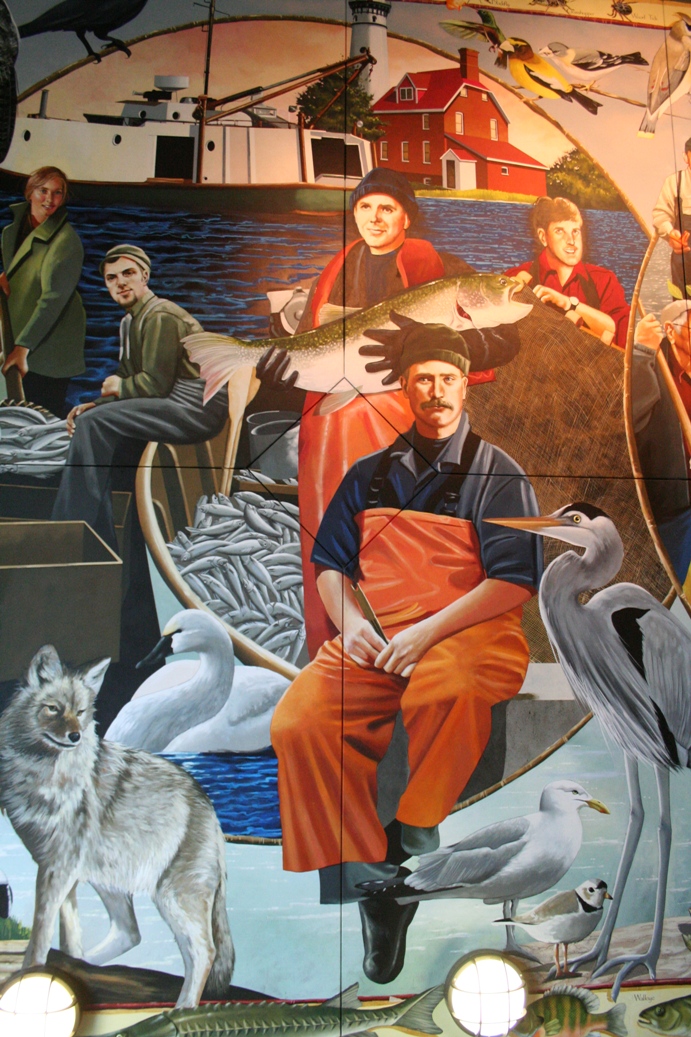
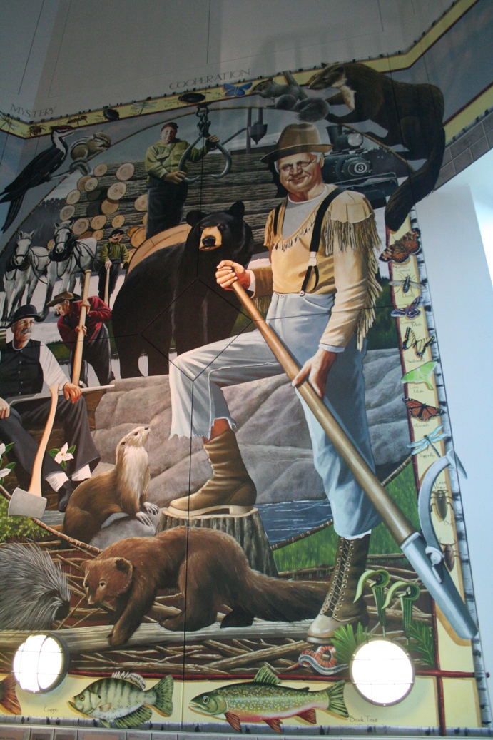
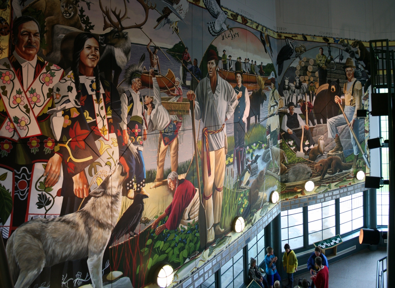
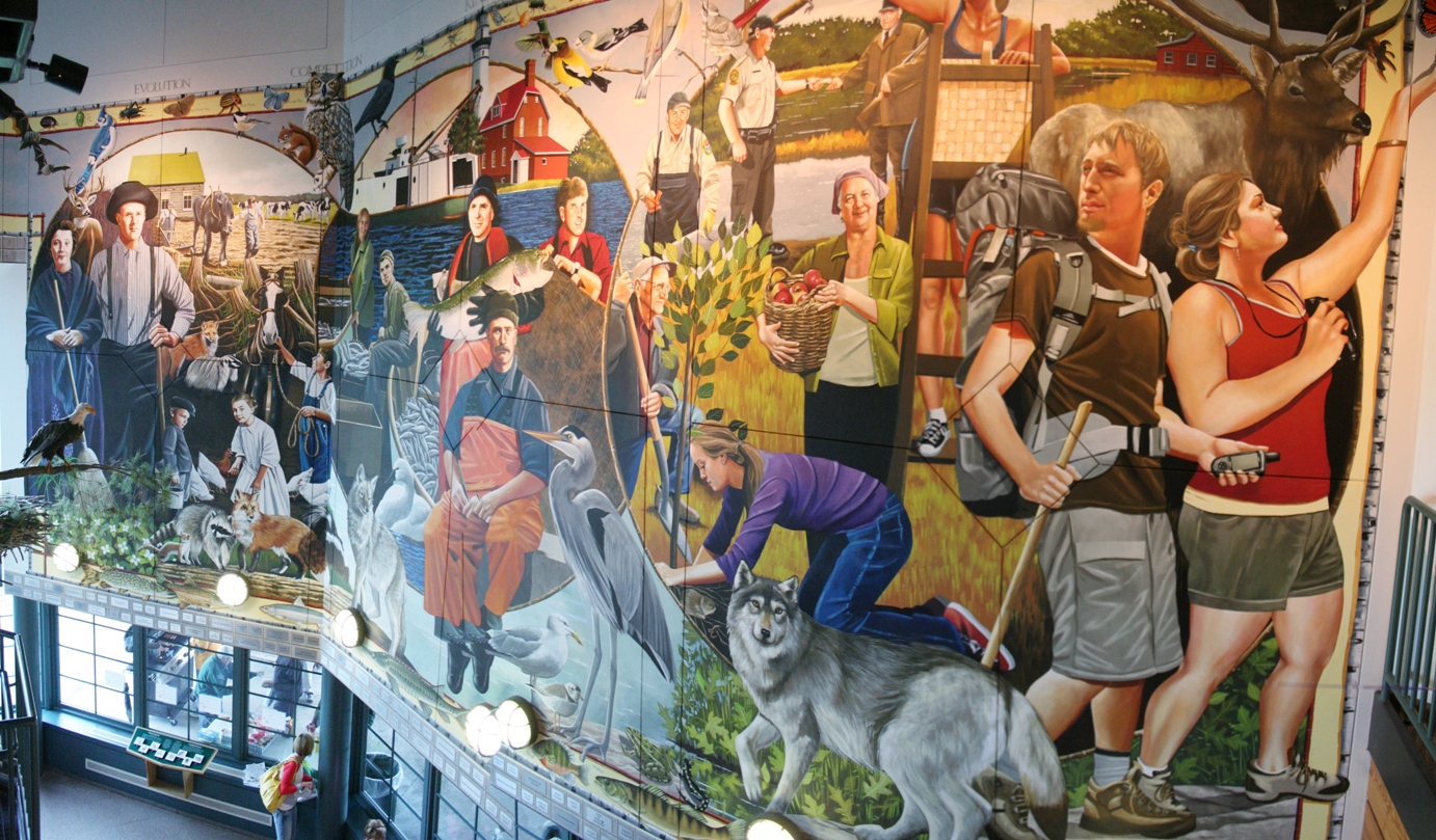
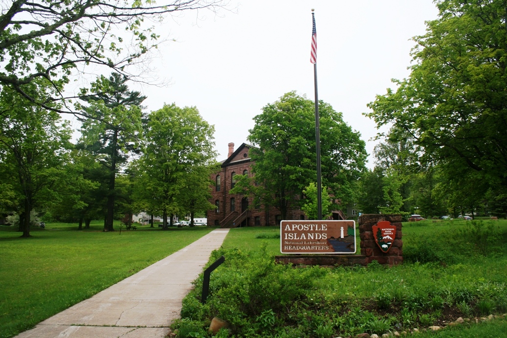
stop was in the area of Ashland and Bayfield
Wisconsin. The photos above are of a mural
that hangs in the
Northern
Great Lakes Visitor's Center in Ashland,
Wisconsin. The mural represents all of the
people who have inhabited this area from the
beginning all the way to modern times.
The
two panoramic photos are of the mural in its
entirety. It was a bit difficult to get the
photos necessary for the panoramic one on the left.
|
|

|
|
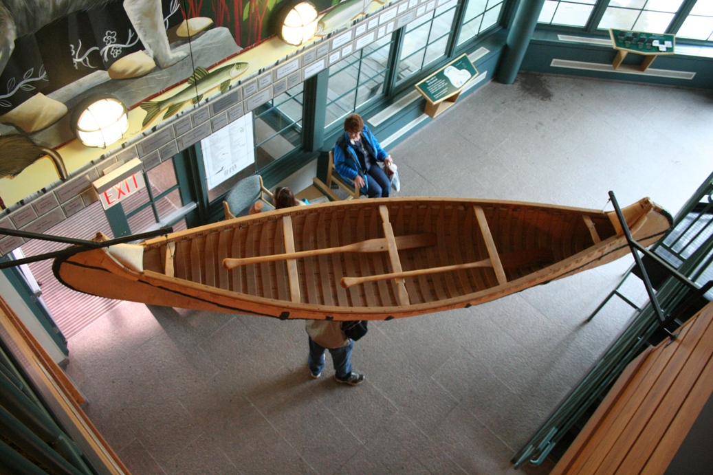
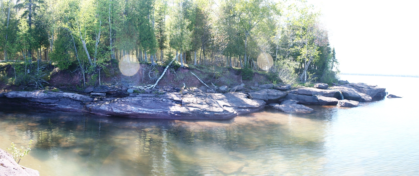
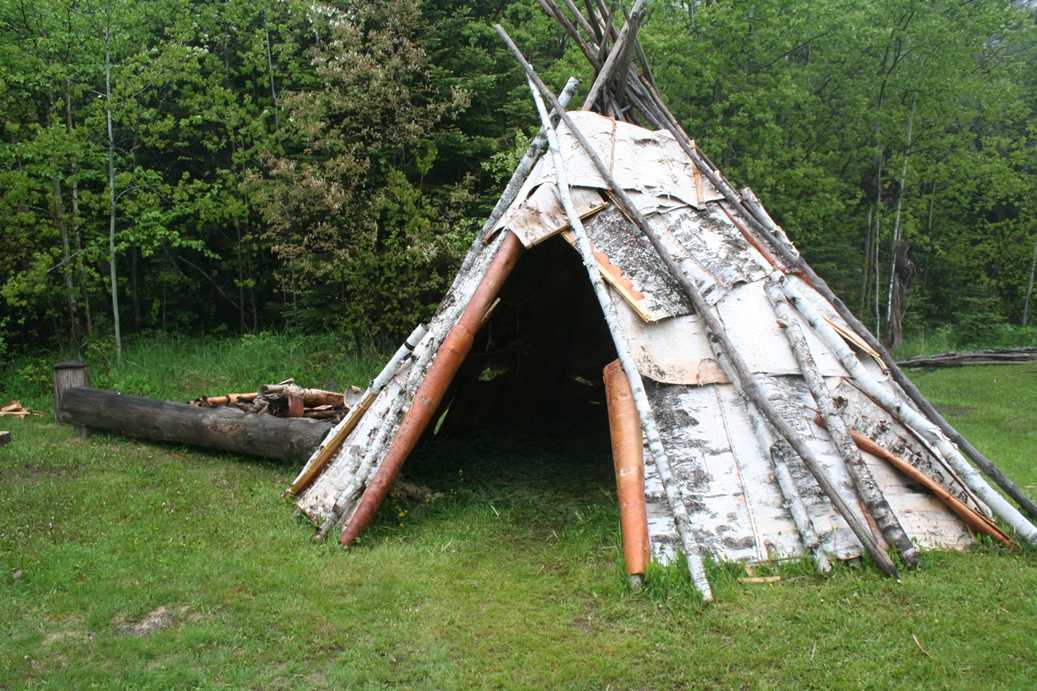
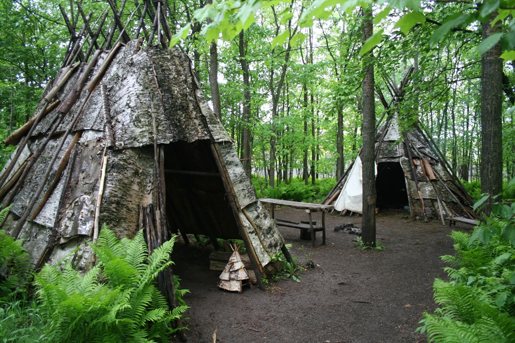
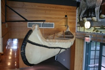
The
canoe above is a representation of a birch-bark
canoe. I believe it is a full birch park, not
just a display model, and I am not sure if it would
float, but it does give you a good idea about the
construction of them. Birch-bark canoes were
widely used for transportation of people and goods
for many years across the Great Lakes.
|
Bayfield, Wisconsin
(Click on Images for Larger Picture)
|
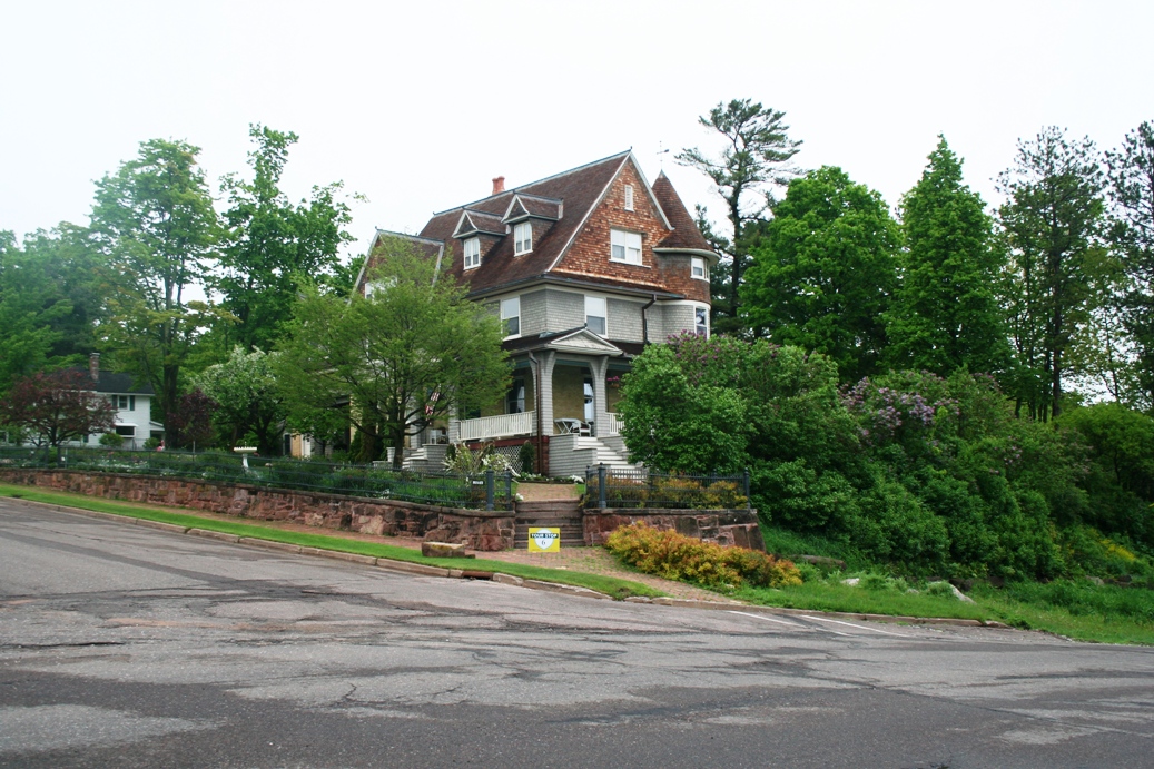
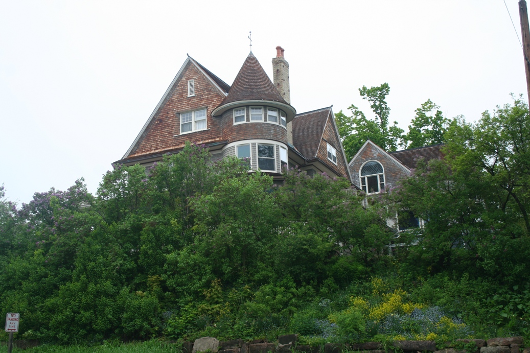
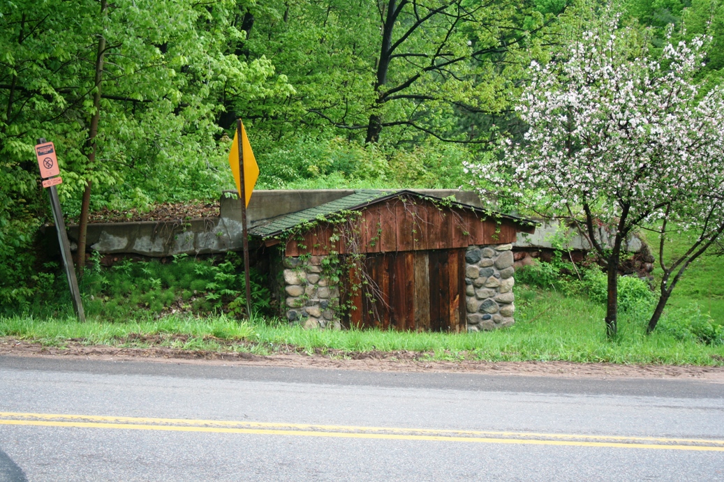
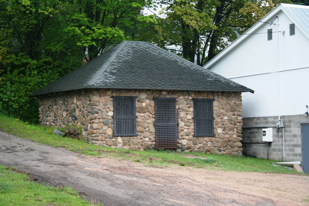
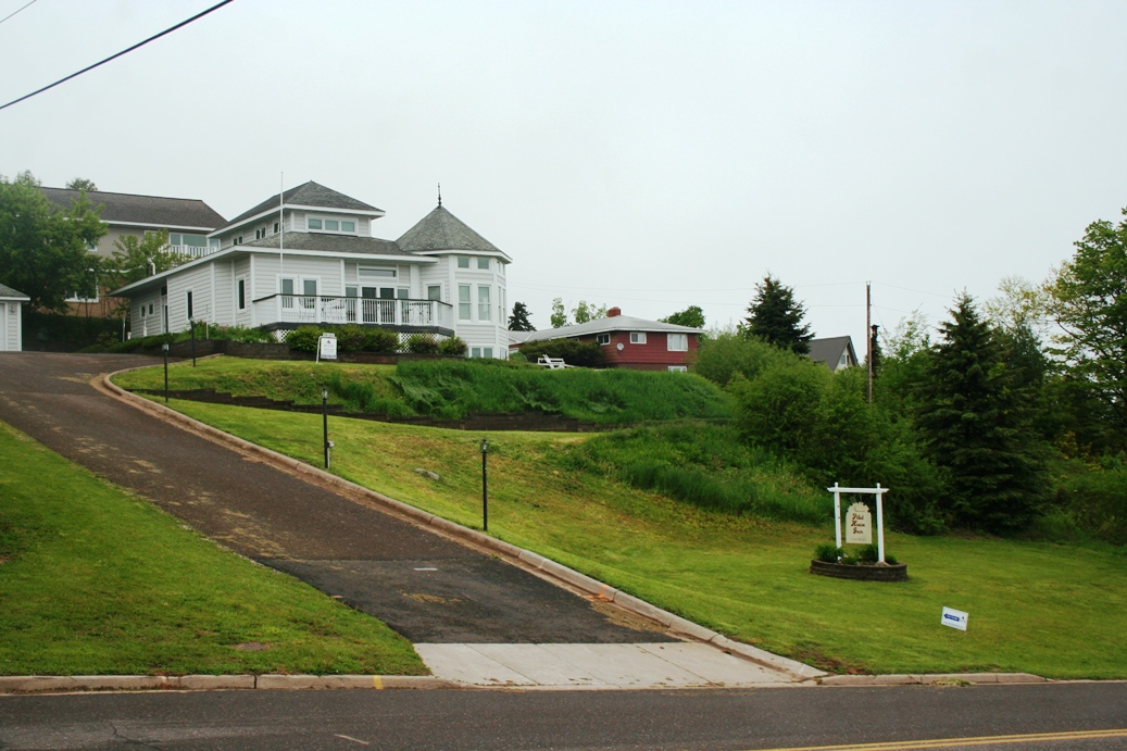
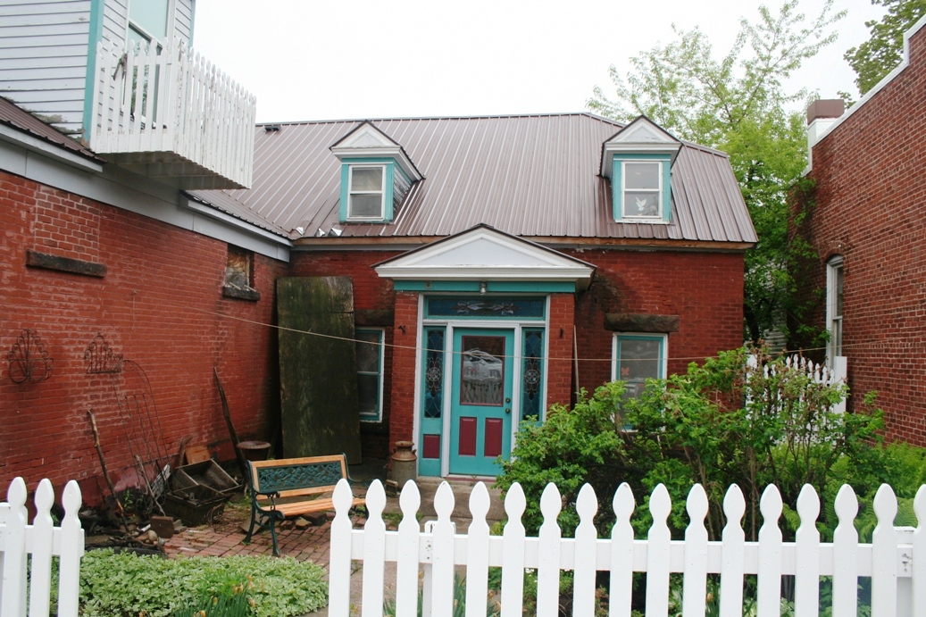
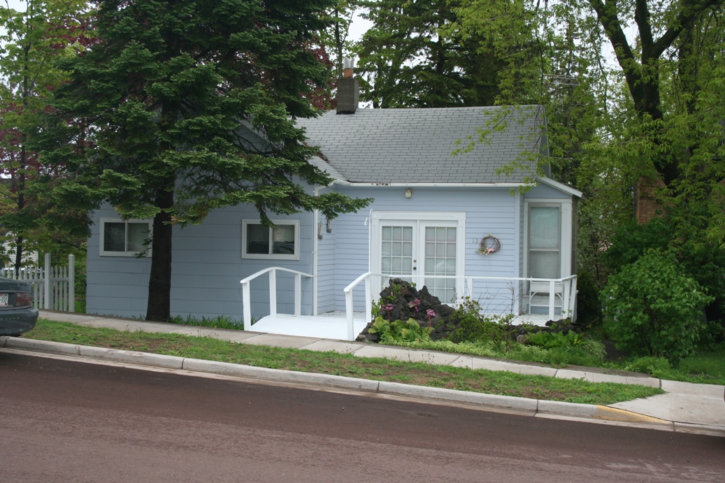
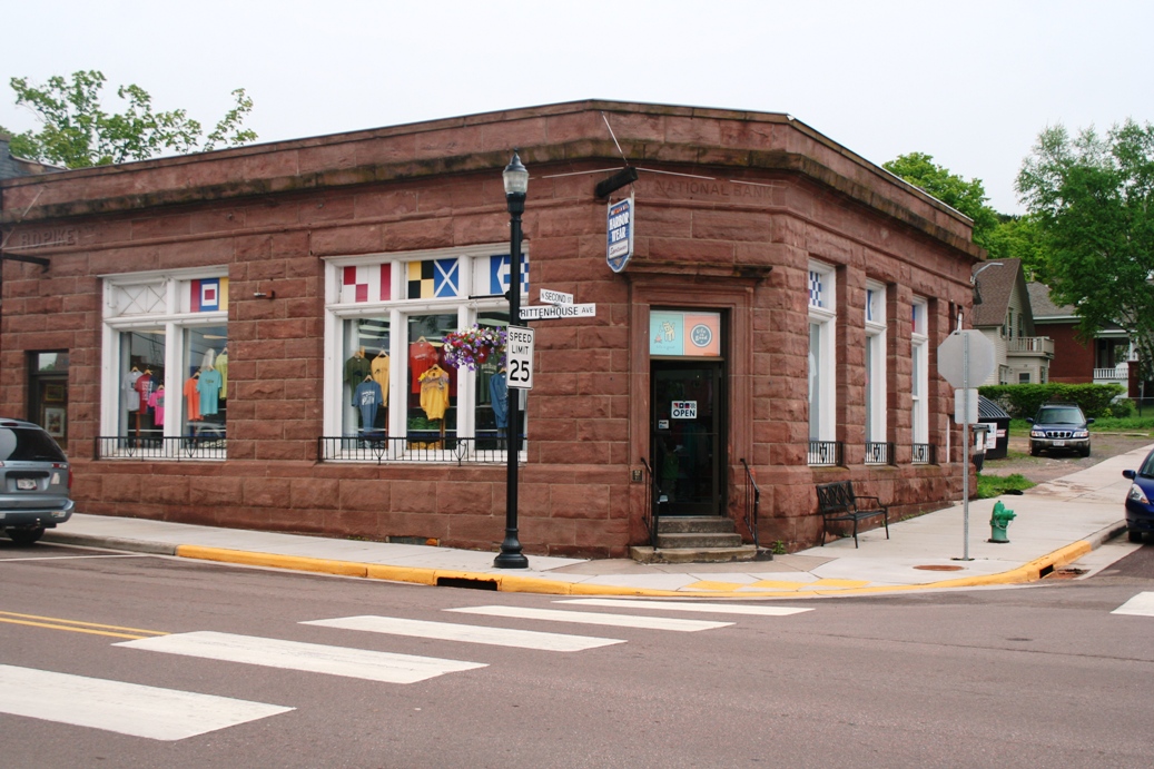
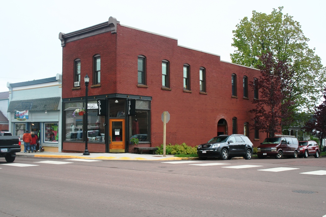
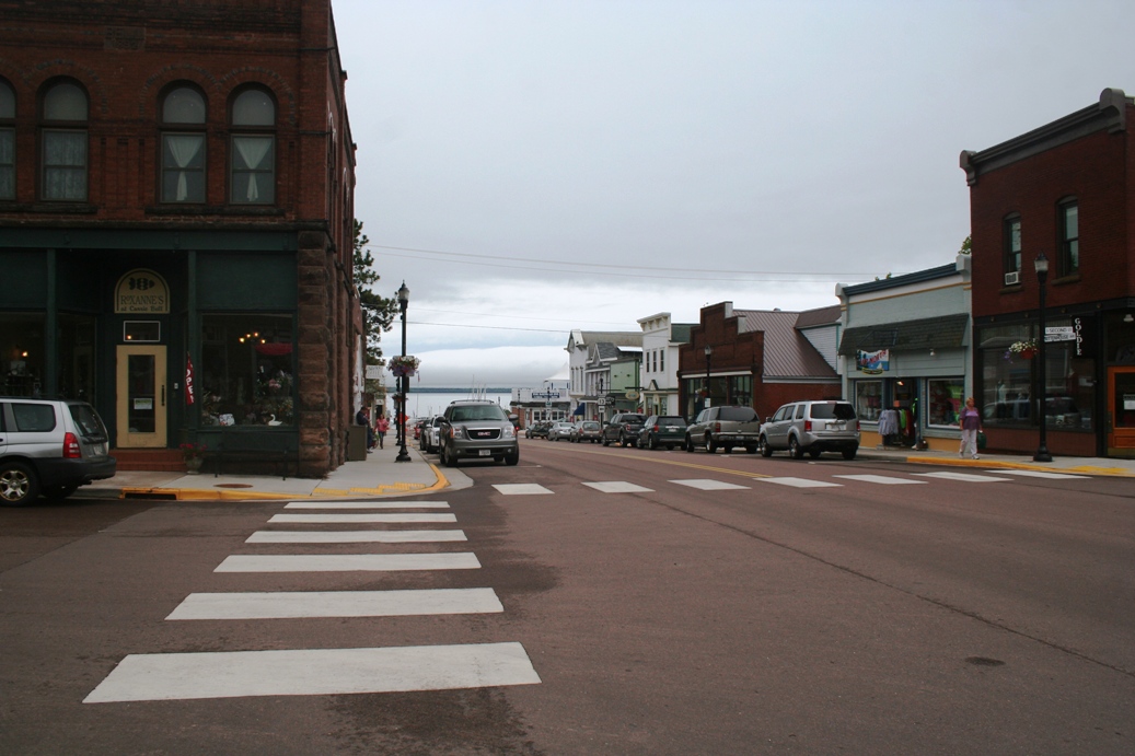
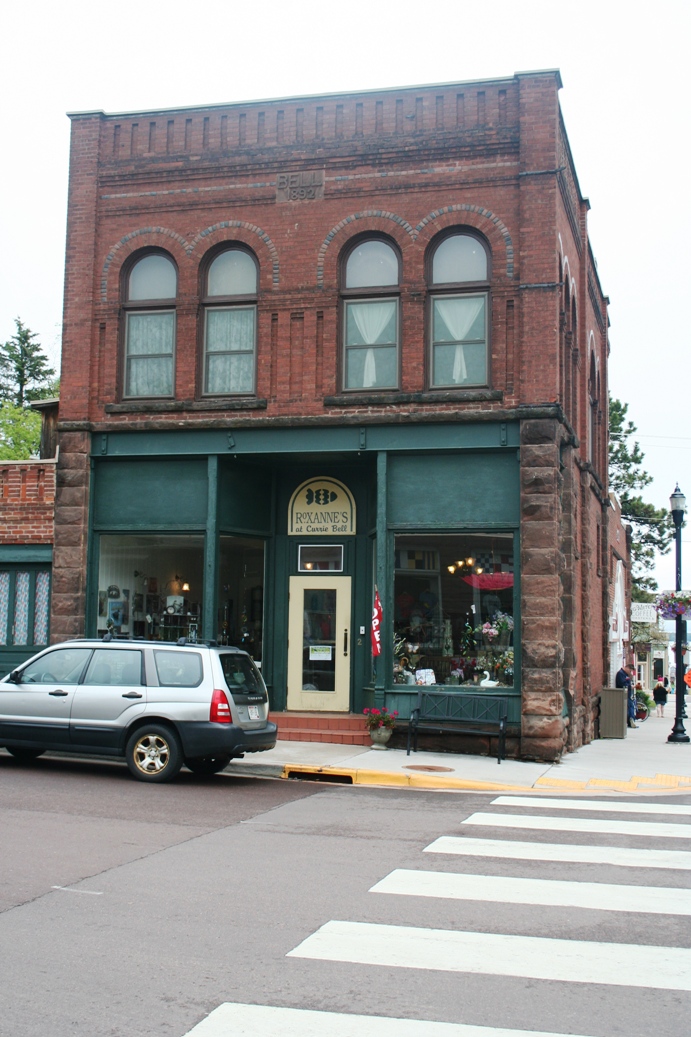
The
photos above are of Bayfield, Wisconsin. They
have many wonderful homes and buildings to look at,
with some of the homes being bed and breakfast
establishments. I especially like the stone
work in the storage buildings. Their downtown
is also a nice place to visit with a variety of
shops and restaurants.
|
Bayfield Marina
(Click on Images for Larger Picture)
|
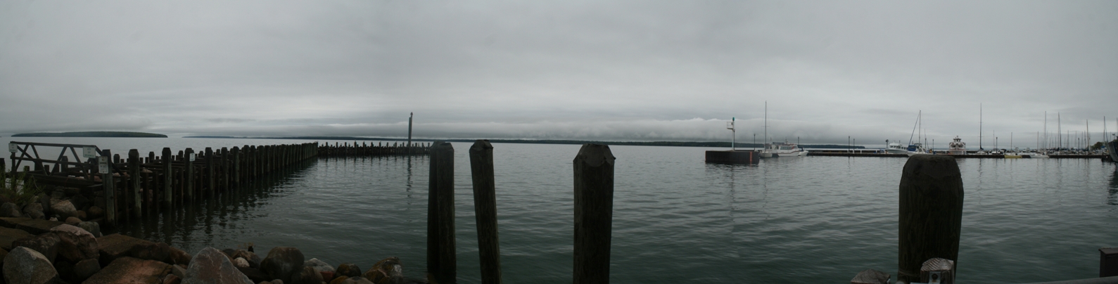
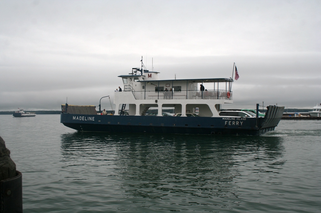
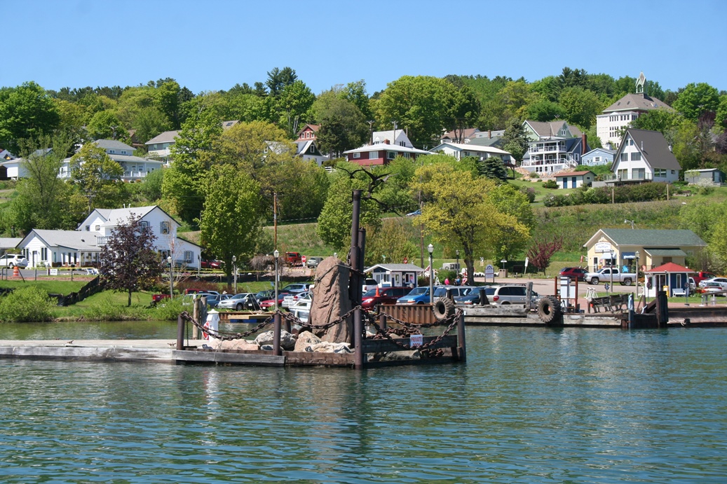
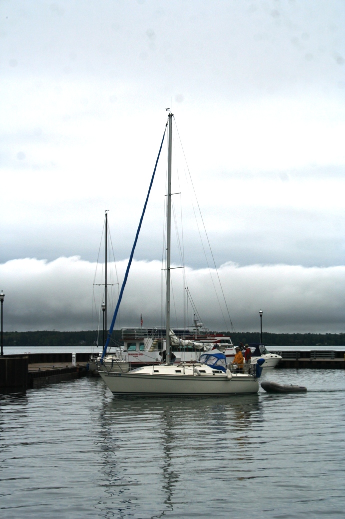
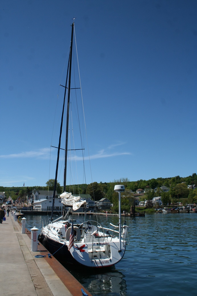
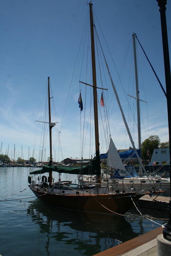
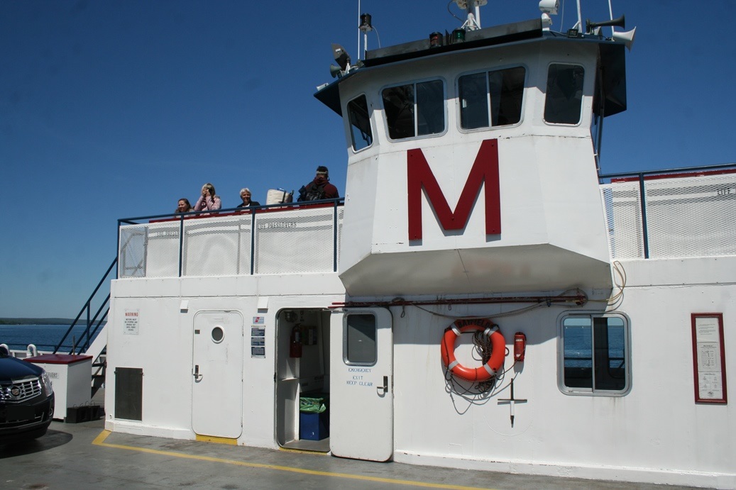
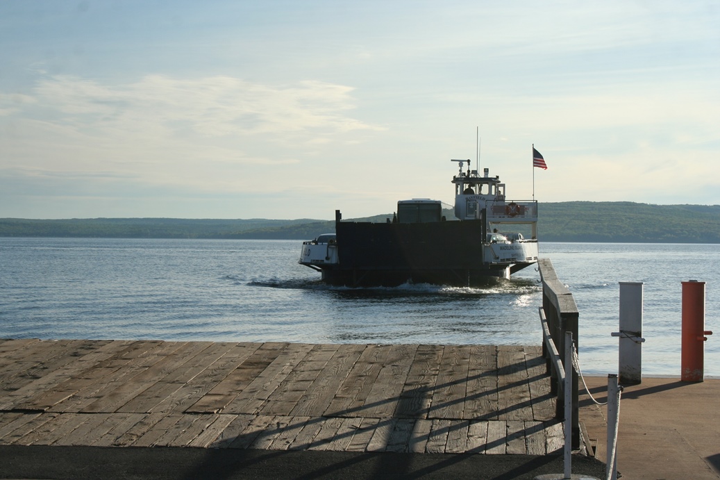
One
of the places I really enjoy stopping by is the
marina. It is fun to watch the ferries load
and unload as they go back an forth between the
mainland and Madeline Island. I also enjoy
seeing the various kinds of boats that are moored in
the marina as well.
|
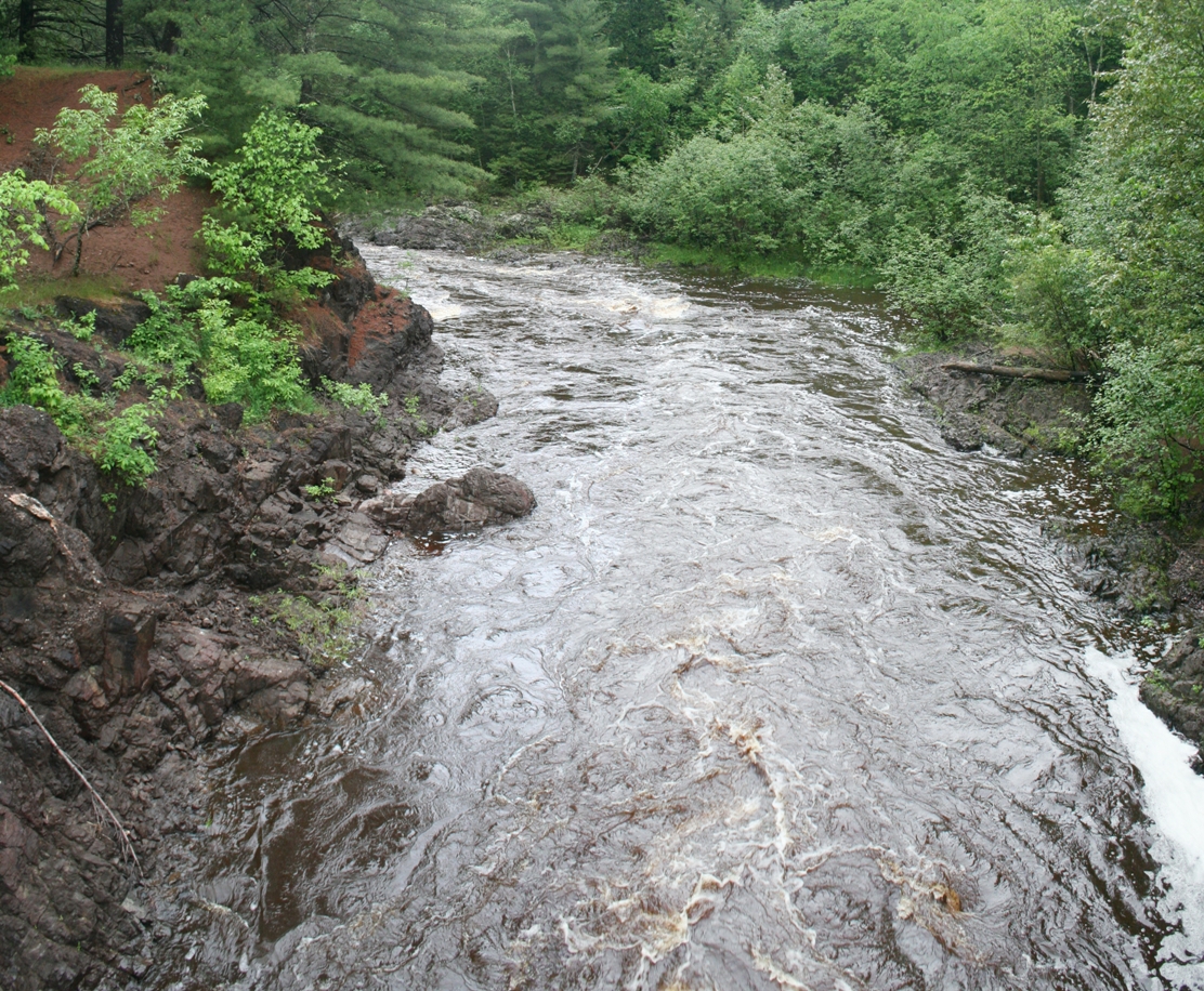
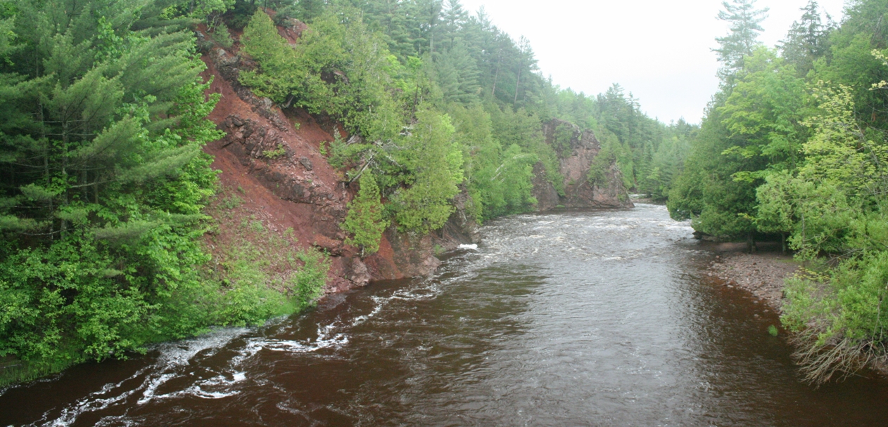
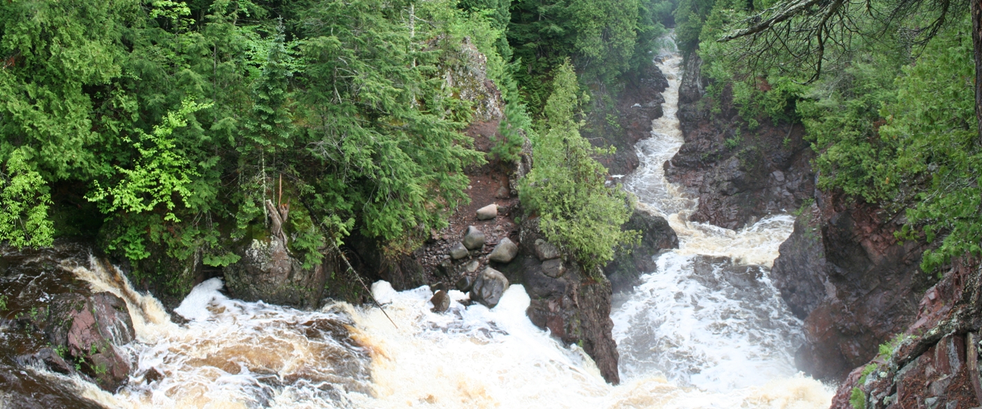
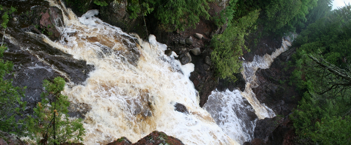
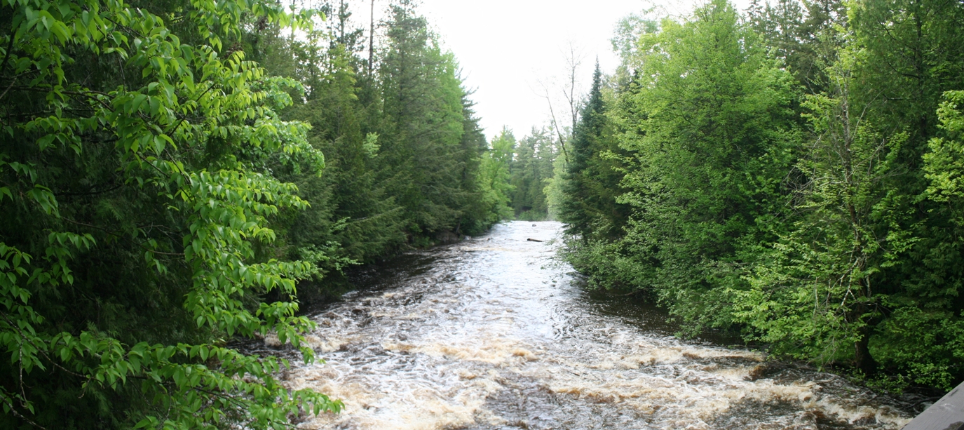
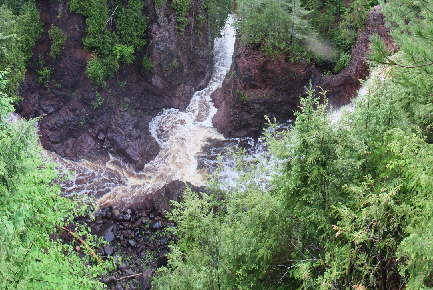
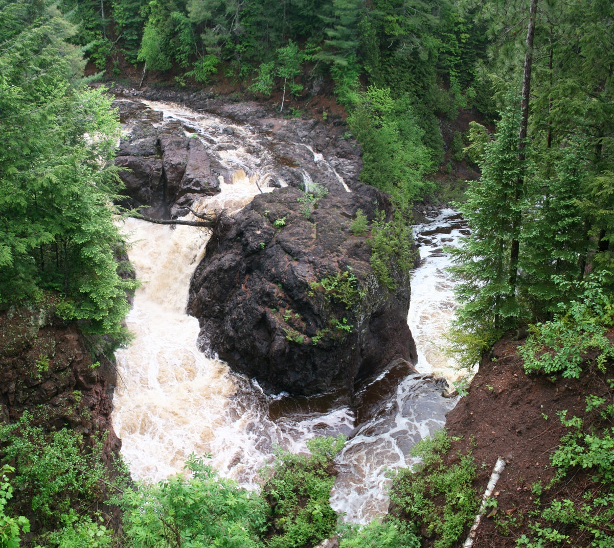
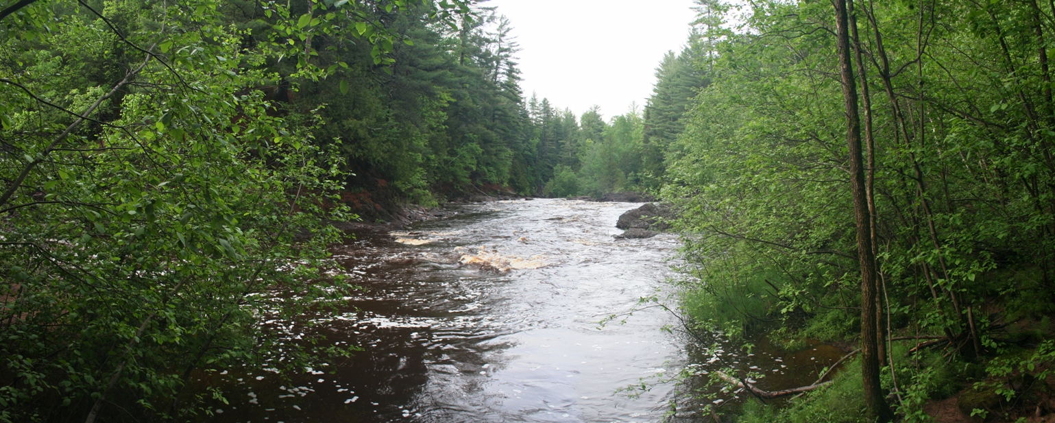
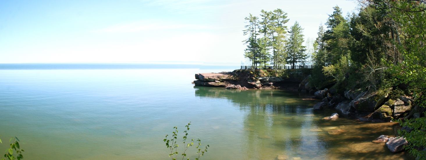
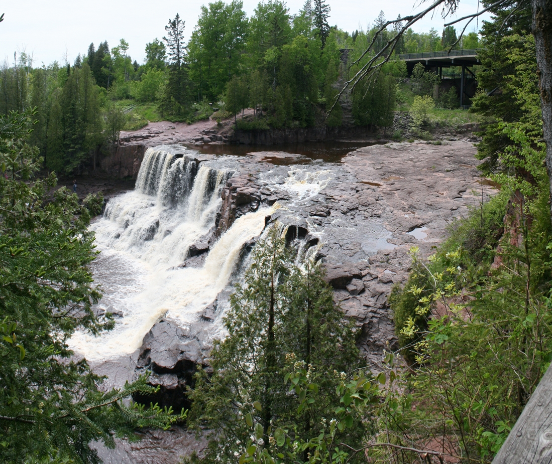
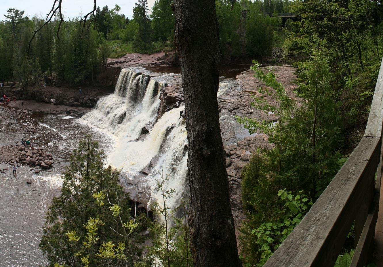
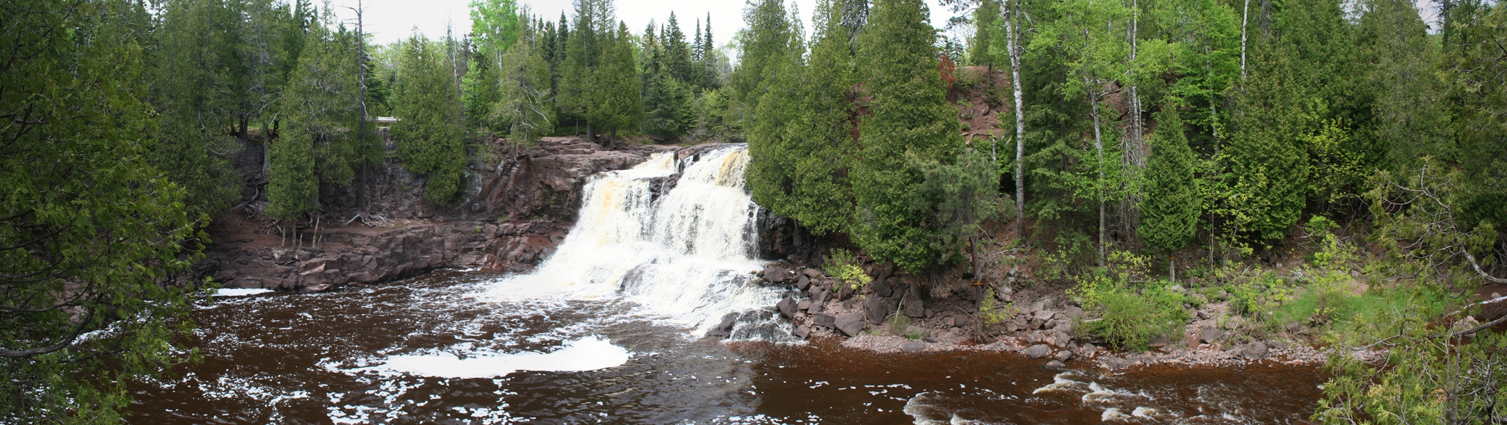
Copper Falls State Park, Wisconsin
(Click on Images for Larger Picture)
|
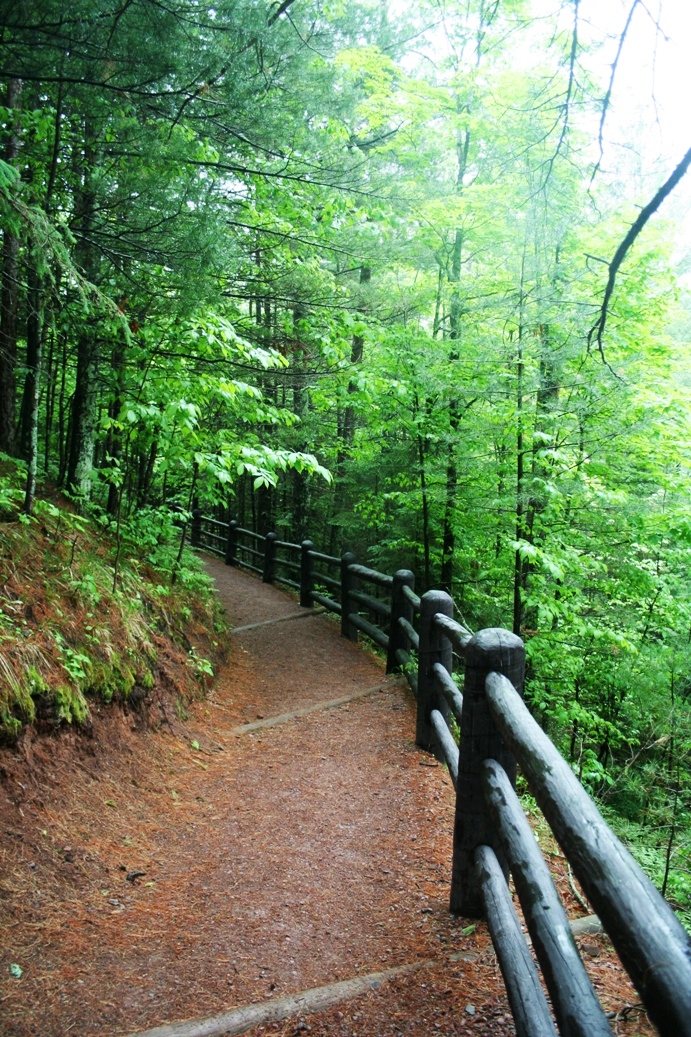
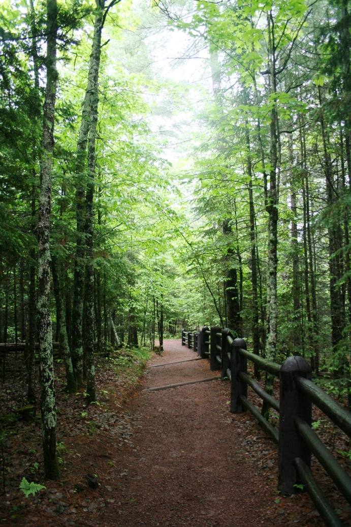
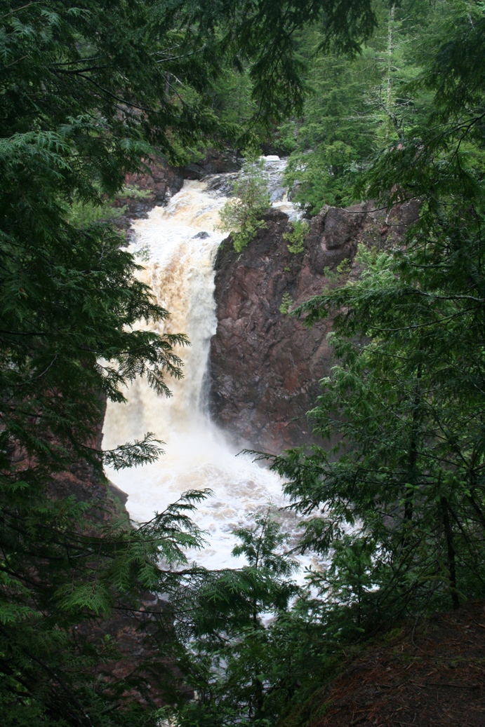
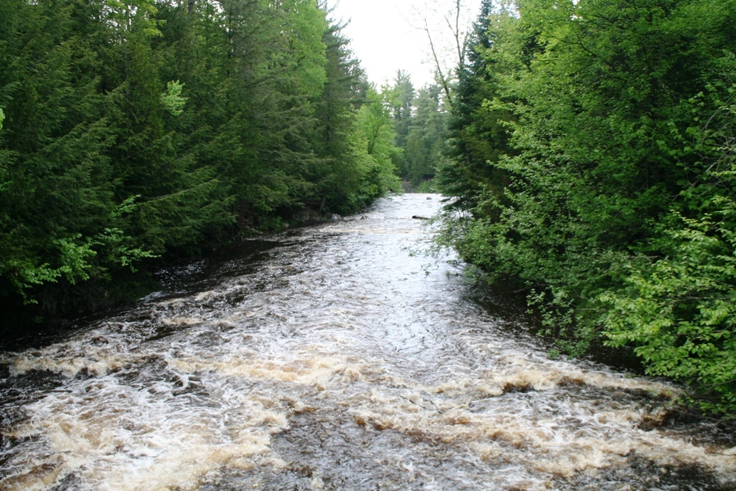
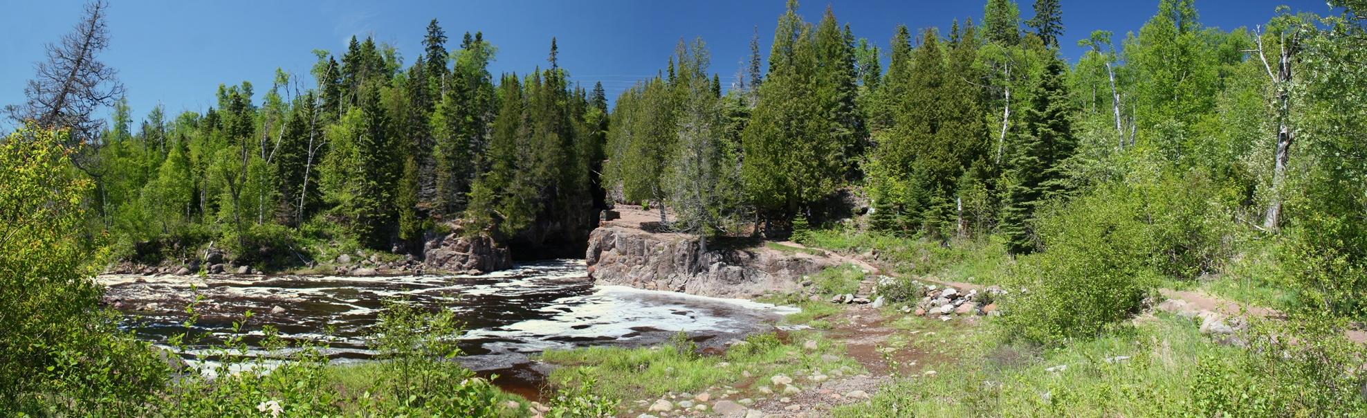
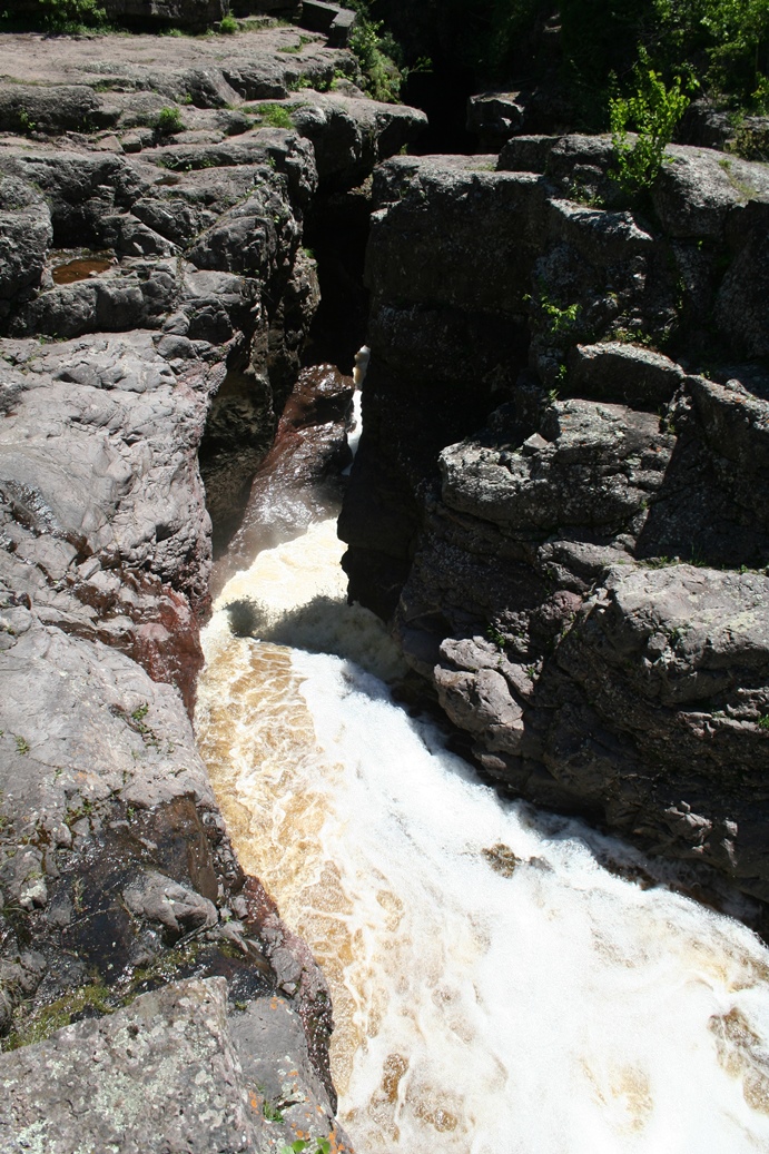
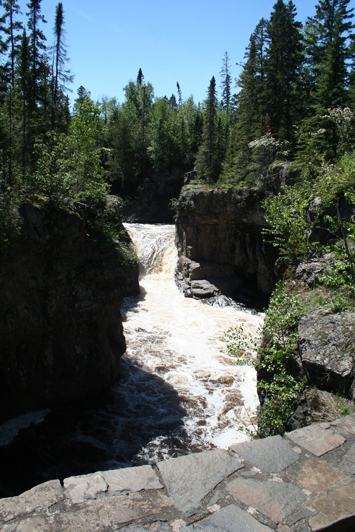
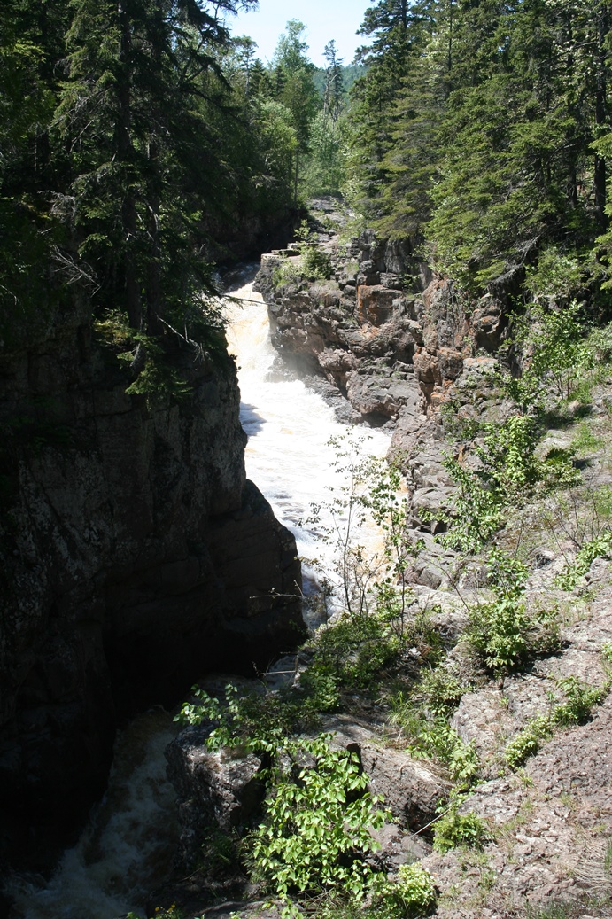
We
did get a break in the weather to do a little hiking
around Copper Falls State Park in Wisconsin.
The photos above are of the Doughboys Trail.
The photos below are of the same area but in a
panoramic display.
|
(Click on Images for Larger Picture)
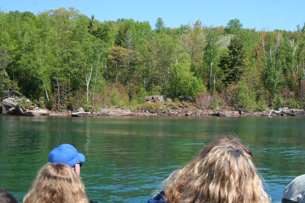
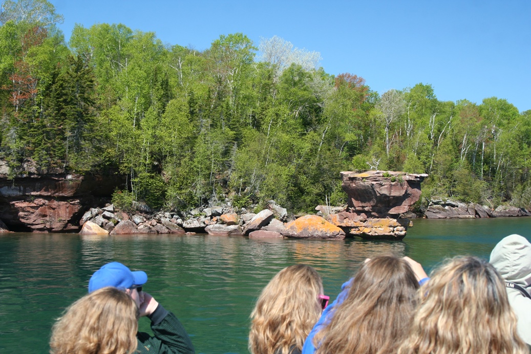
Apostle Islands
Grand Tour
(Click on Images for Larger Picture)
|
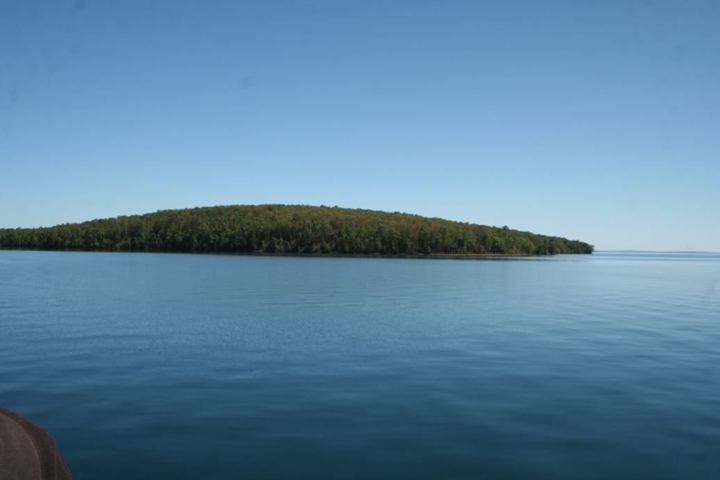
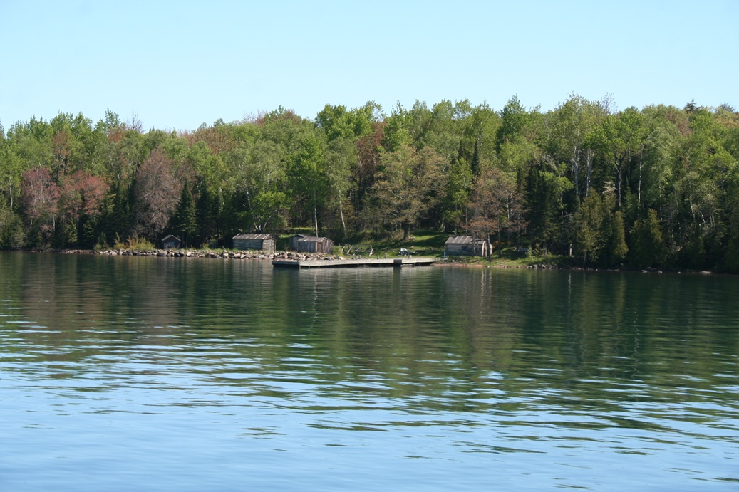
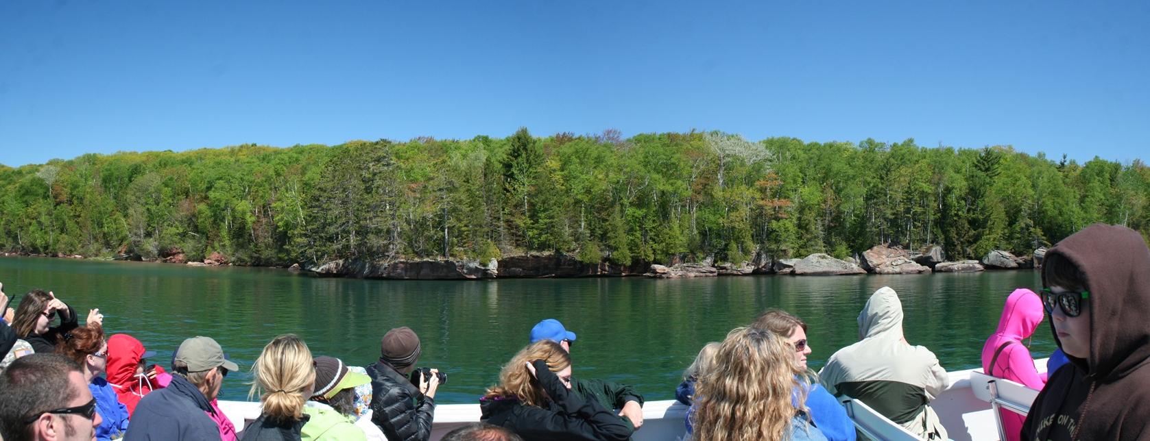
The
company called
Apostle Island Cruises offers several different
cruises throughout the season. The tour we
took, shown in these photos, is the Grand Island
Tour. The tour starts in Bayfield, Wisconsin,
and winds through the islands that make up the Apostle
Islands. The boat we took this tour is shown
in the first picture. It was a different boat
from the one we took a few years previous. The
second and third photos of some quarry remains from
either Basswood or Hermit Island. I cannot
remember which. The fourth and the fifth are
of Manitou island and the Fish Camp that remains on
the island. The last is of, I believe, Otter
Island.
|
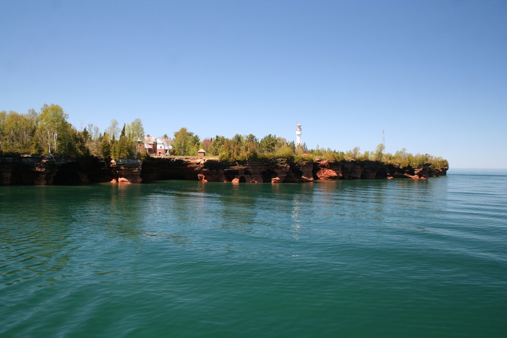
Lighthouses
(Click on Images for Larger Picture)
|
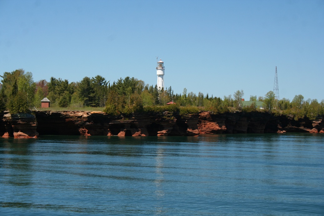
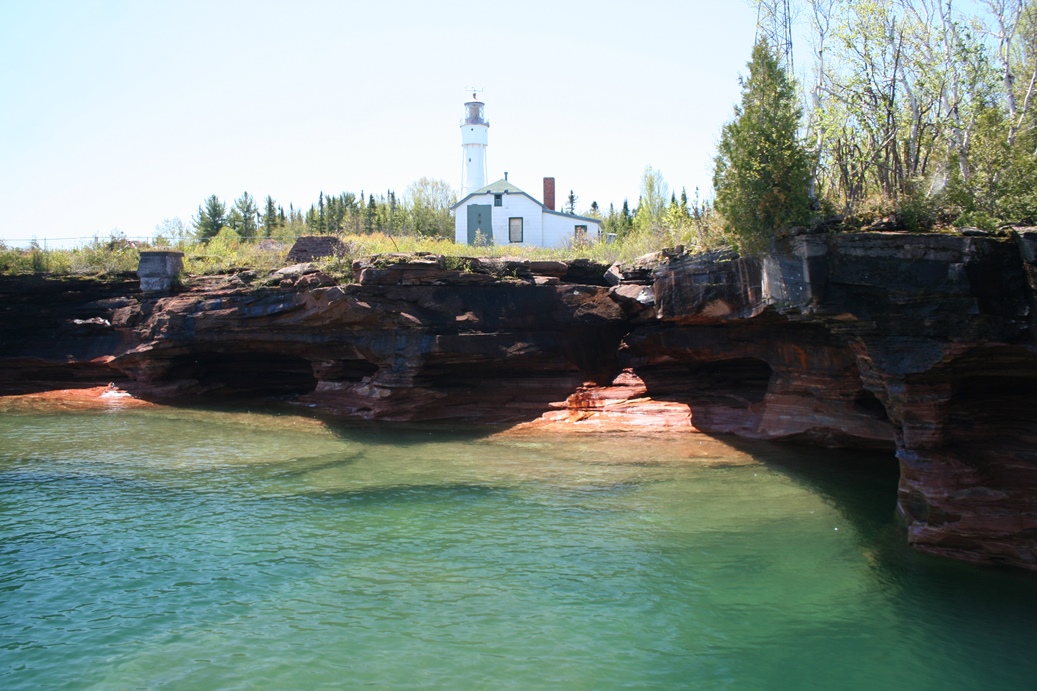
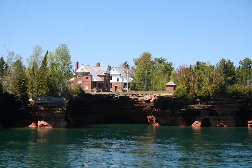
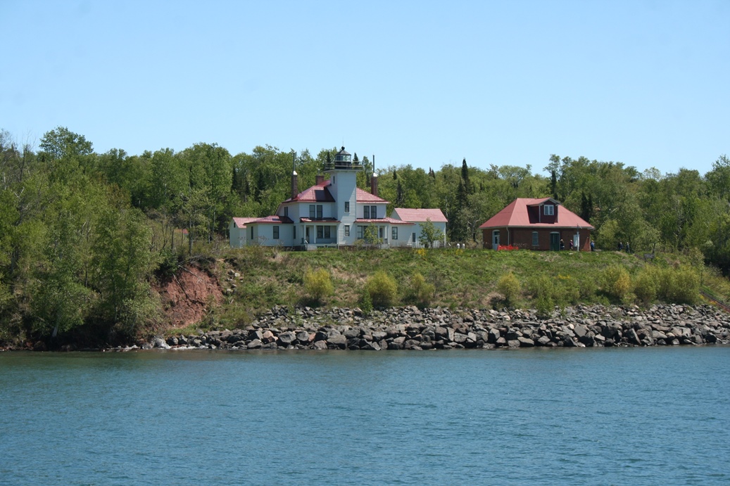
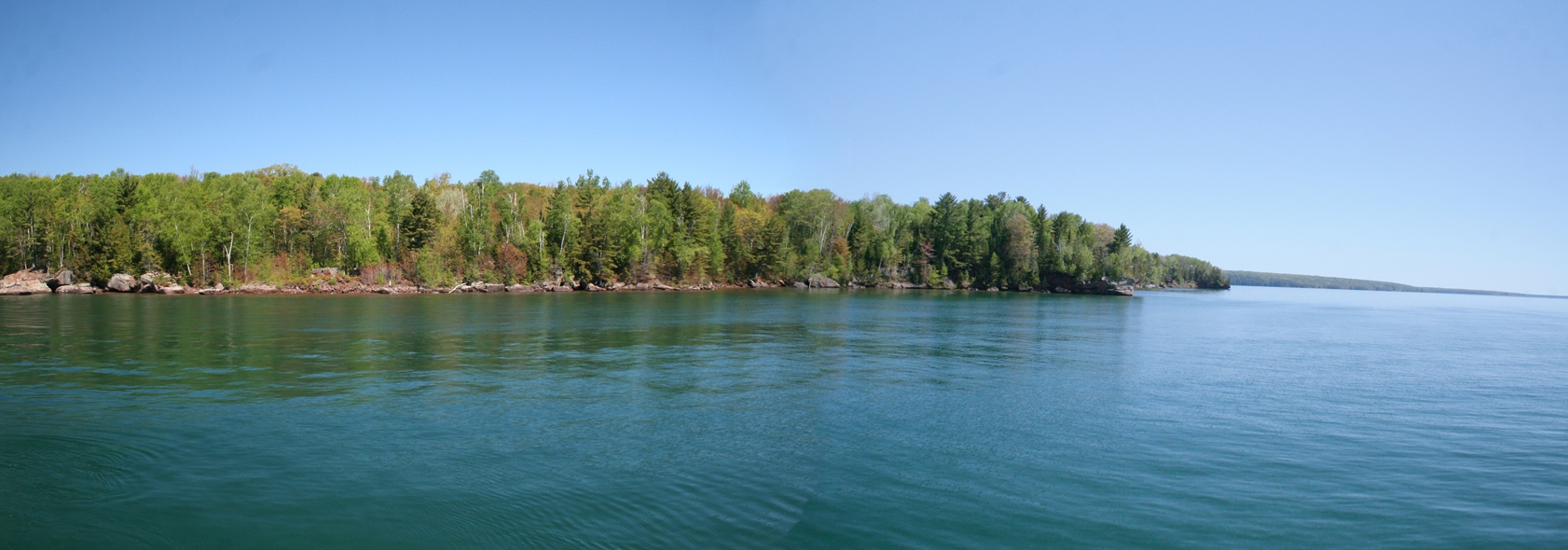
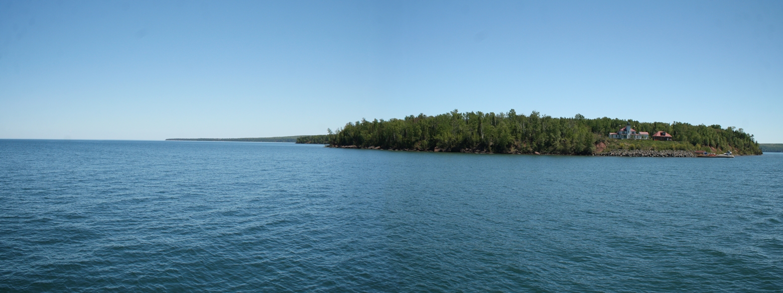
Along the tour, you get a close up view of
a couple of lighthouses. The first one is of the
lighthouse on Devil's Island. That island is
the last island before entering the waters of Lake
Superior. The boat does go out a bit as it
circles the island for the return trip to Bayfield.
Devil's Island lighthouse is shown in the first four photos.
The last one is the lighthouse on Raspberry Island.
This one I believe is open to private tours of the
lighthouse and its grounds, but you would have to
visit the National Park website to verify that.
|
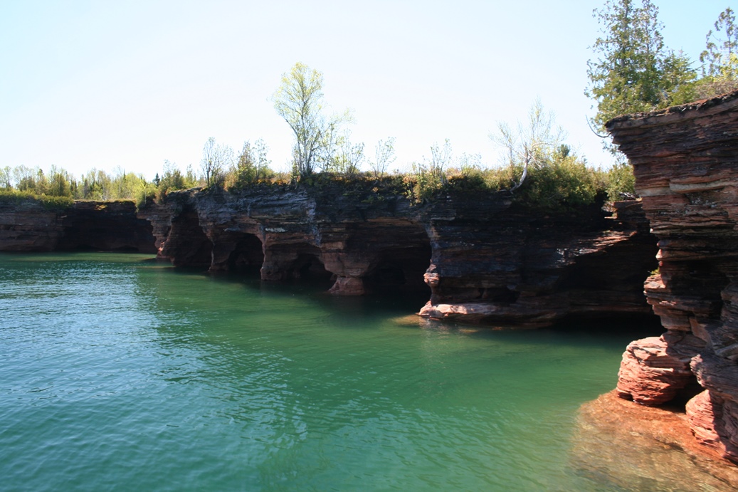
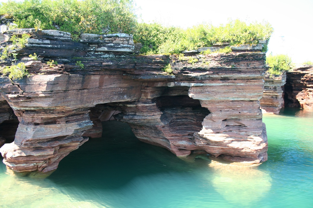
Sea Caves
(Click on Images for Larger Picture)
|
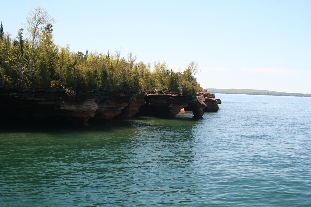
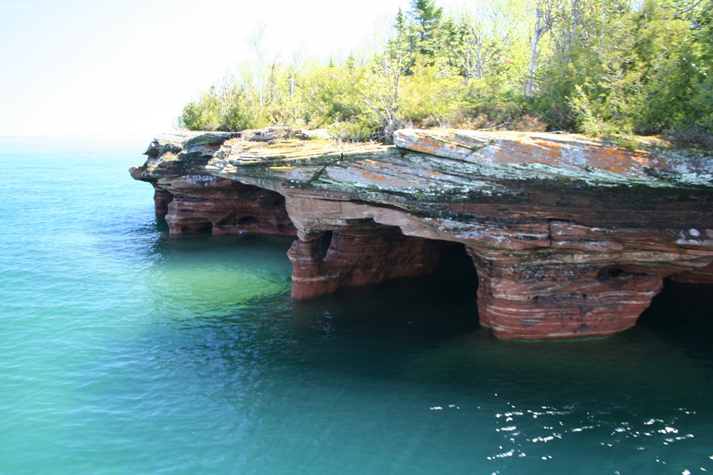
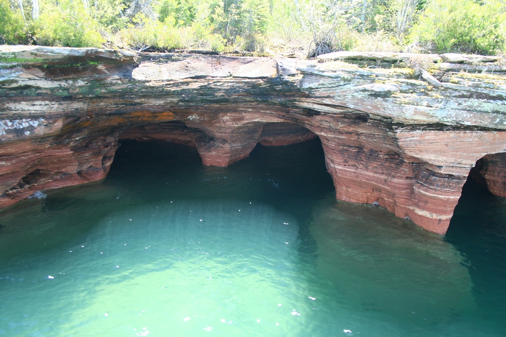
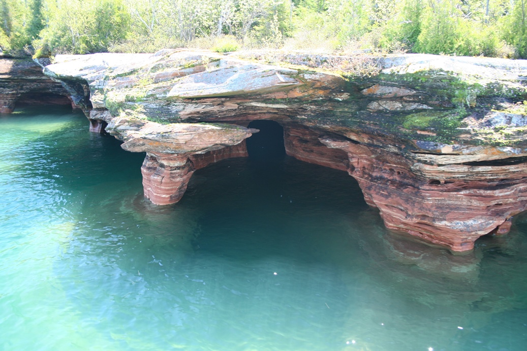
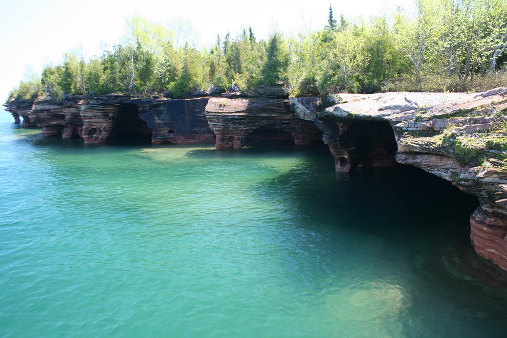
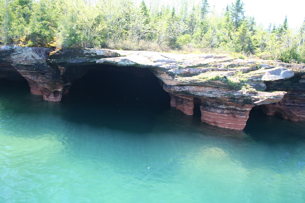
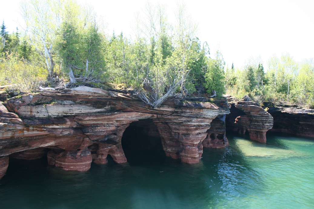
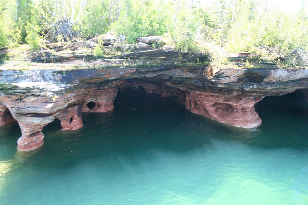
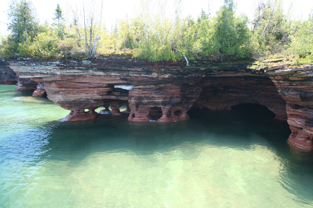
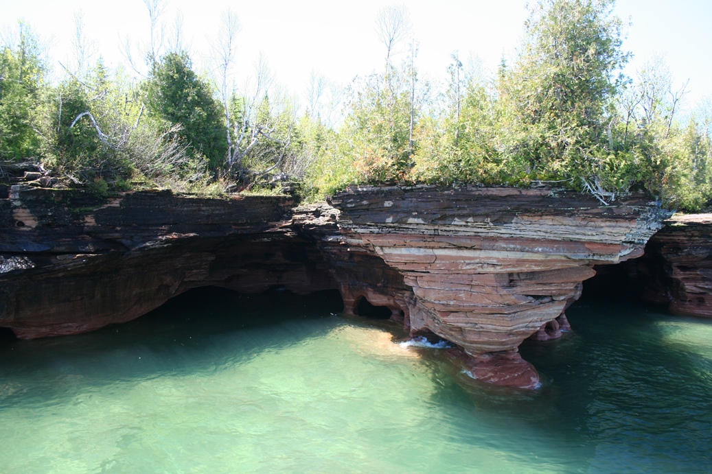
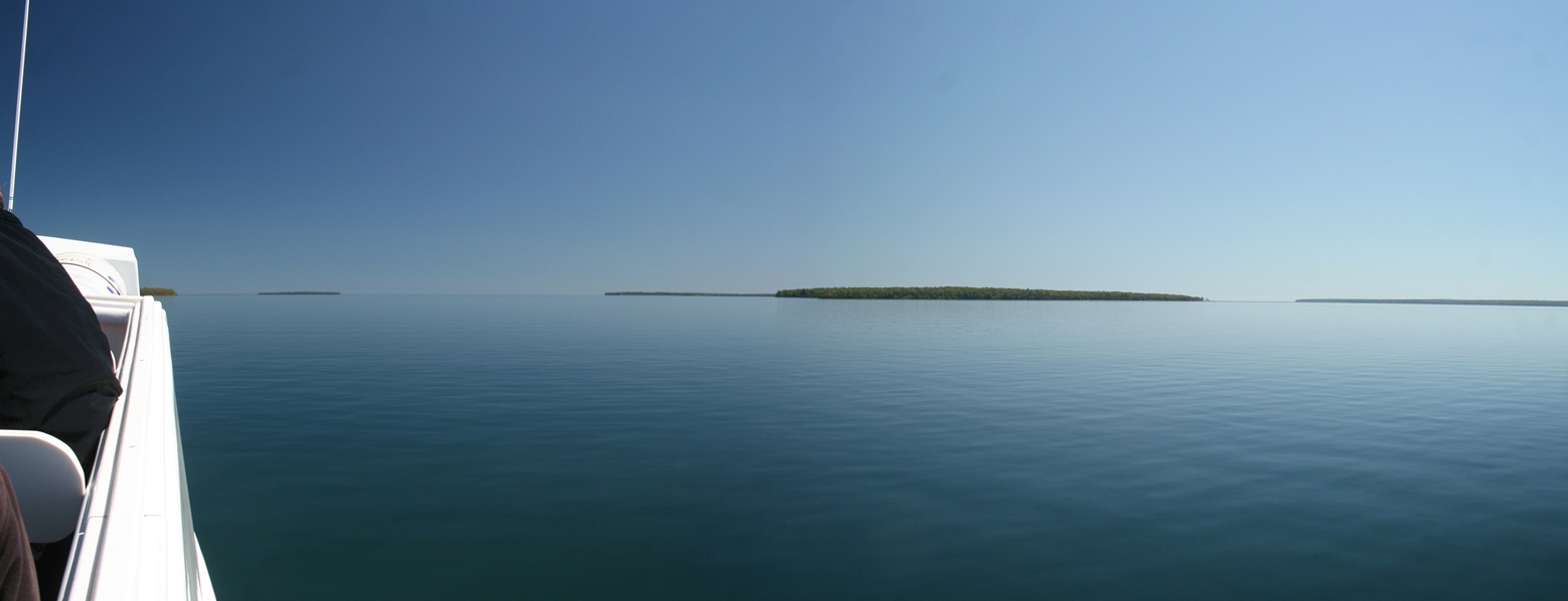
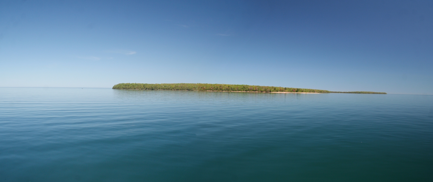
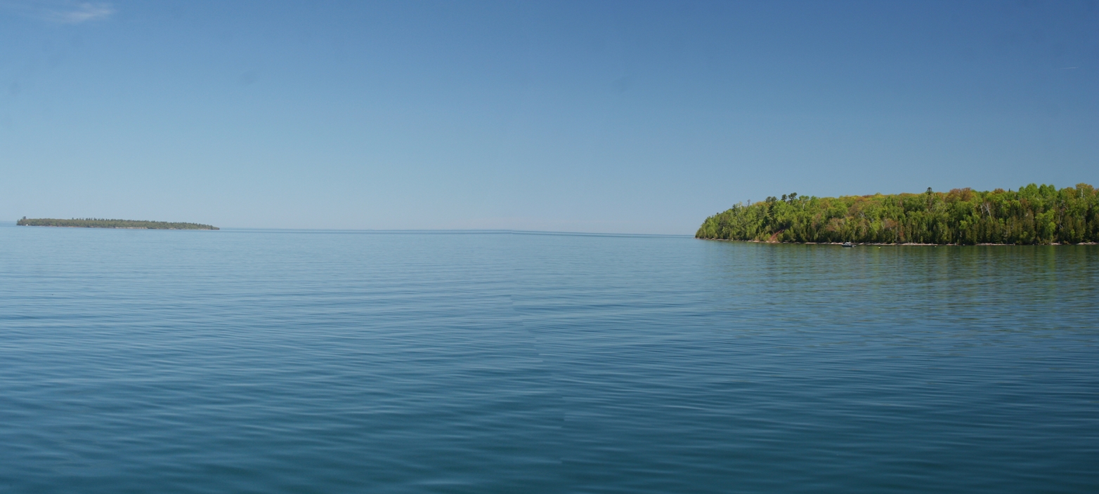
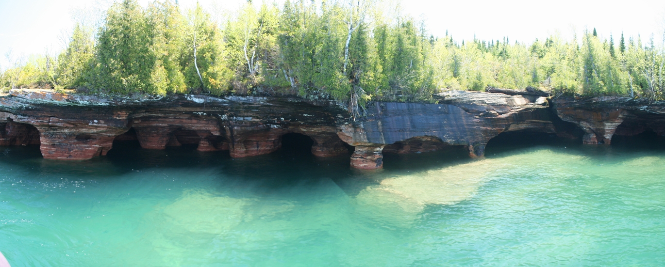
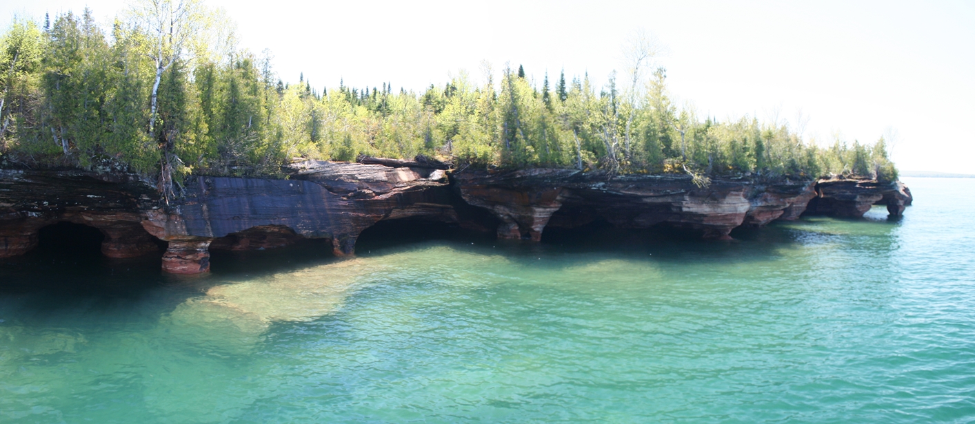
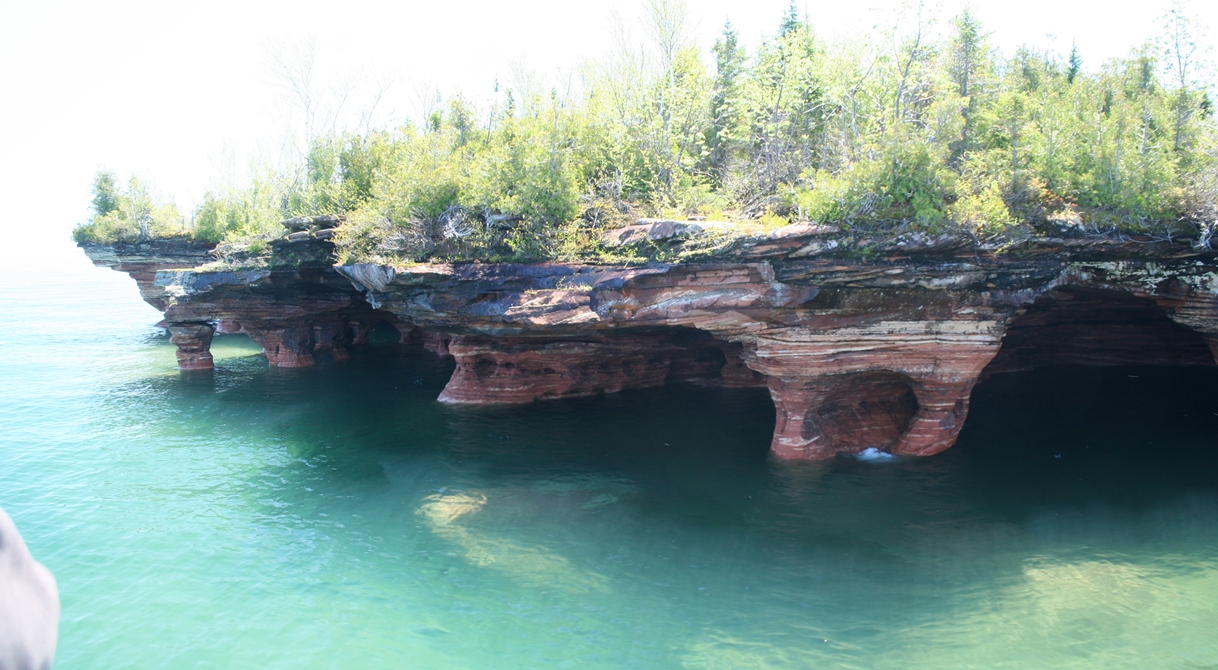
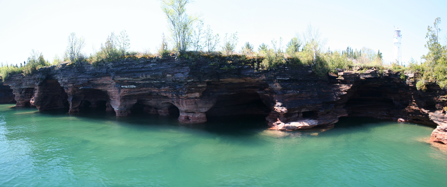
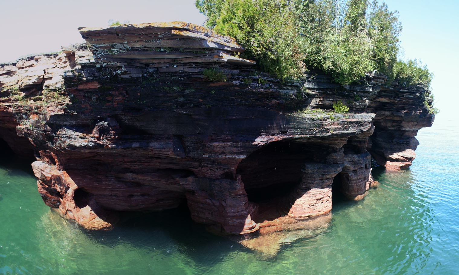
One
of the more impressive sites you get to see are of
the Sea Caves located along the northern shore of
Devil's Island. We were there in the middle of
June, 2014, and if you look closely in a few of the
pictures, you will still
see ice in some of the caves.
The
panoramic photos of the tour, sea caves,
and Raspberry Island Lighthouse are shown below.
|
Panoramic
(Click on Images for Larger Picture)
Madeline Island Ferry
Trip to Madeline Island
(Click on Images for Larger Picture)
|
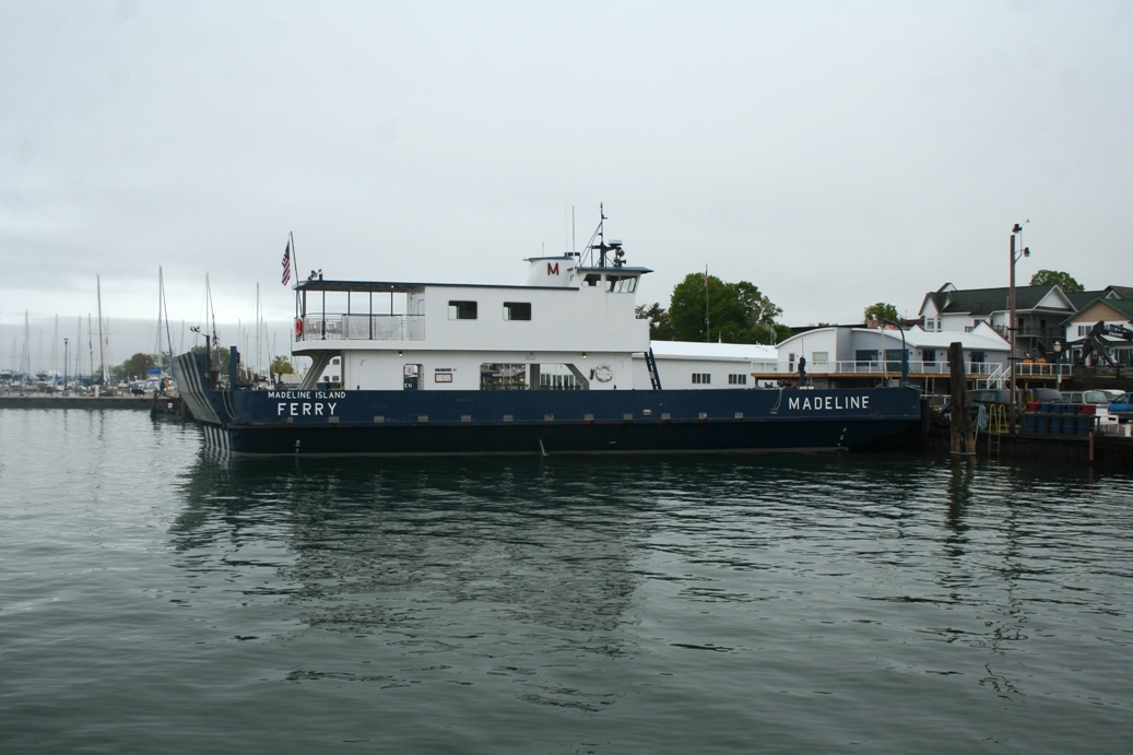
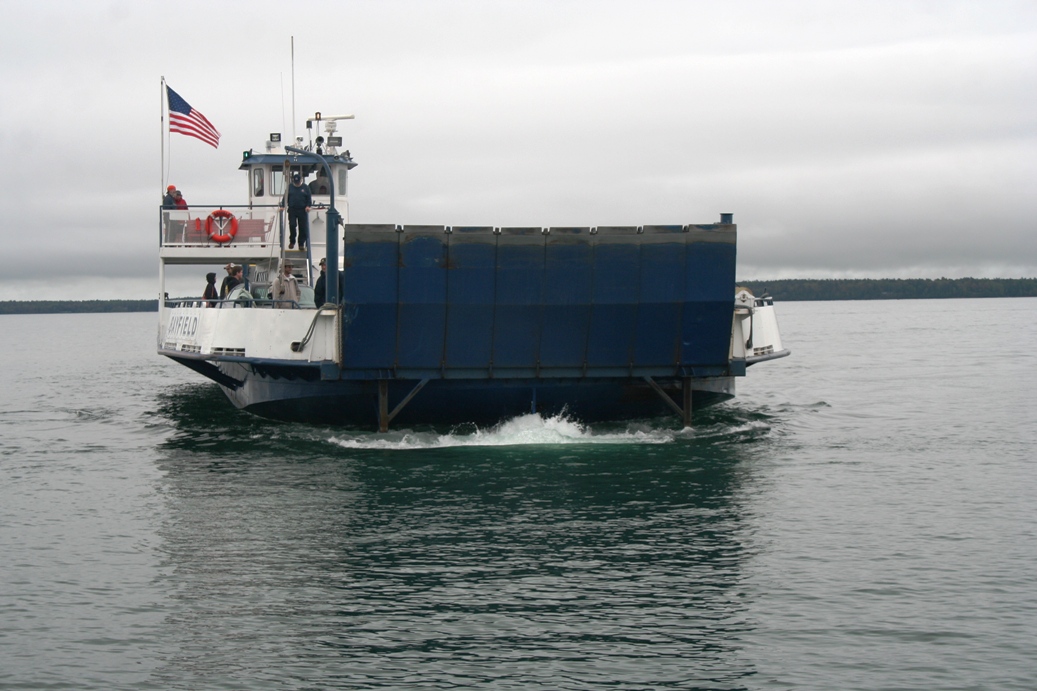
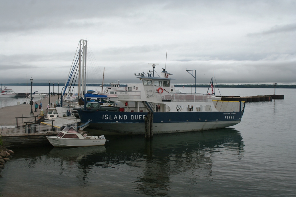
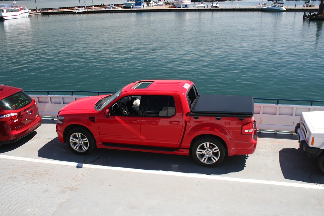
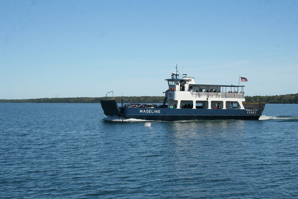
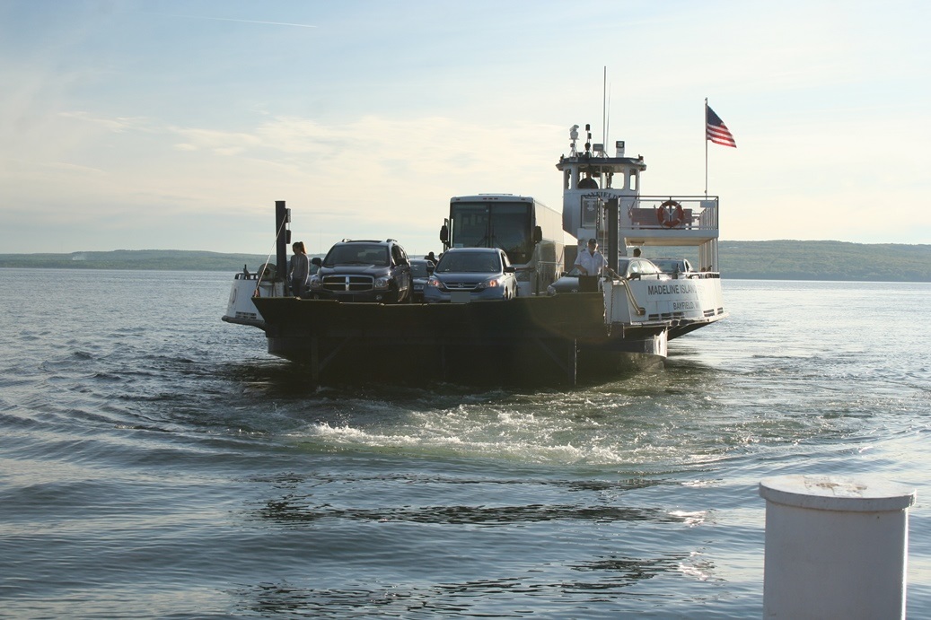
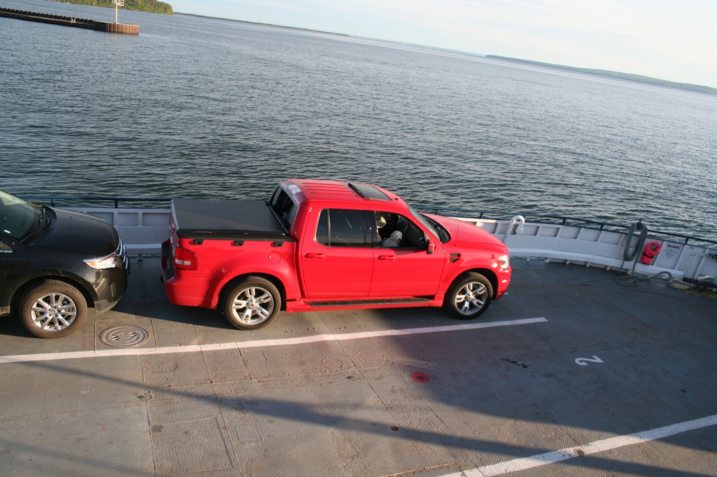
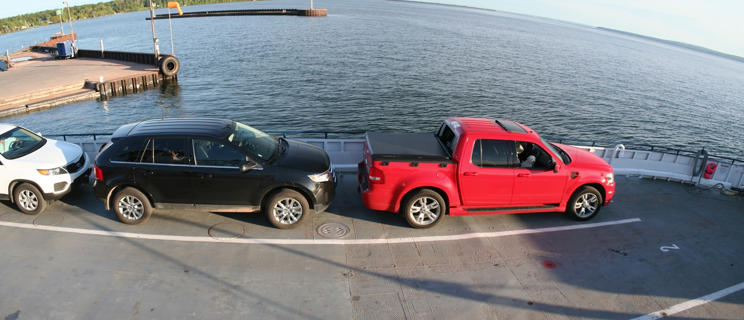
I
always enjoy the trips to and from Madeline Island
on the ferry. It is fun to see what types of
vehicles are using the ferry, as well as watching
the traffic on the water. Although I have not
been on very many large boats or ships, I still do
take advantage of the time to explore what the
vessel looks like, regardless of size.
|
Return trip to Bayfield
(Click on Images for Larger Picture)
|
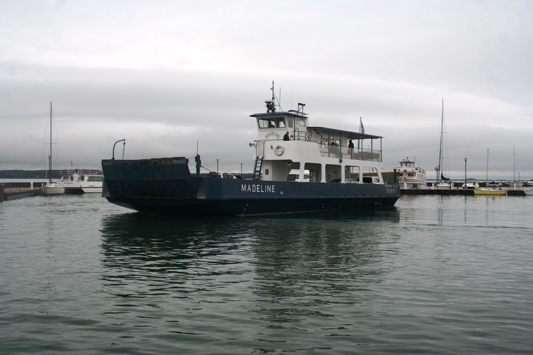
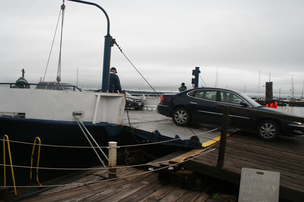
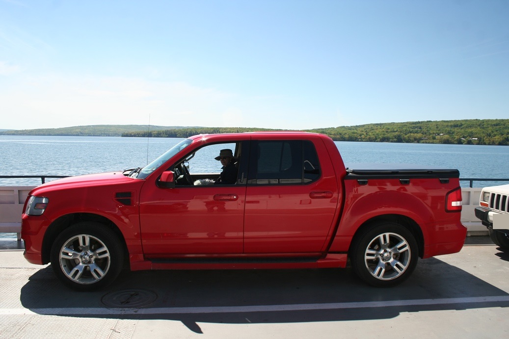
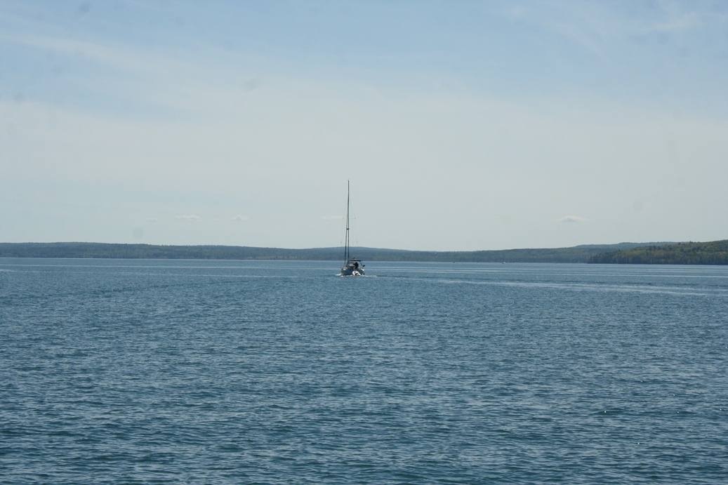
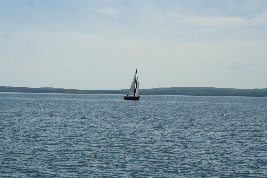
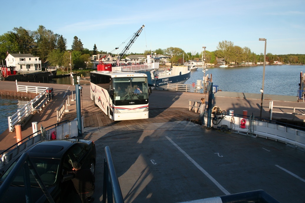
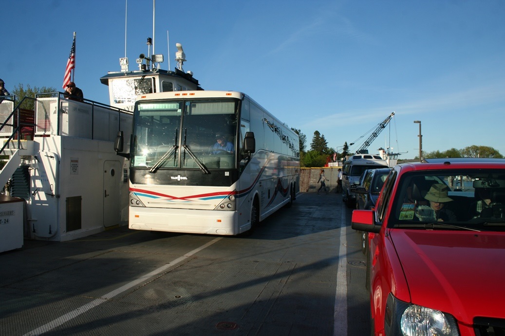
The
return trip was a bit interesting this time as well.
While I was watching the ferry come in, I could tell
from a distance that there was something large on
the deck. At first, I thought it was a large
RV heading to the campground, but then I realized it
was tour bus. The real surprise was when it
came back and reloaded for the return trip to the
mainland. I know that ferries are designed to
handle all sorts of vehicles, but I always forget
about the large trucks, small semis, and buses that
need to use the ferries as well.
|
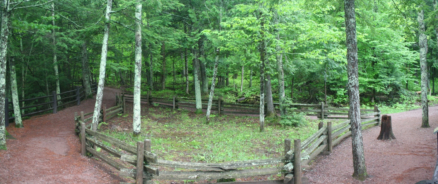
Madeline Island Hike
(Click on Images for Larger Picture)
|
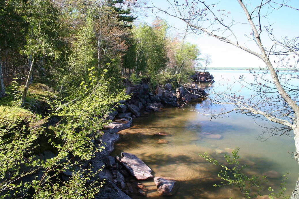
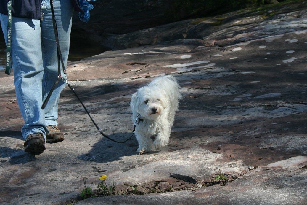
The
afternoon of the Apostle Island Grand Tour, we
decided to go over to Madeline Island and explore
the state park. They have some very nice
trails to hike, explore, and get a great view of the
lake. I would strongly recommend, if you are
in the area to take some time and explore the local
community on the island, as well as the lake shore
drive and hiking trails.
|
Panoramic
(Click on Images for Larger Picture)
Lost Creek Adventures
Kayaking
(Click on Images for Larger Picture)
|
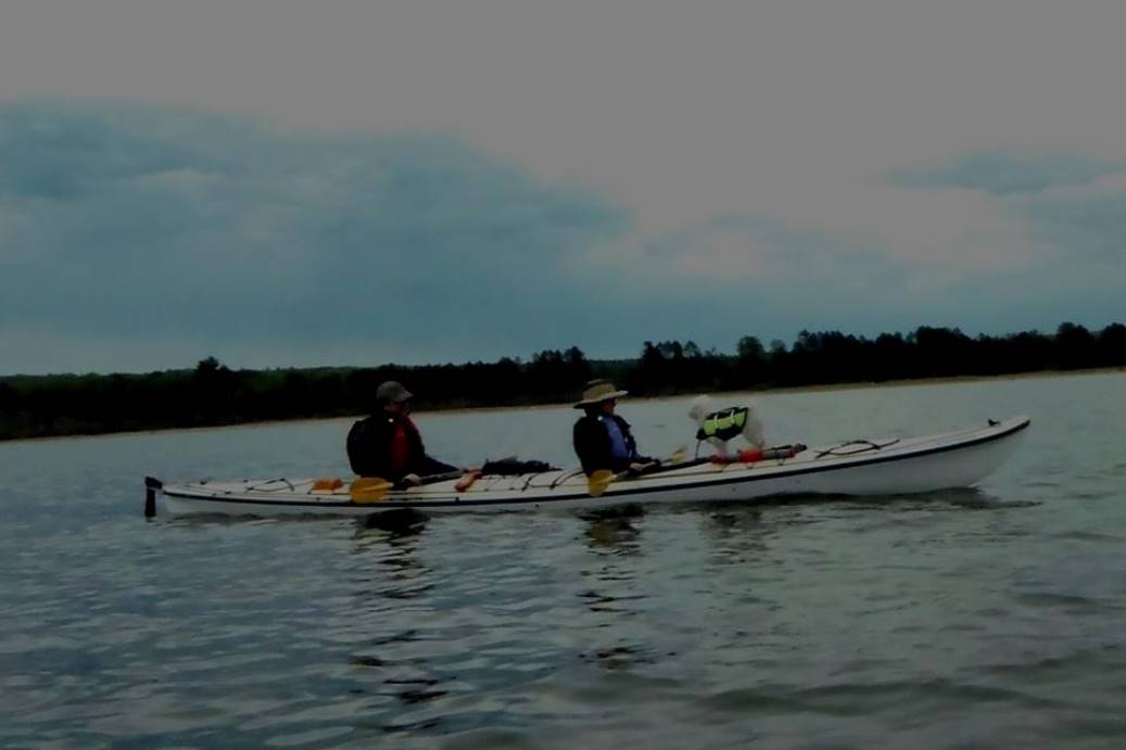
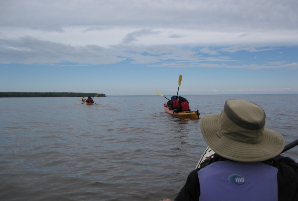
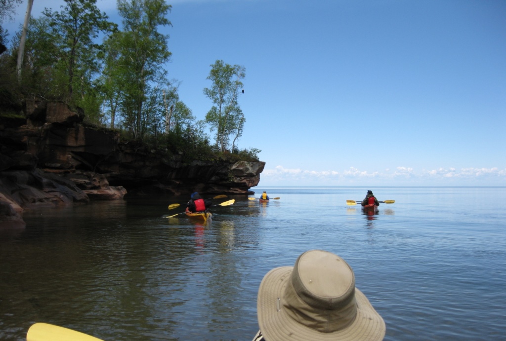
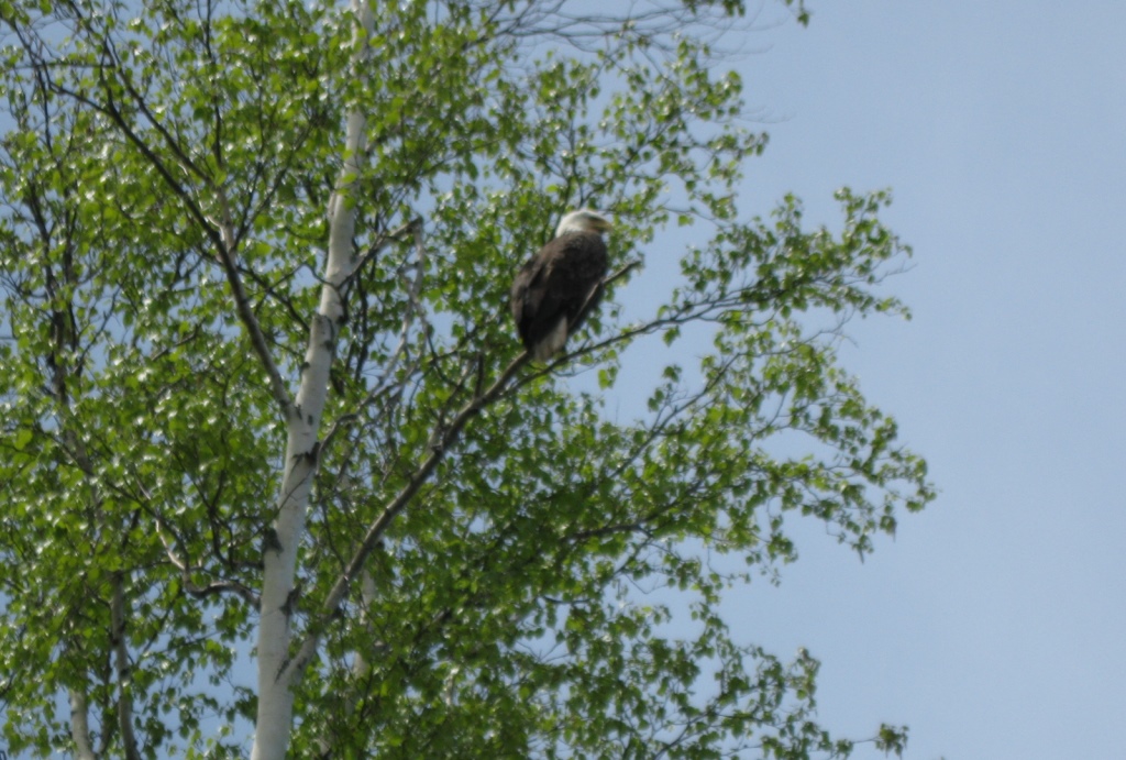
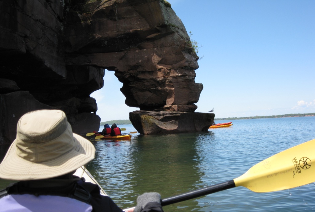
We
did something a little new this trip and took a
kayaking tour. We used the company
Lost Creek Adventures and they provided us with
very nice equipment, two very friendly and
knowledgeable guides, and a wonderful morning of
fun. The photos look a little different
because I did not use my camera on this excursion.
Mine was too big to fit in a water proof bag, so I
used the camera Lisa brought along. Yes, that
is an eagle in the forth picture of this group.
|
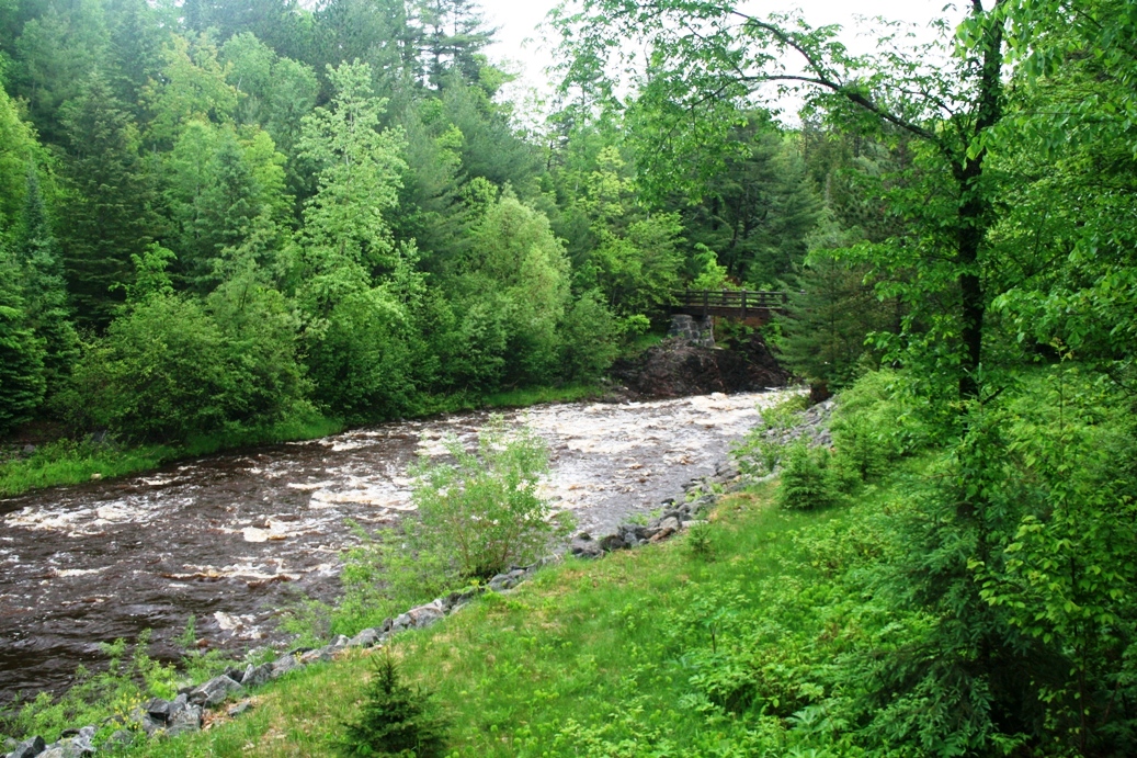
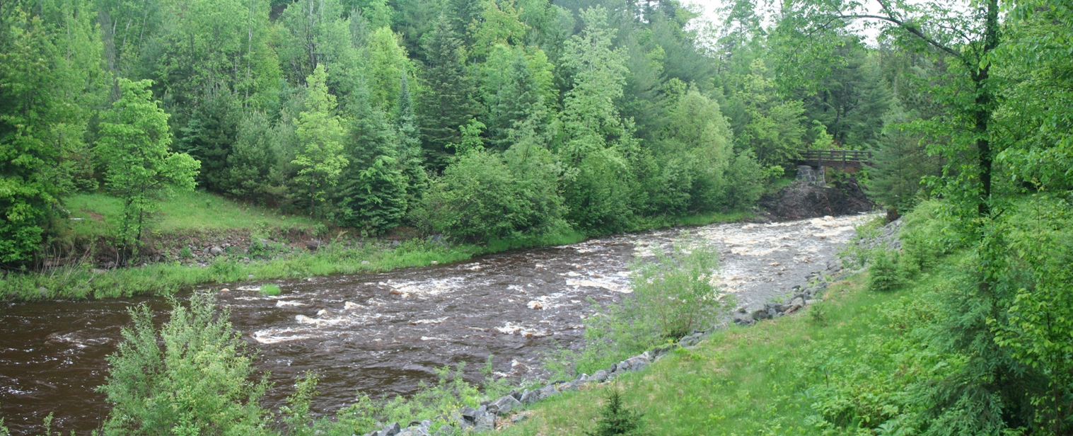
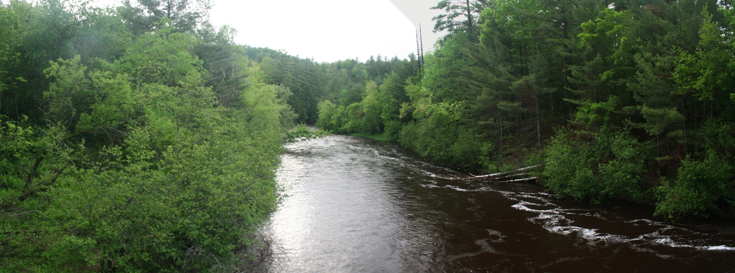
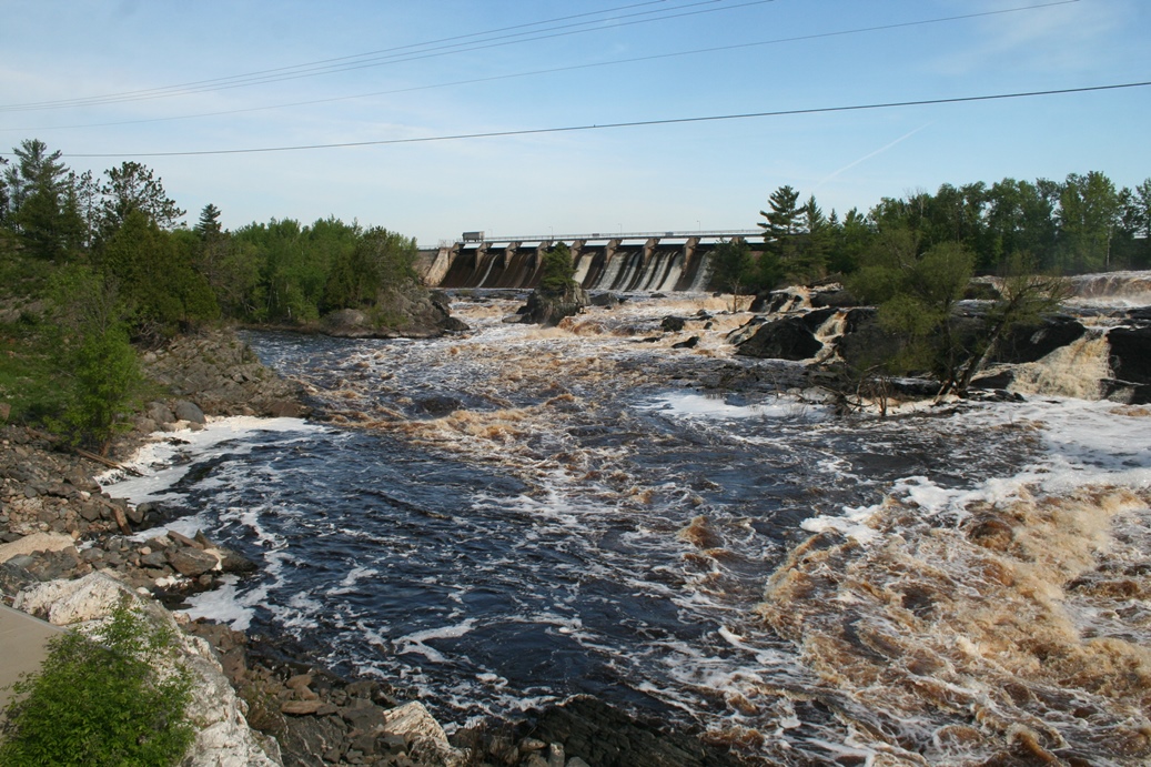
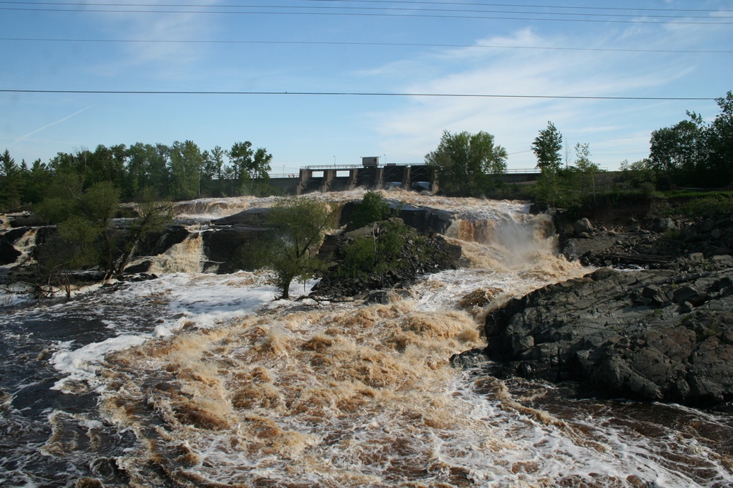
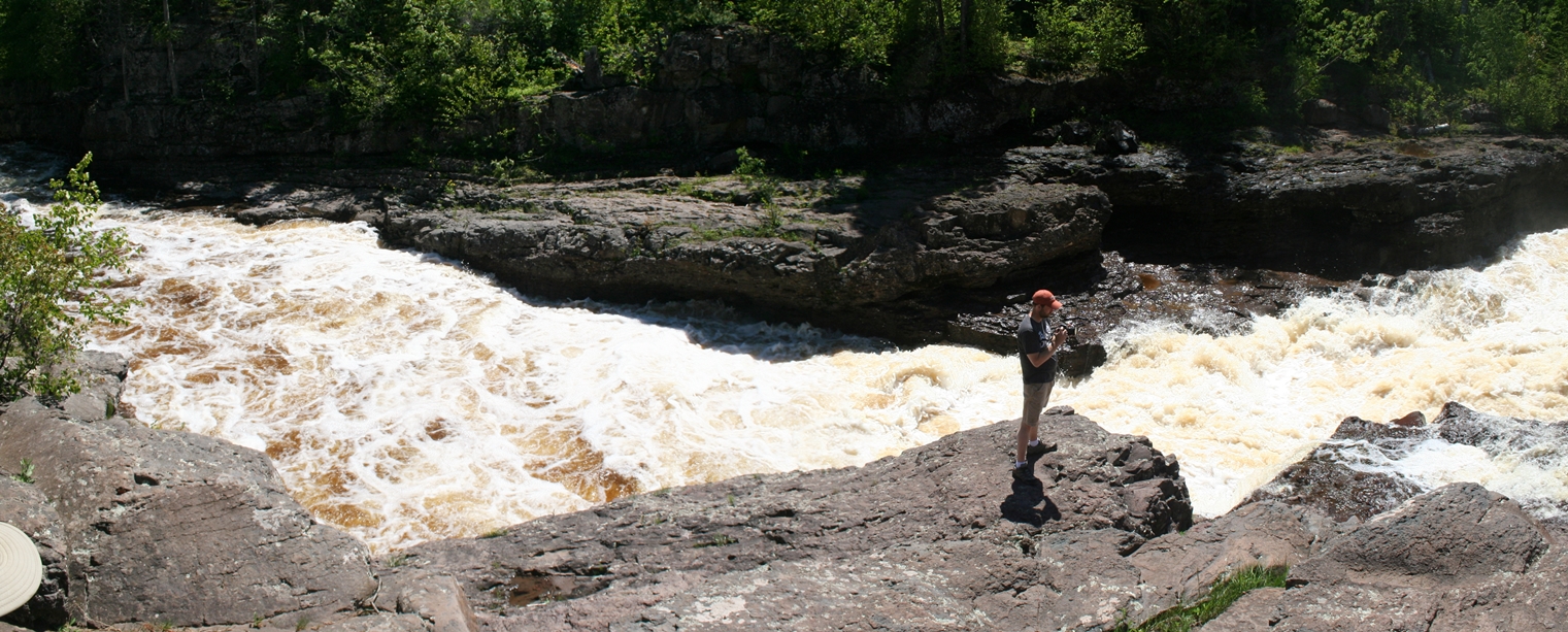
Jay Cooke State Park
The Swinging Bridge
(Click on Images for Larger Picture)
|
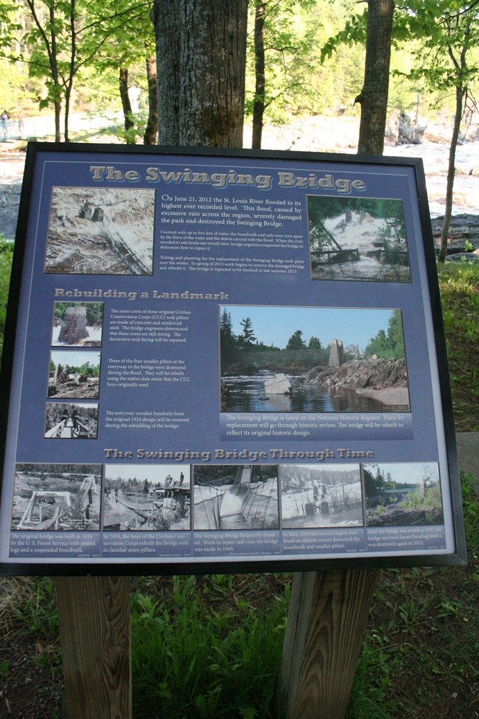
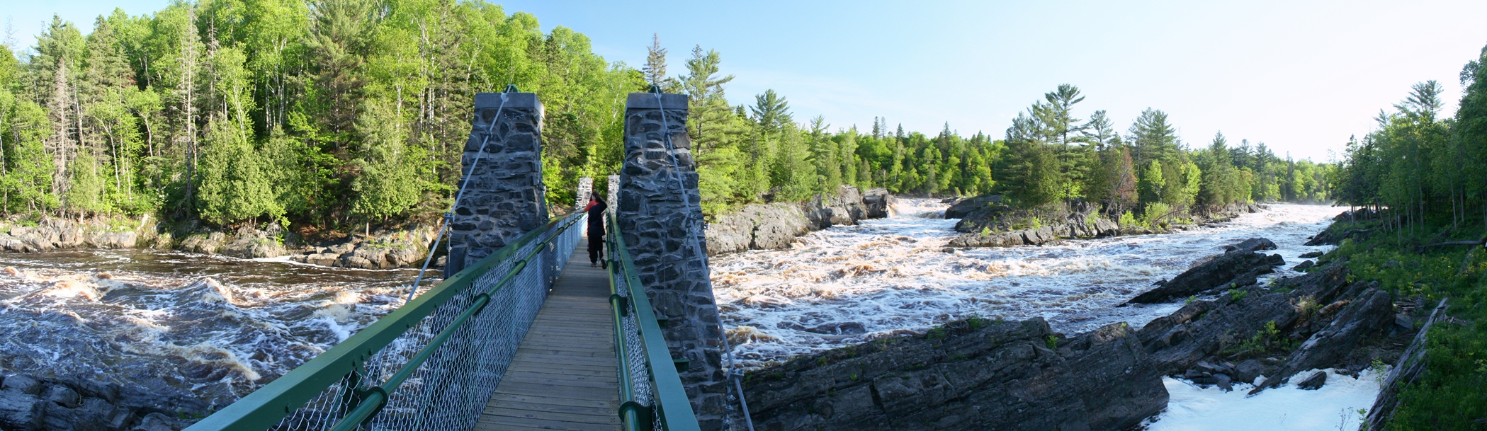
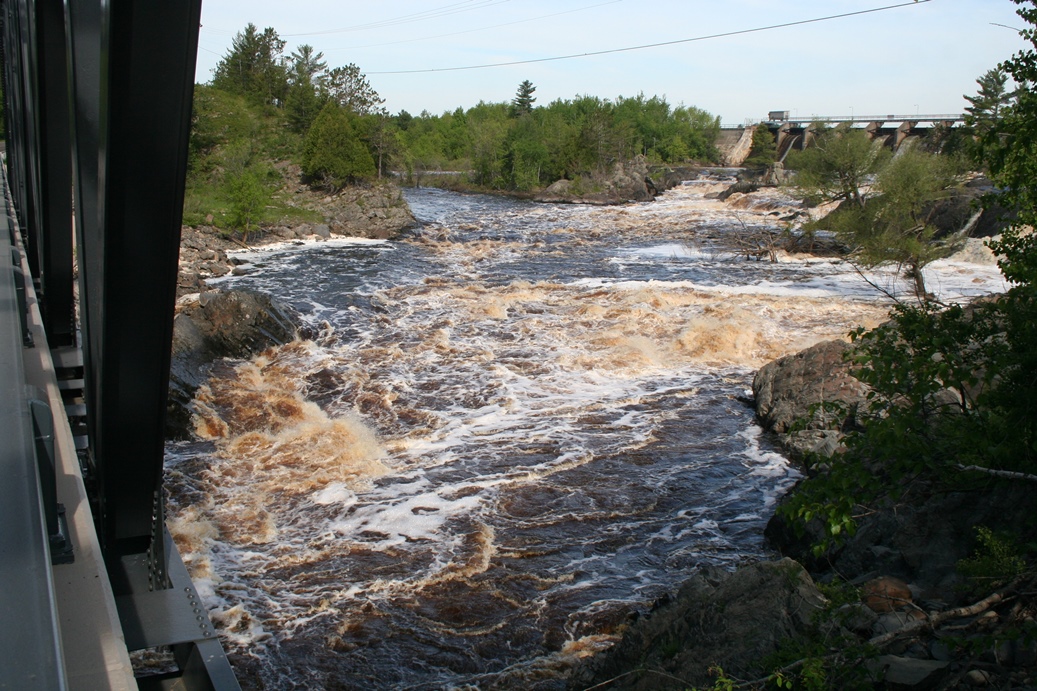
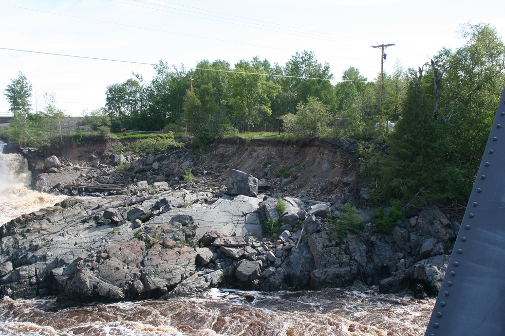
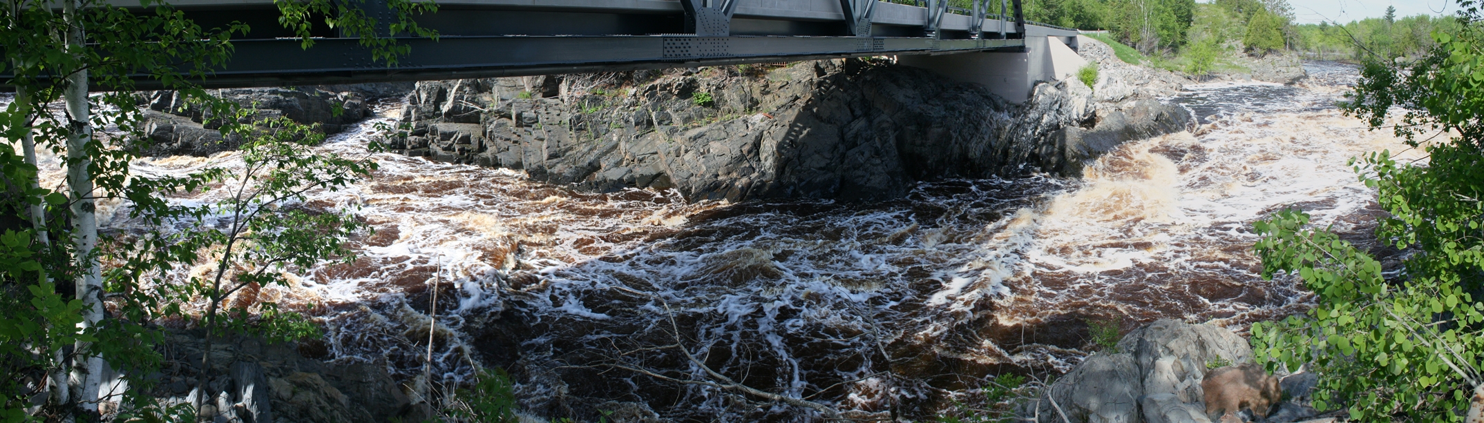
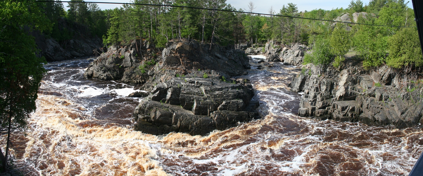
We
only spent a few nights in Jay Cooke State Park, and
did the tourist thing in Duluth, Minnesota, so we
did not get a chance to explore may of the park's
trails. We did go out to the swinging bridge
and the view was pretty spectacular as compared to
years past. The water was extremely high this
year, due to the amount of rain fall, so the rapids
were extremely active.
It
is a bit difficult to read in the first picture with
the sign, but apparently the water was so high in
2012, that the bridge was washed out. So the
one you see in the pictures is yet another
replacement bridge. Quite impressive the power
of water.
|
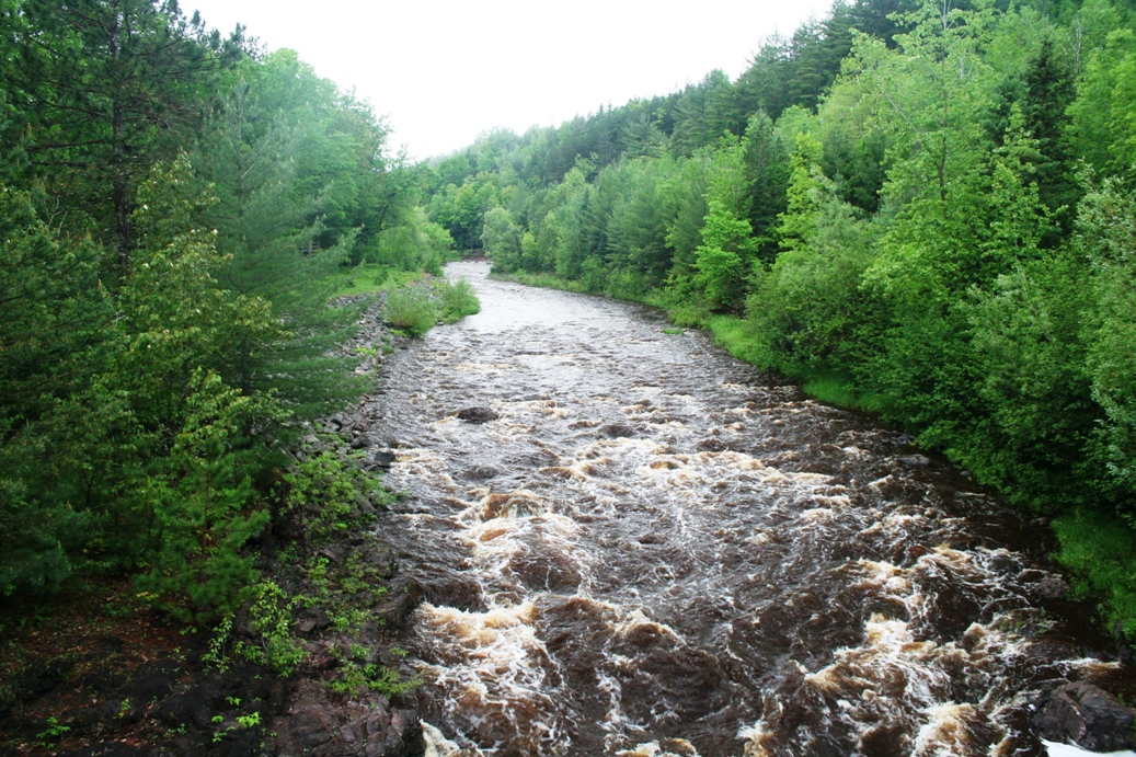
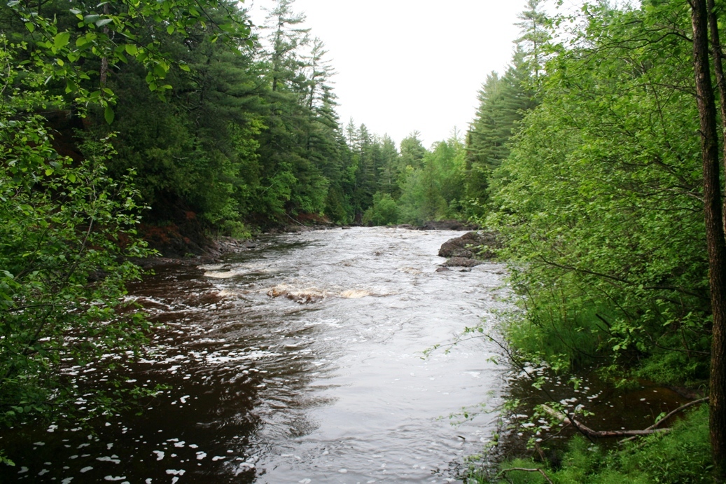
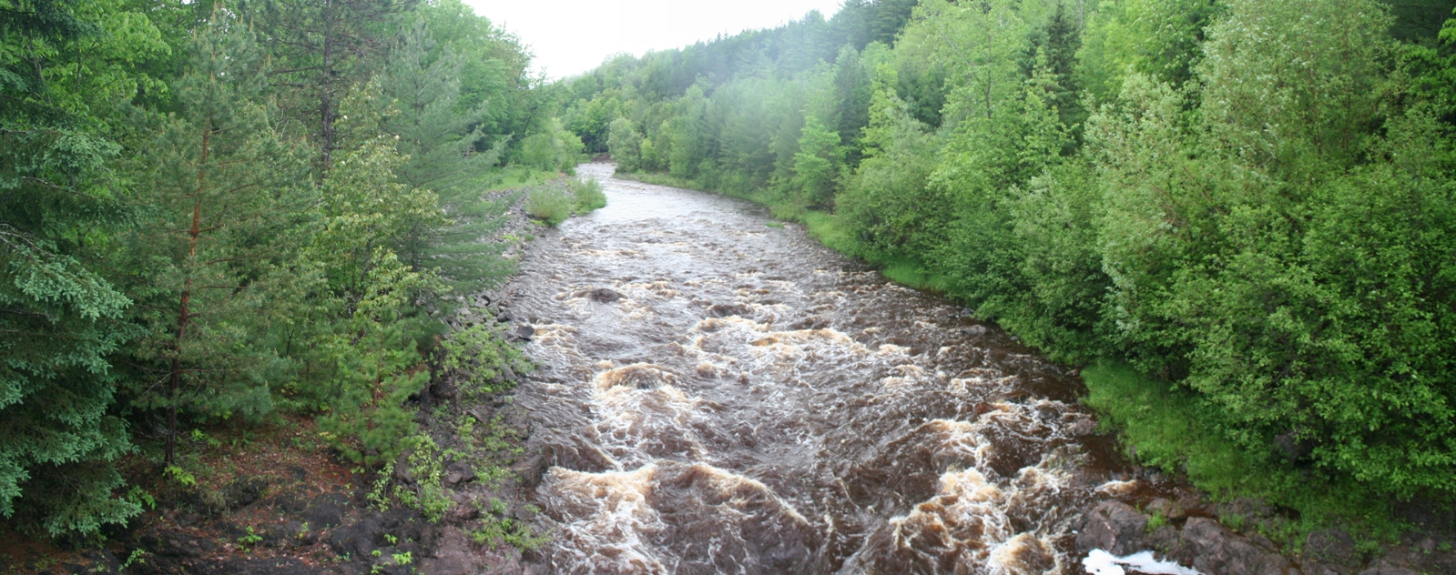
National Kayak and Canoe Center
(Click on Images for Larger Picture)
|
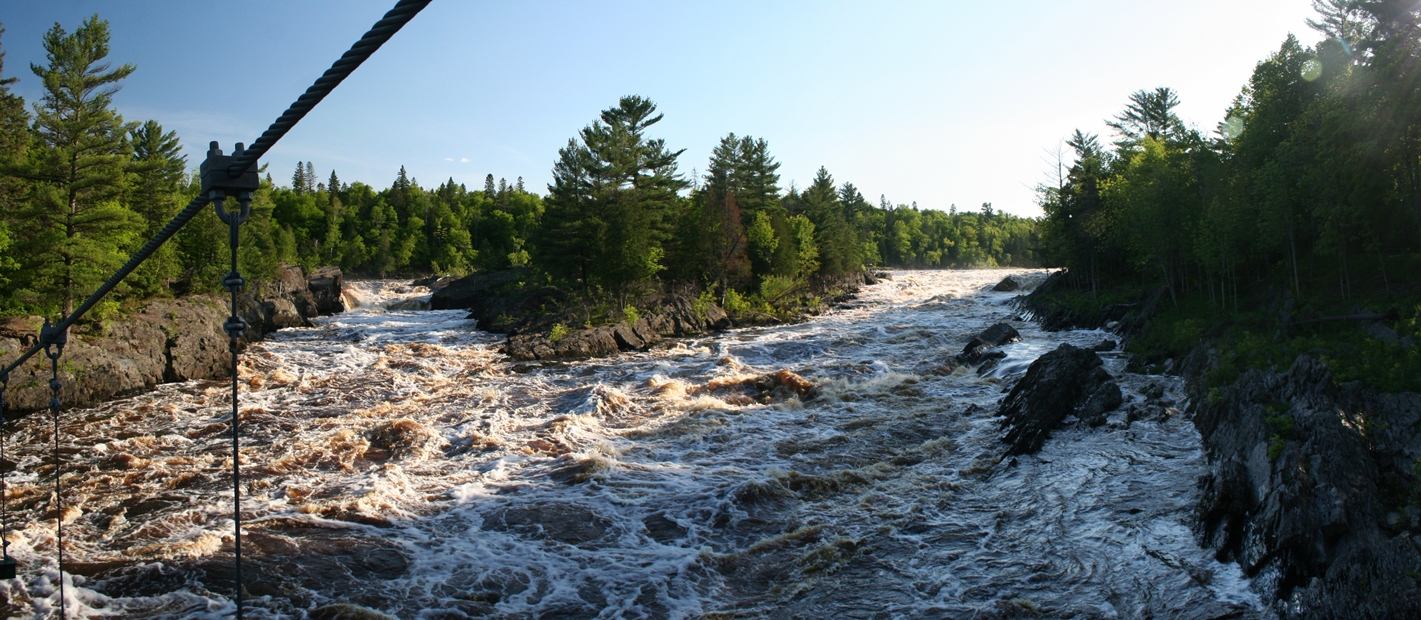
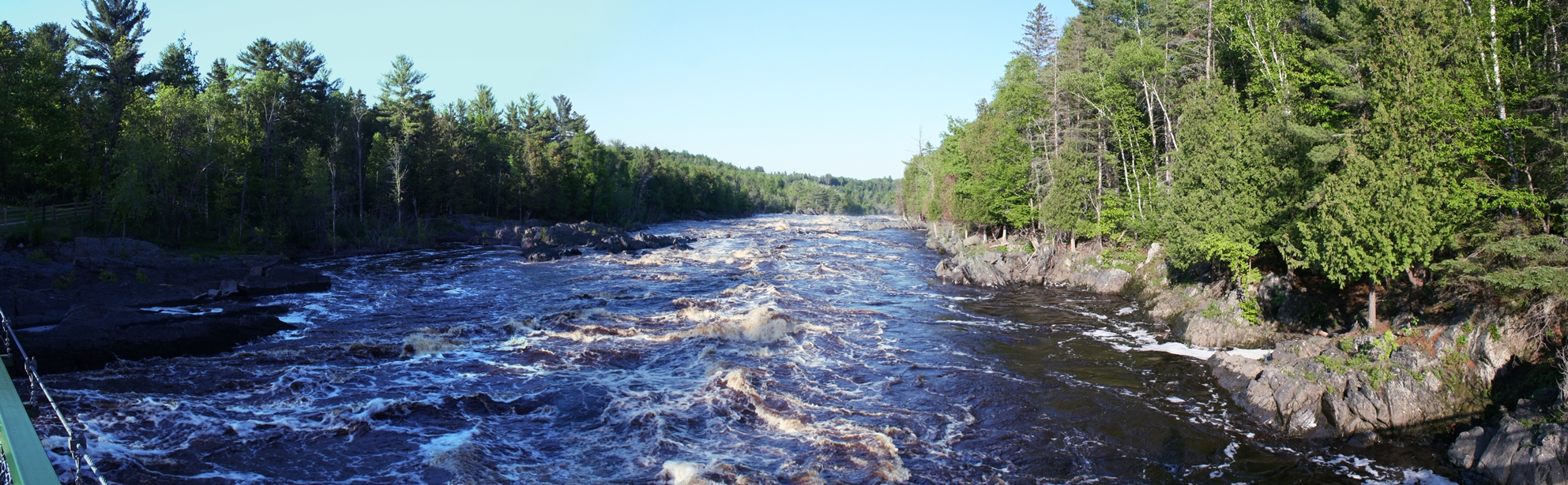
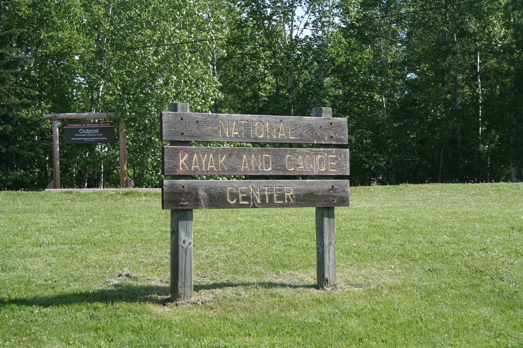
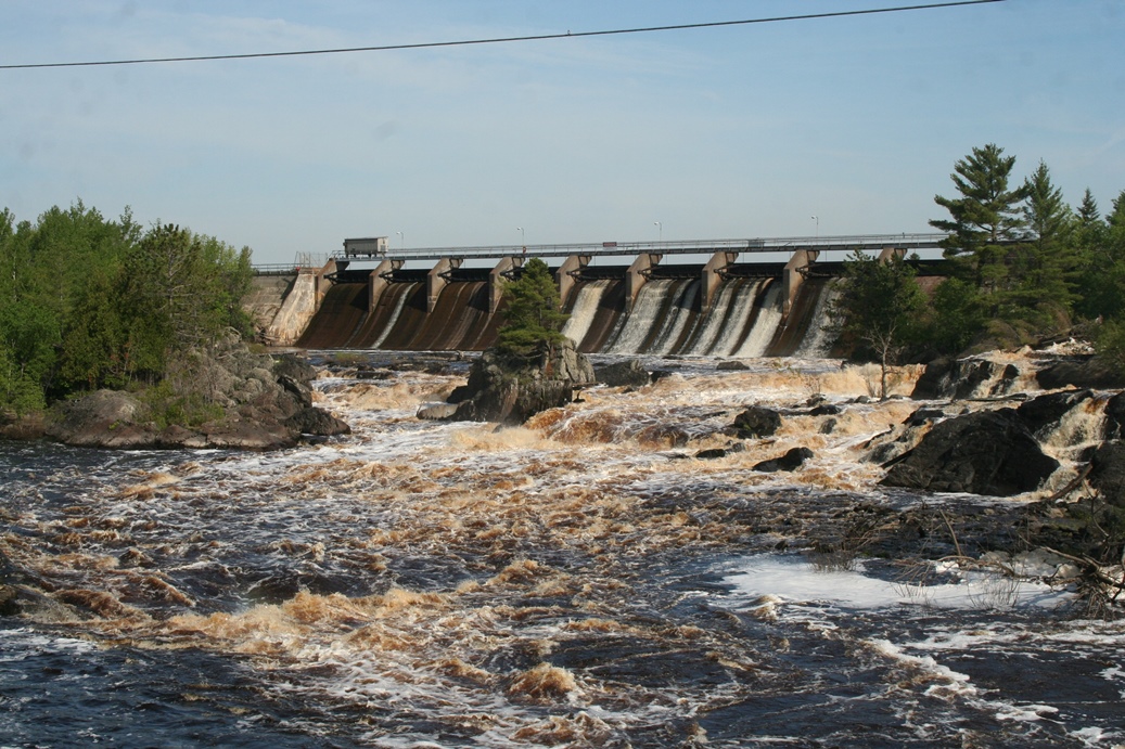
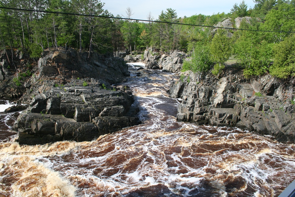
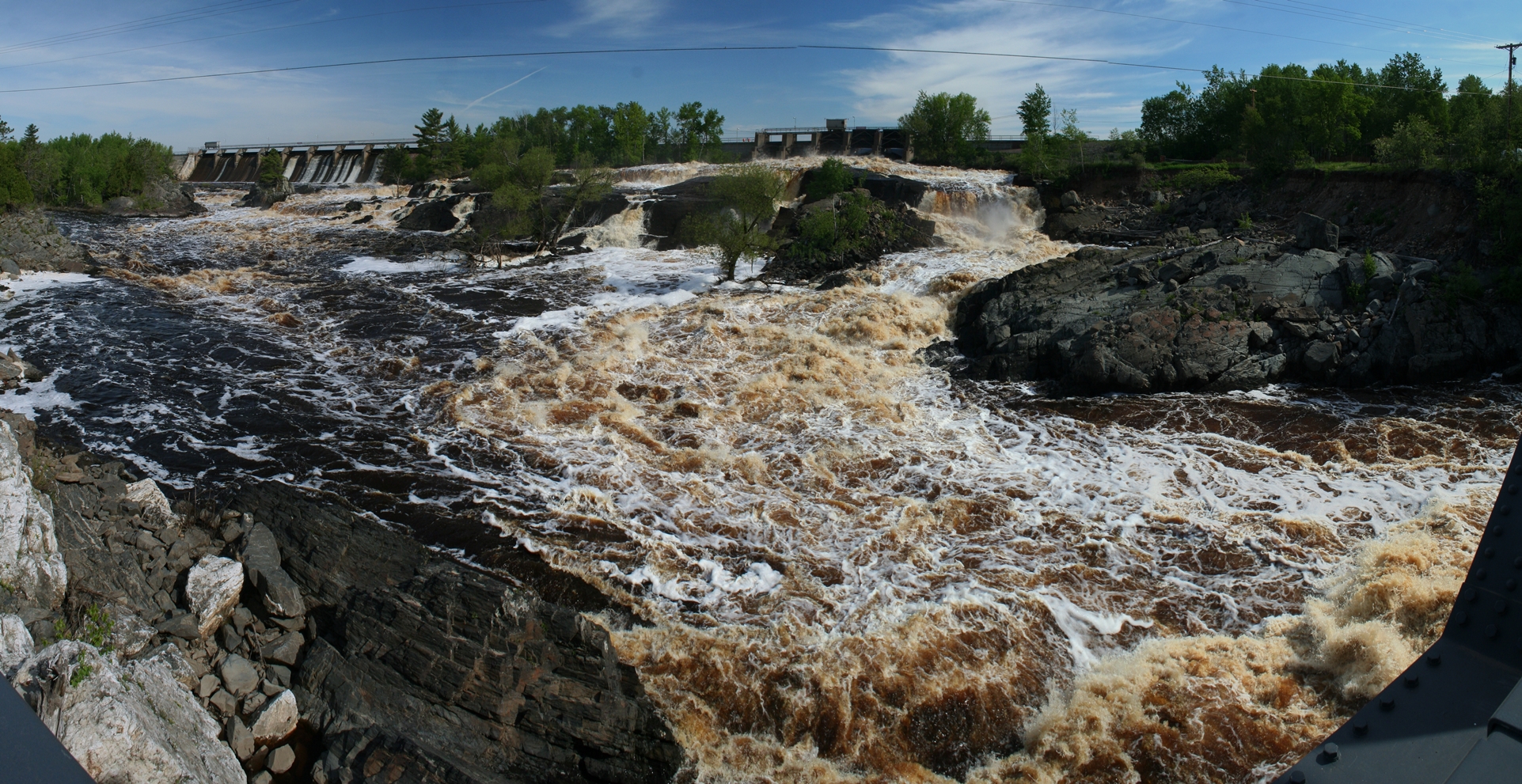
This
place is along the drive to Jay Cooke State Park,
and in years past, I always wanted to stop and get
photos, but never really took the opportunity.
Well this year, was the perfect time to stop.
With all of the high water, the rapids were really
rolling here. When we pulled into the closest
parking lot to the dam and river to get photos, I
noticed a sign that said
National Kayak and Canoe Center. I did not
realize that they actually kayaked down this
particular portion of the river, but according to
their website, they do somewhere south of the dam.
Please visit the website for more information.
|
Panoramic
(Click on Images for Larger Picture)
North Shore Scenic Railroad
Lester River Excursion
(Click on Images for Larger Picture)
|
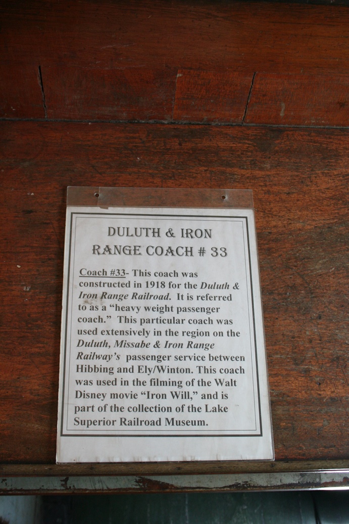
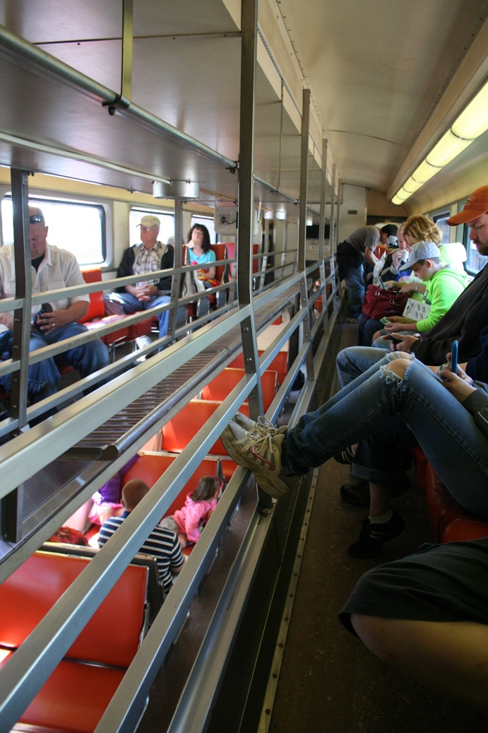
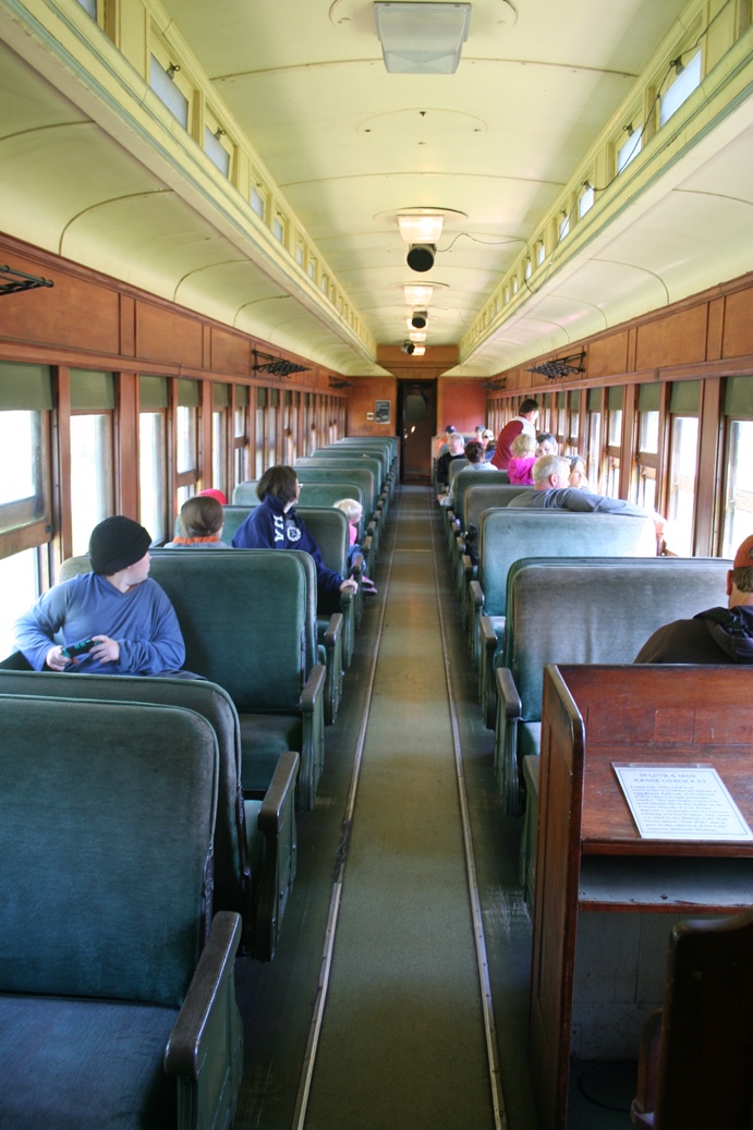
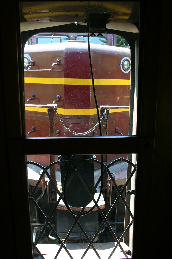
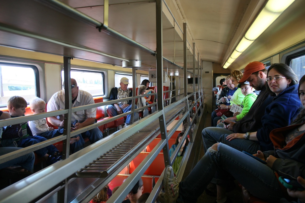
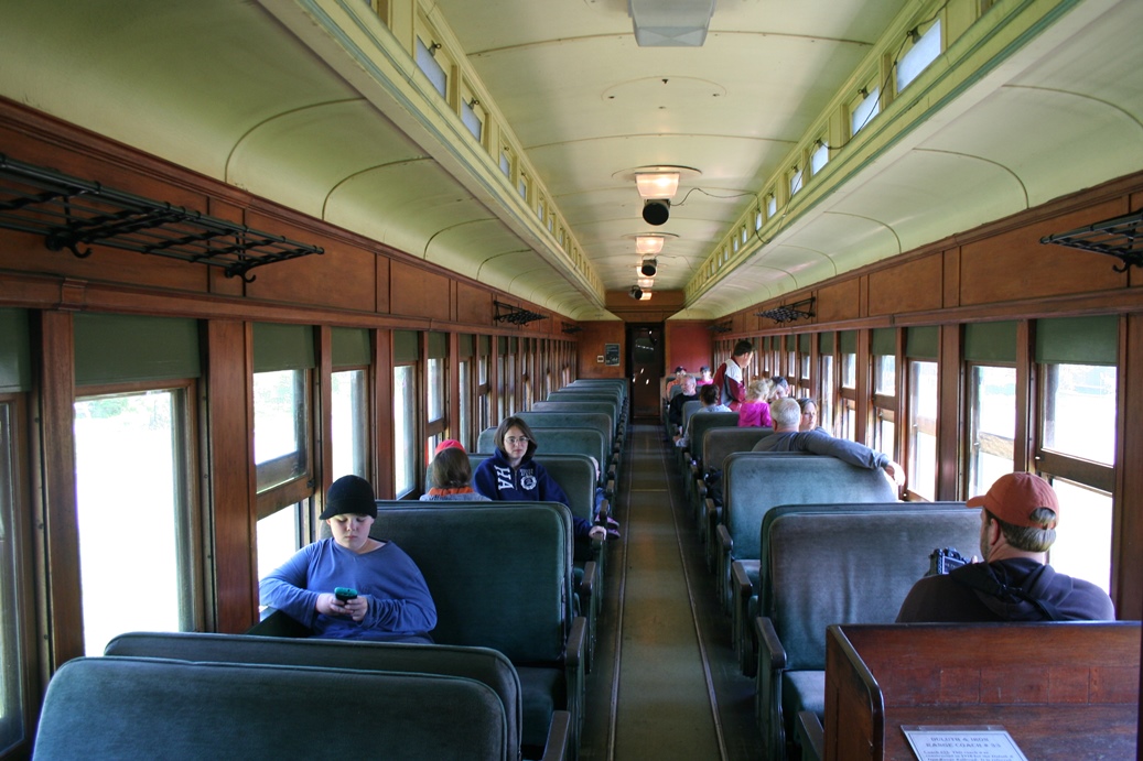
This
was the second time we traveled on the
North Shore Scenic Railroad. The last time
was for the Two Harbors tour, but unfortunately, due
to some bridge construction, the Lester River
Excursion was the farthest the train was traveling
this particular day. It was still well worth
it. We started off in the more modern of the
passenger cars and eventually moved back to the
vintage car in the rear (on the way back it was in
the front). The card in the first photo gives
you a bit of the history of this particular car.
|
Views from the Train
(Click on Images for Larger Picture)
|
The
scenery is actually more interesting than these few
photos show, but it does reveal the variety of
scenery that you will see on the tour.
|
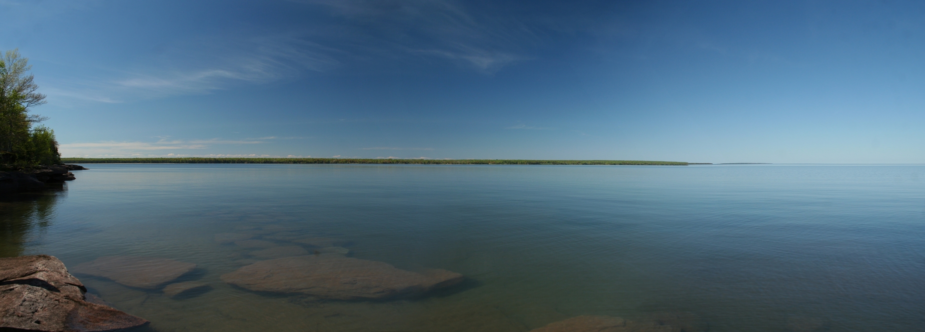
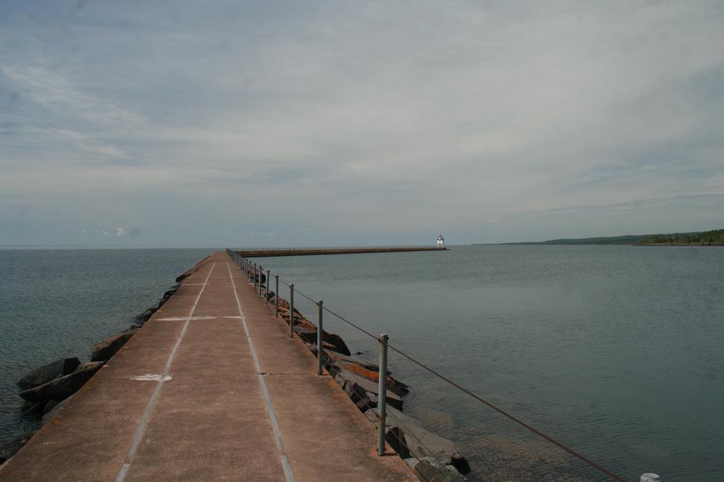
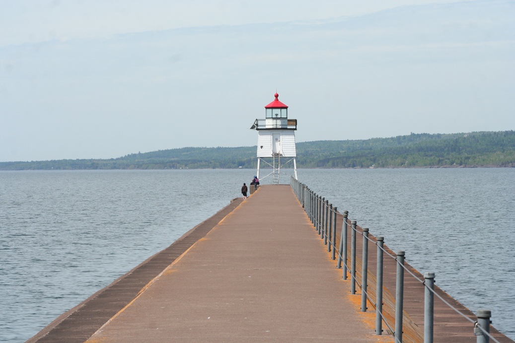
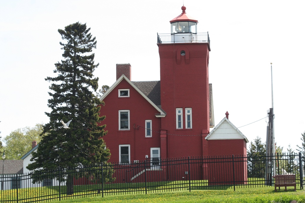
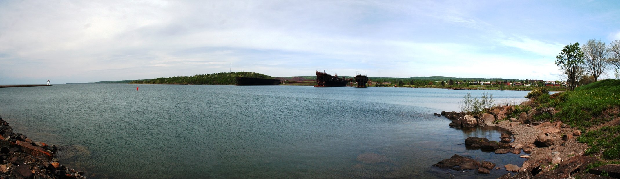
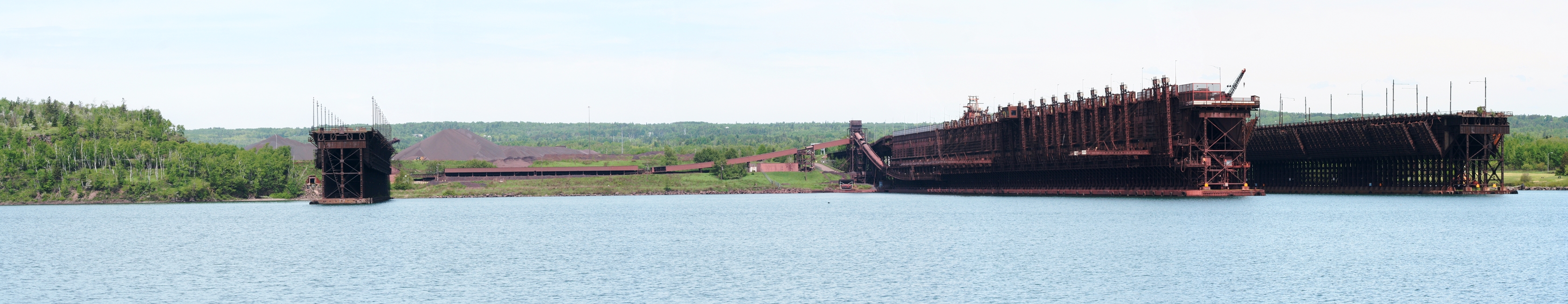
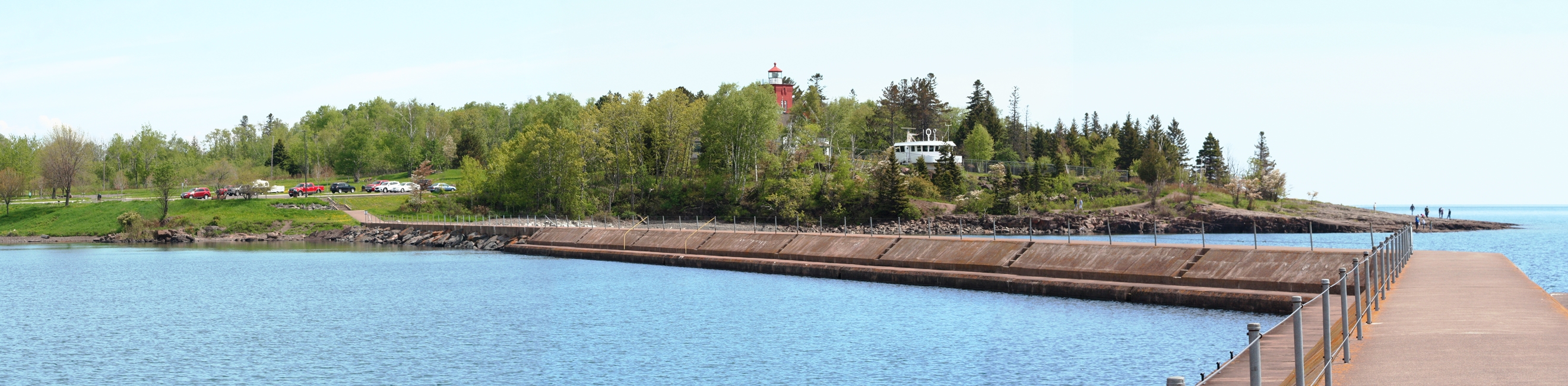
Two Harbors, Minnesota
(Click on Images for Larger Picture)
|
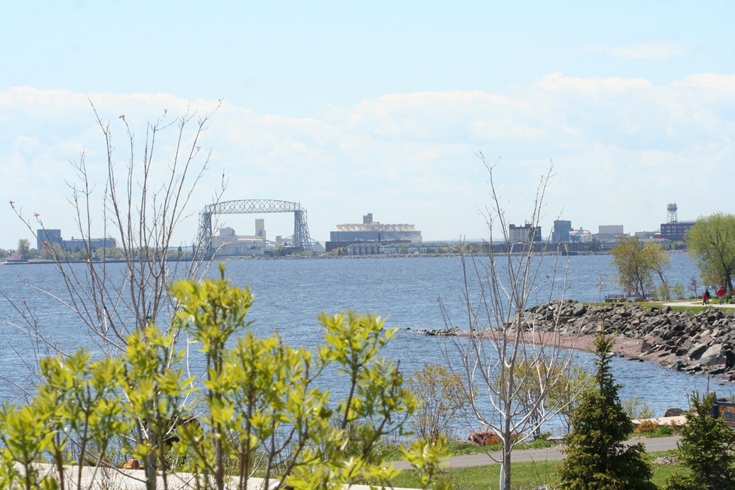
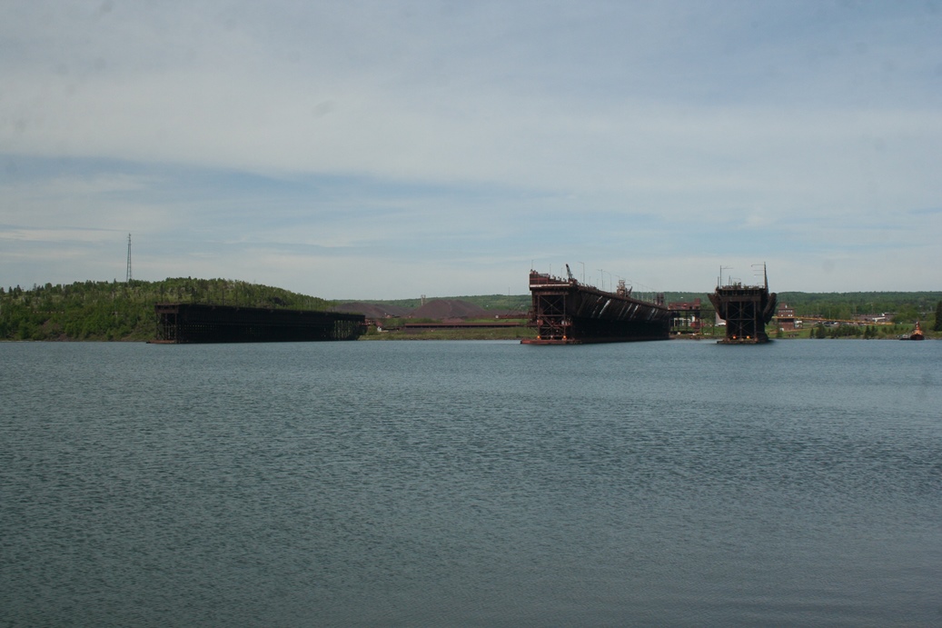
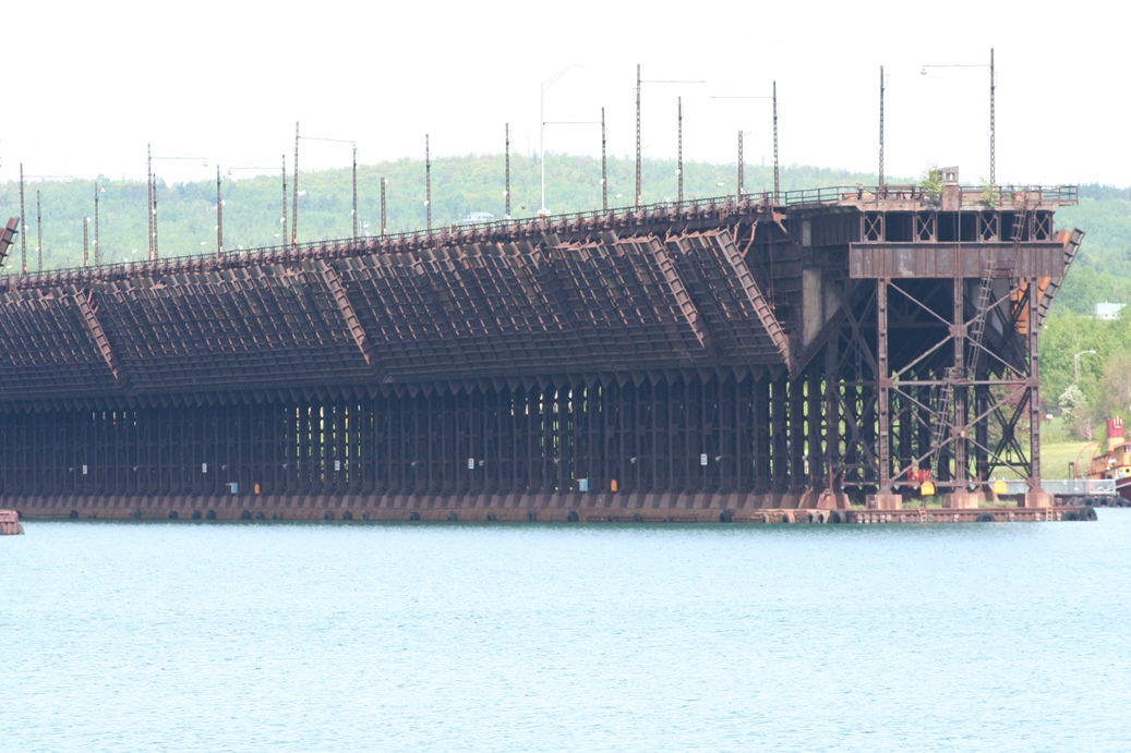
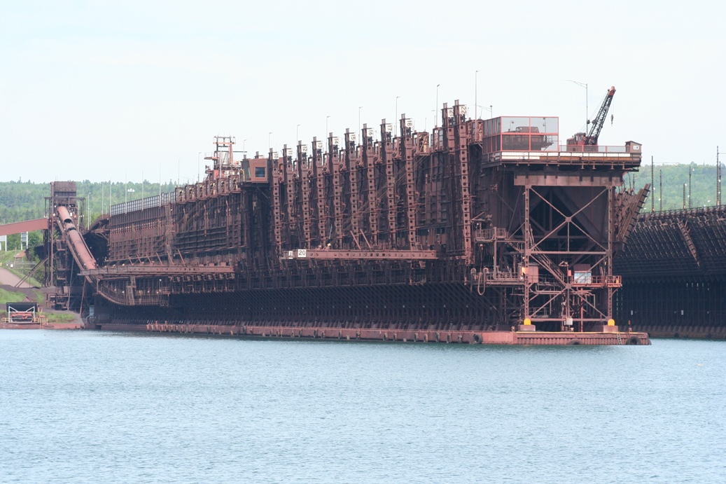
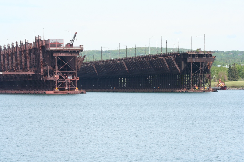
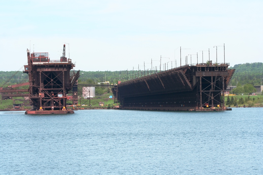
We
made several stops on our way from Jay Cooke State
Park to Temperance River State Park in Minnesota.
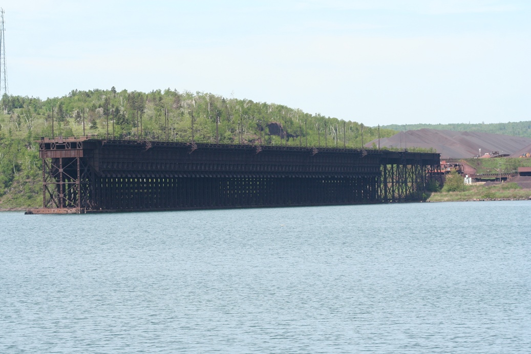
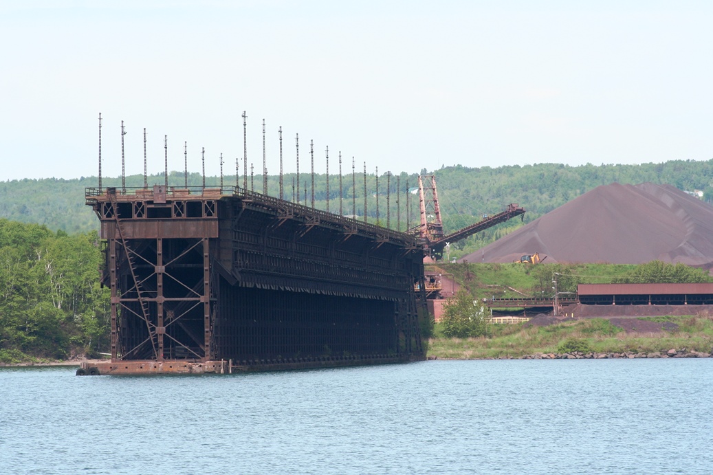
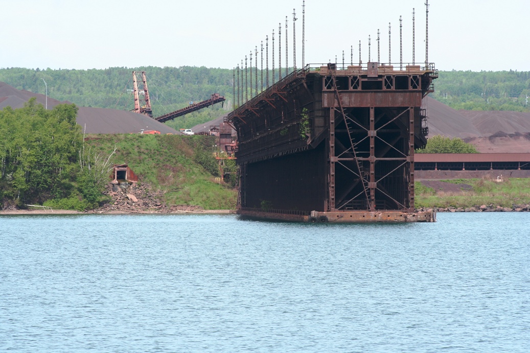
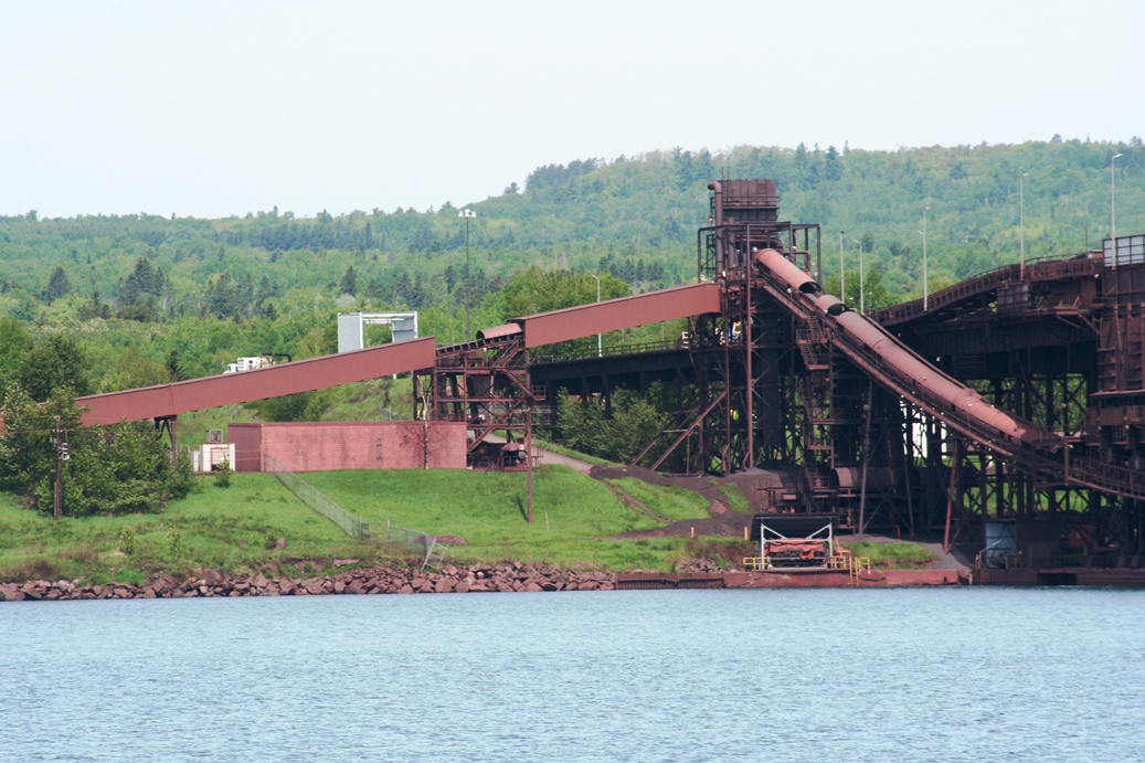
The first of which was Two Harbors. This is a
favorite of ours and never really gets dull for us.
We were hoping to see an ore boat at the docks at
least, but unfortunately, nothing was really
happening. I did get some good shots with a
telephoto lens, but unfortunately, the lighting was
bit tricky, especially when it came to the panoramic
shots below.
|
Panoramic
(Click on Images for Larger Picture)
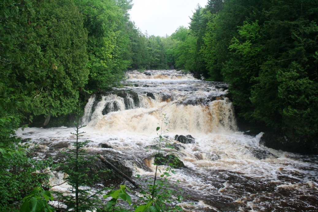
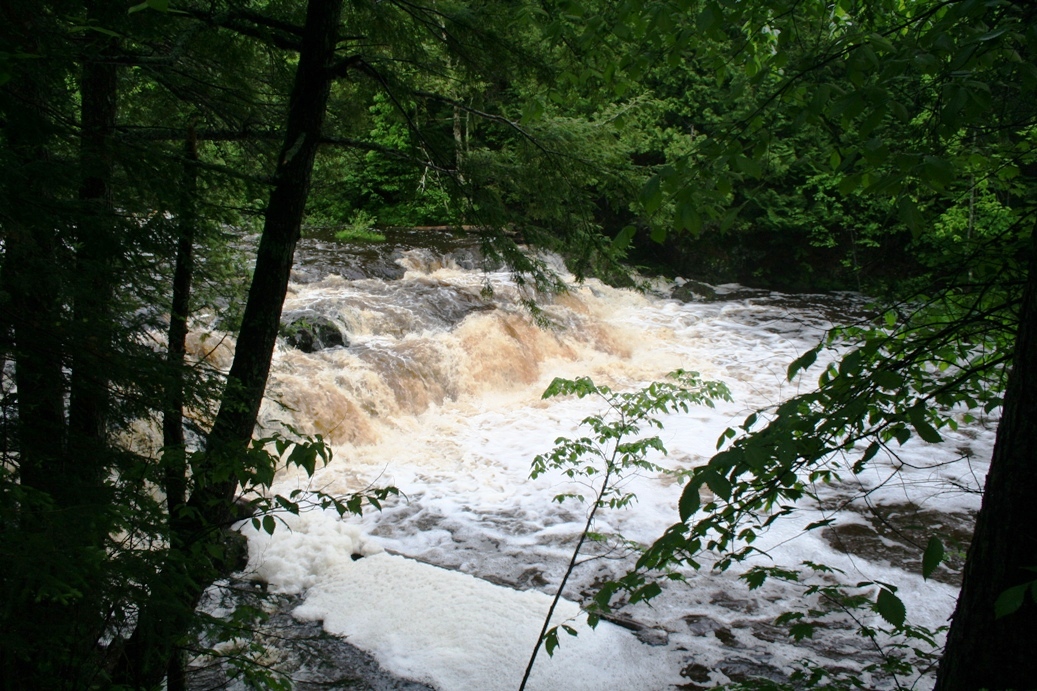
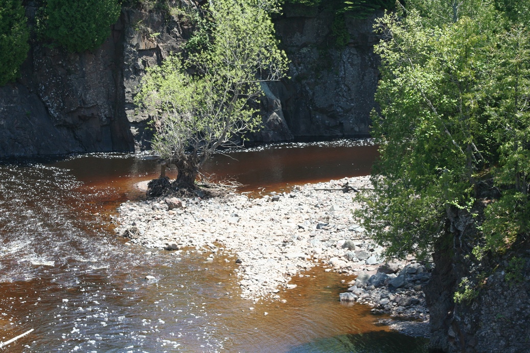
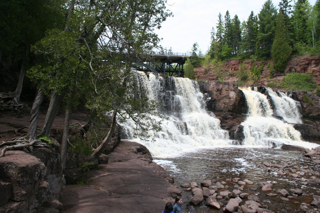
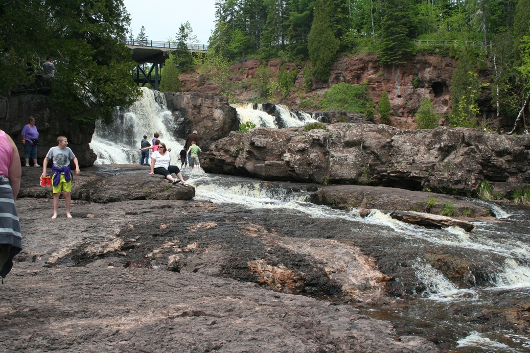
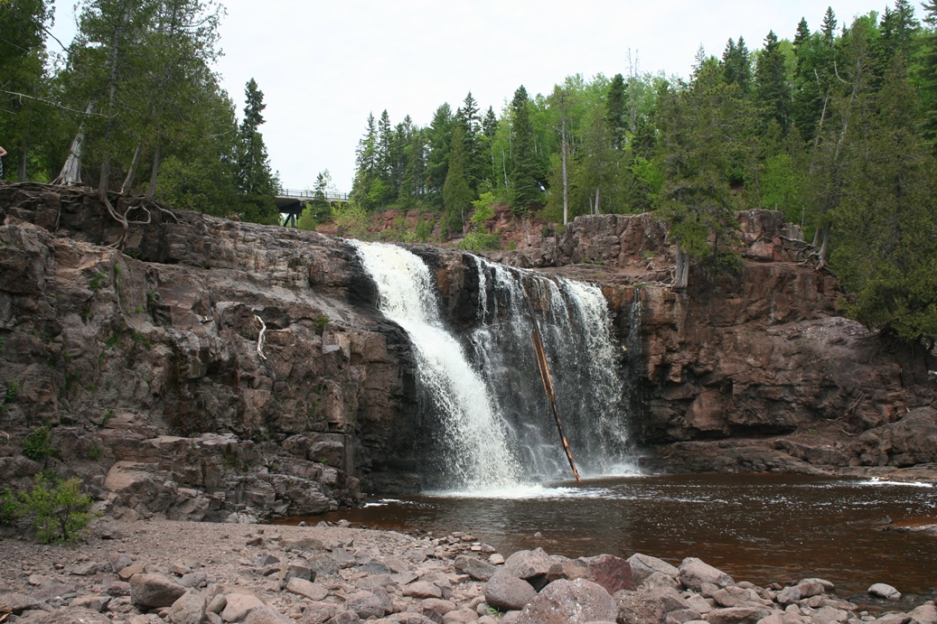
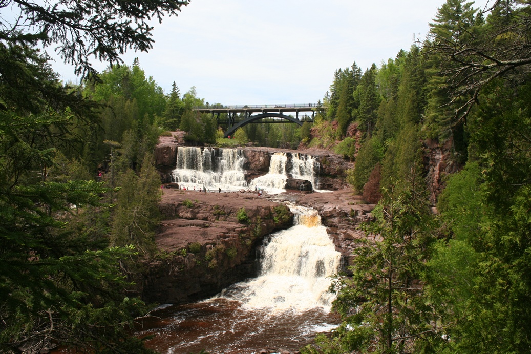
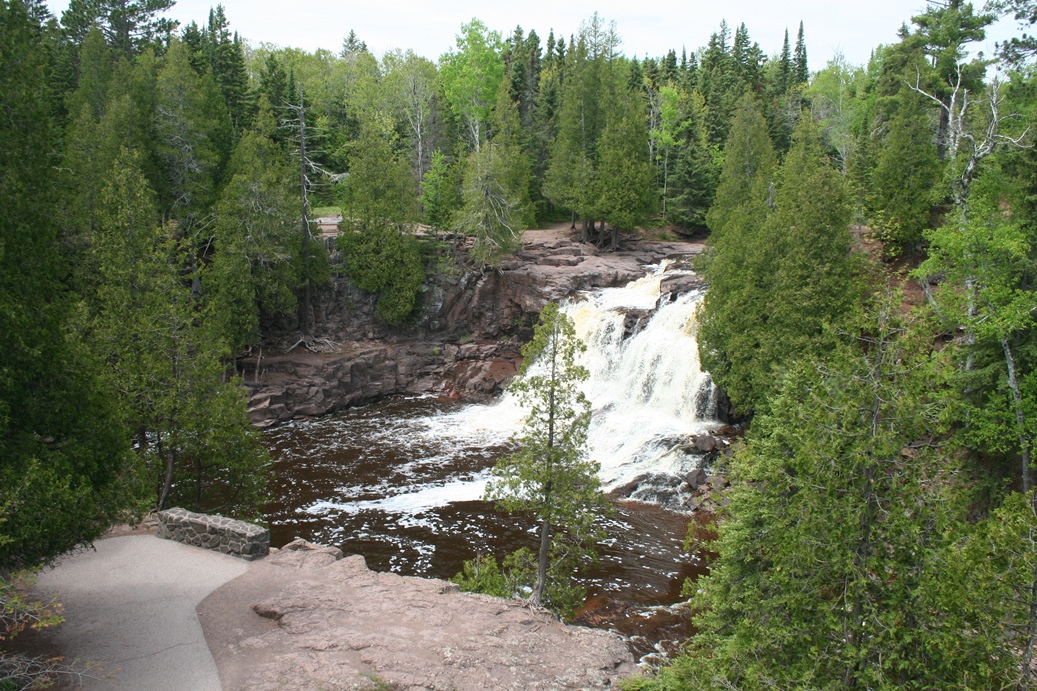
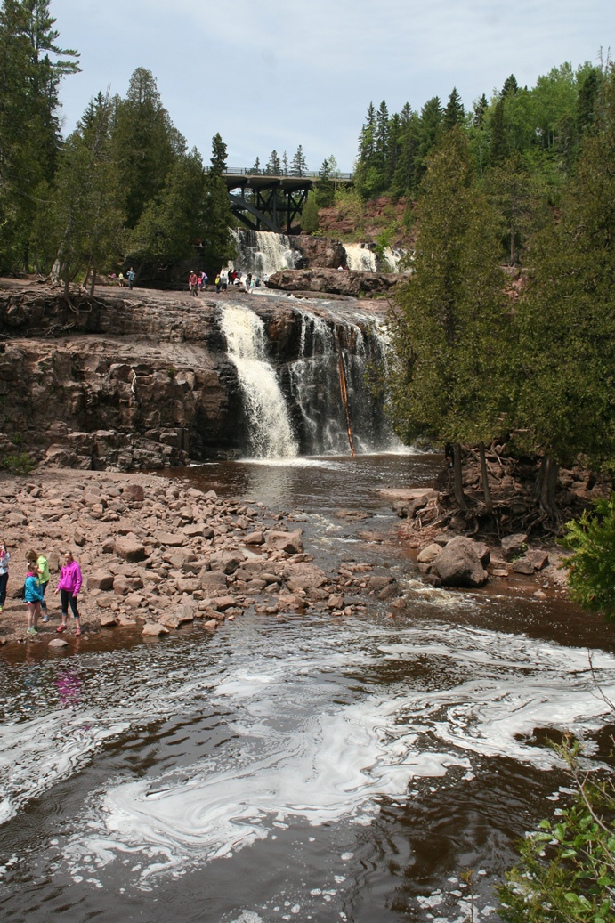
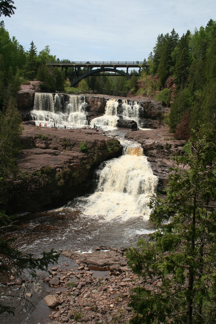
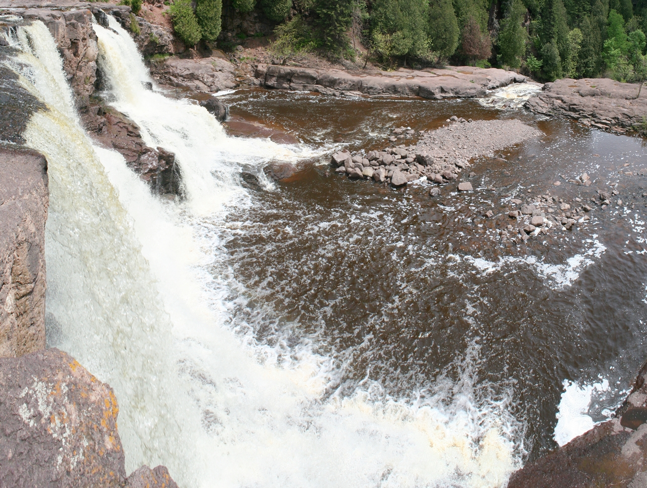
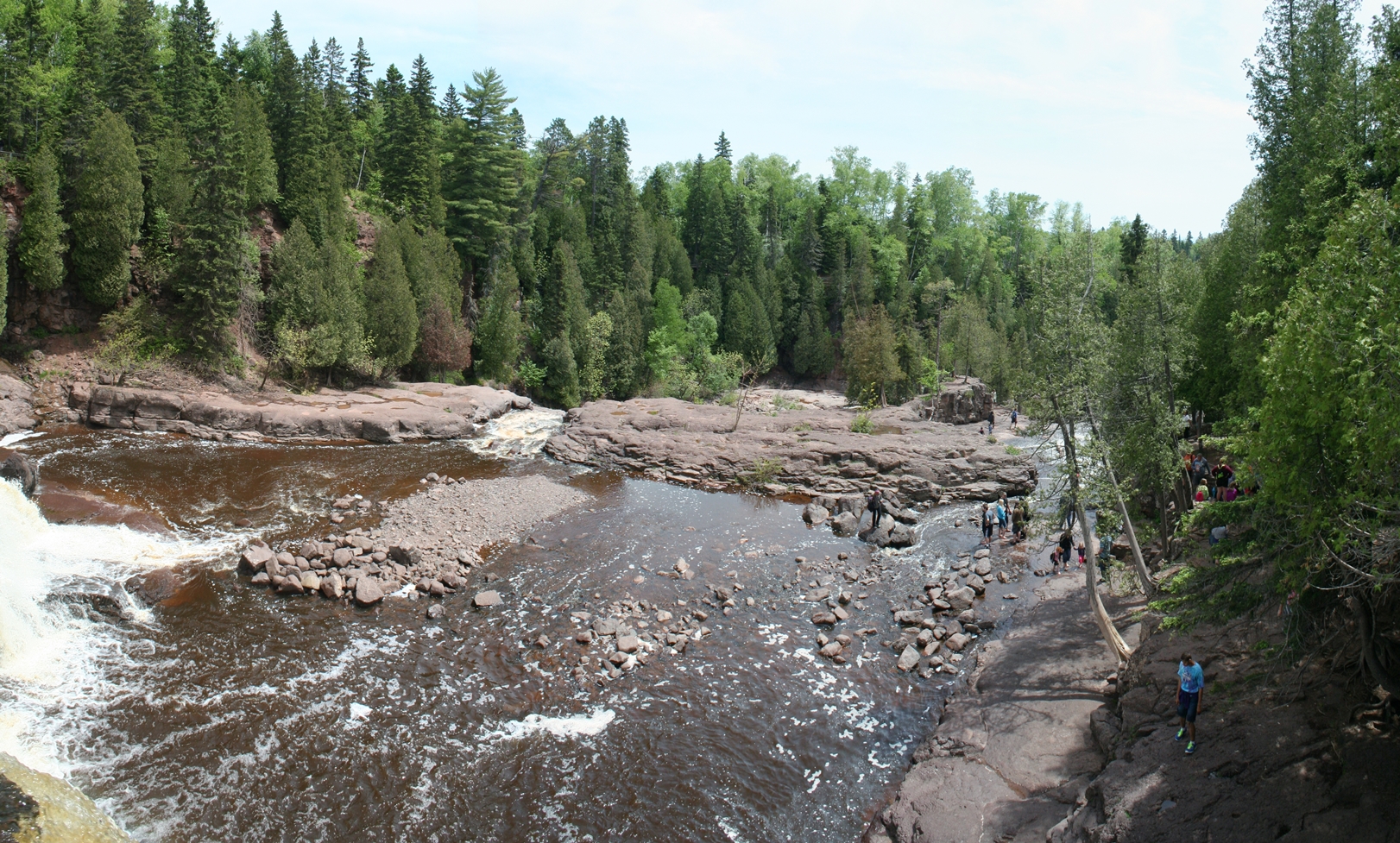
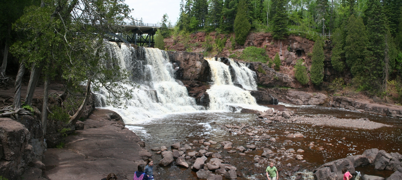
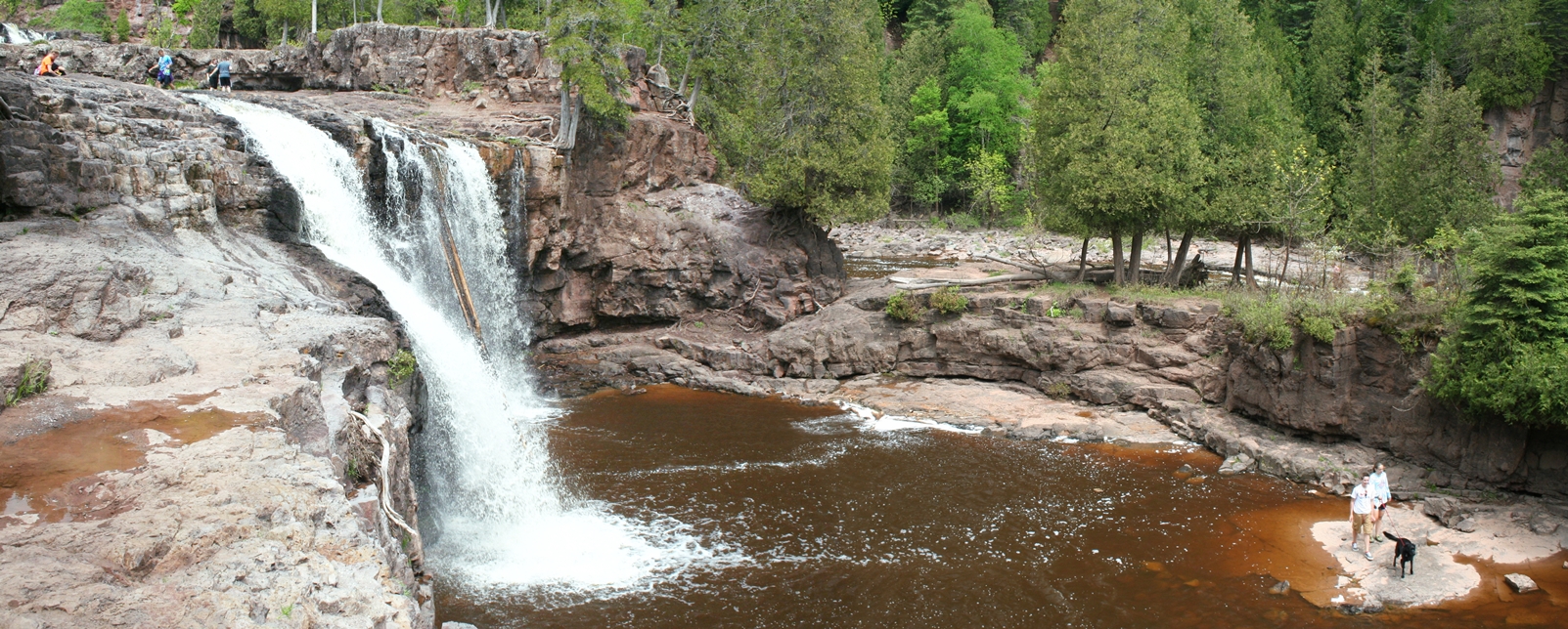
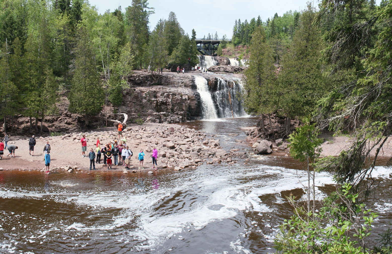
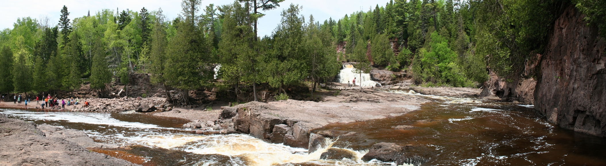
Gooseberry Falls, Minnesota
(Click on Images for Larger Picture)
|
Another stop along the drive up the North Shore was
Gooseberry Falls. I was hoping that the falls
might have been flowing a bit more this time of the
year, but unfortunately it was not. The falls
were still pretty impressive and it was fun to walk
down below the falls where the water usually
covered. We ended up going down to the bottom,
crossing over, and then going up to the first falls
in this portion of the river.
|
Panoramic
(Click on Images for Larger Picture)
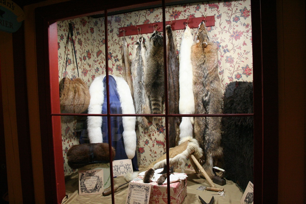
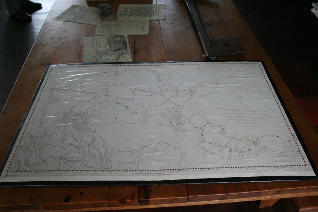
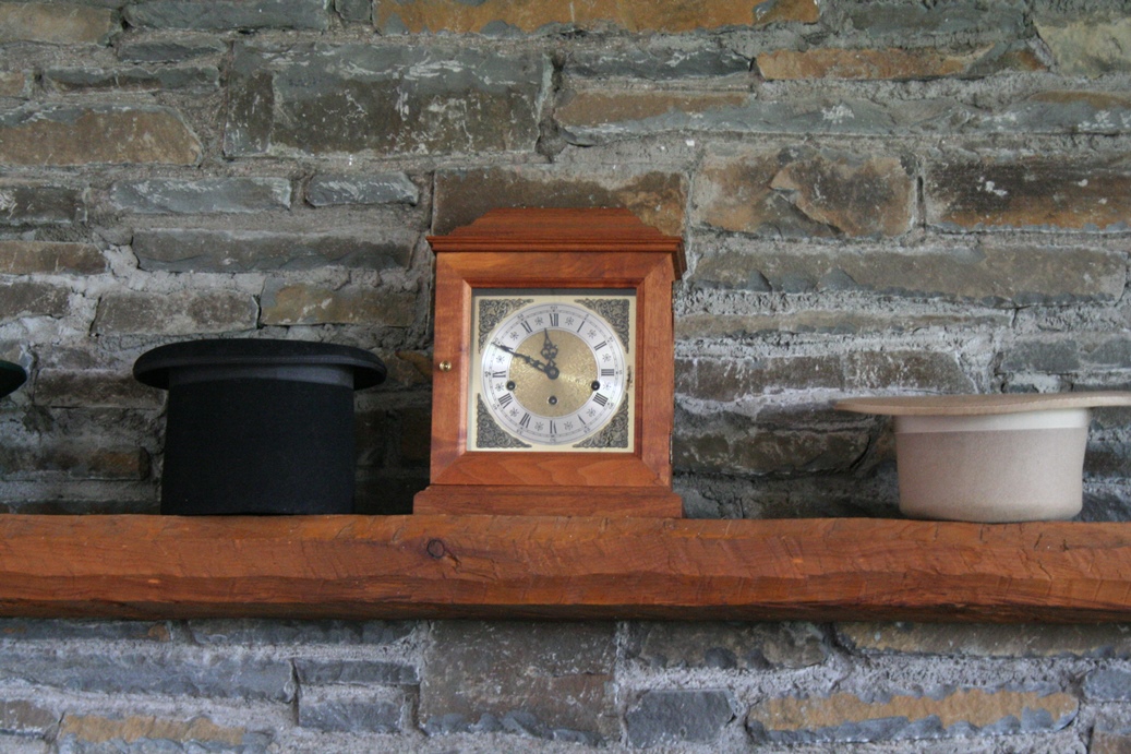
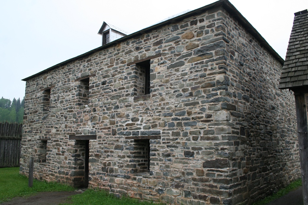
Grand Portage Trading Post
(Click on Images for Larger Picture)
|
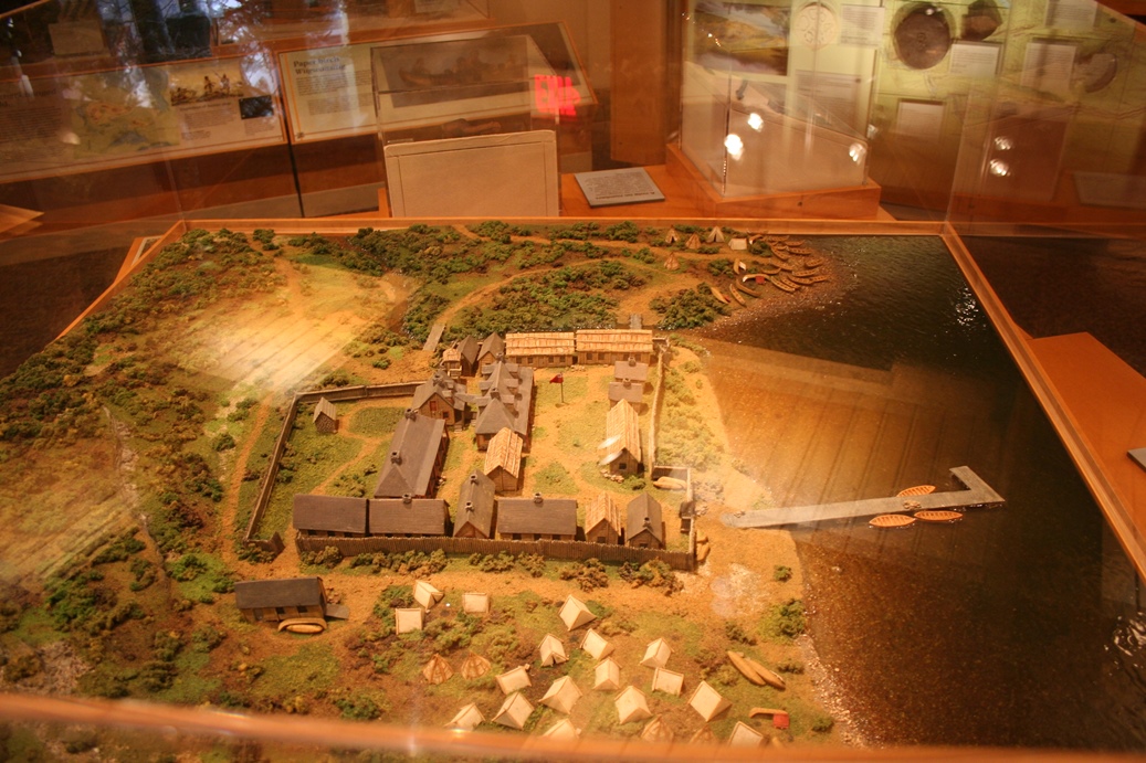
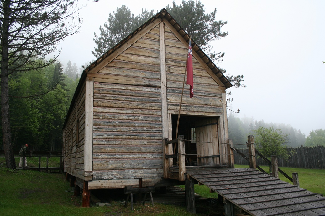
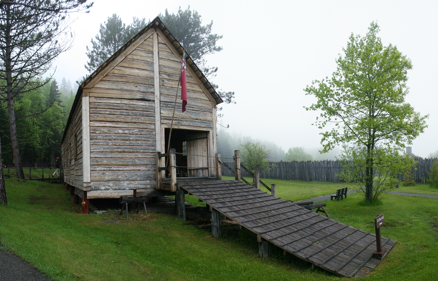
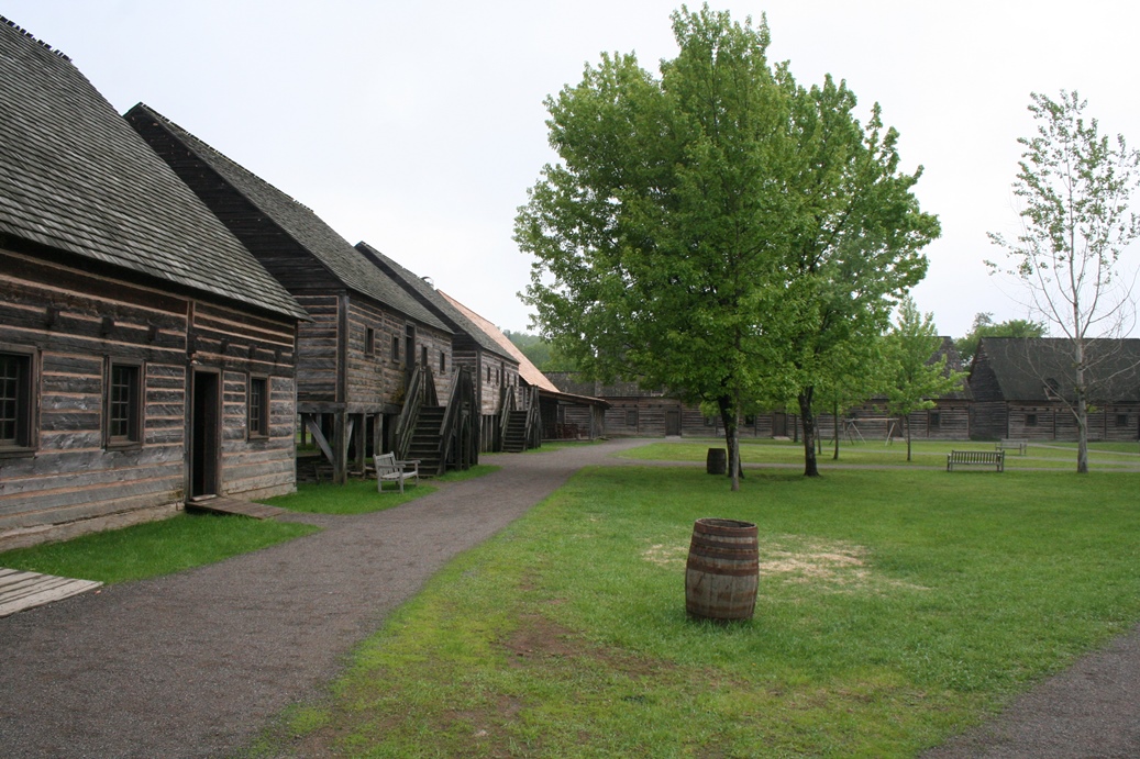
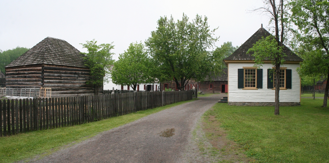
We
visited the reconstruction of the Grand Portage
Trading Post again this year. We really enjoy
visiting these types of historic areas, especially
if they are in original condition. While the
Grand Portage Trading Post a completely
reconstructed site, they have done a really
wonderful job in recreating the historical site to
its original glory. I recommend taking a tour
of the museum before going out to the Post itself.
It helps to learn about the site, its purpose, and
history. The first photo above is of a
representation of what the post and area looked like
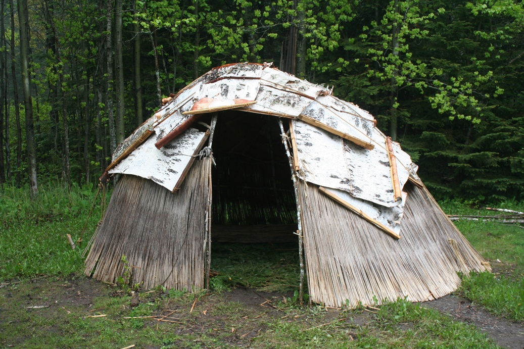
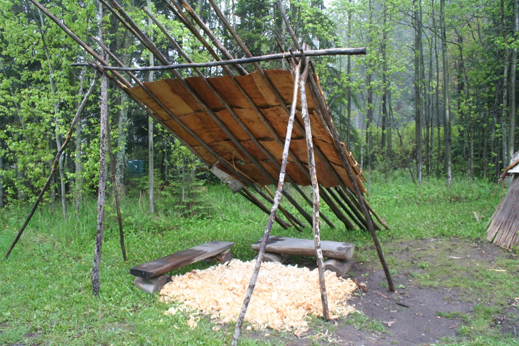
during the time of its use. The second photo
is of the various stages of a birch bark canoe.
Both are located in the visitor's center museum.
If
you would like more historical information about
this site, please visit our photo album from
2010 of this site, or
you can visit the official website of the
Grand Portage National Monument.
|
|
|
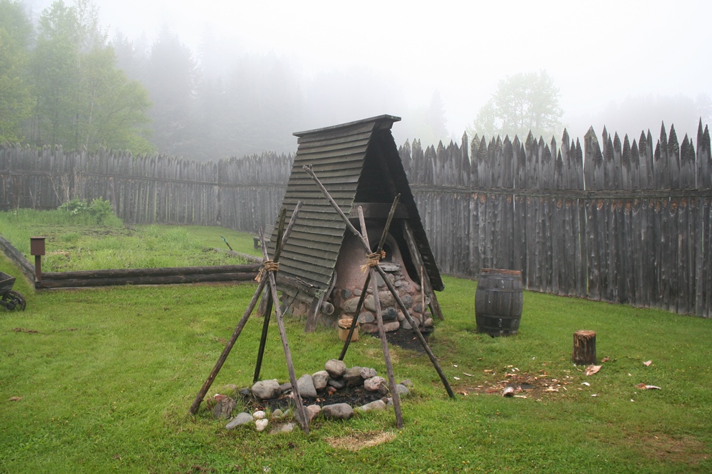
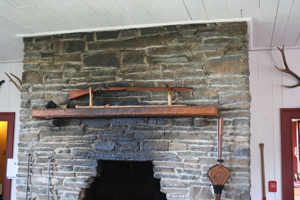
The
photos above are from the various areas around the
outside of the main post and building. You can
take one of the guided tours in which the guide,
usually one of the re-enactors, describes the
various areas of the post, as well as sharing many
stories about the post and the people who used it.
This particular trip for us, we just did the self
guided tour of the post, but I would recommend at
least one time doing a tour with a guide.
|
|
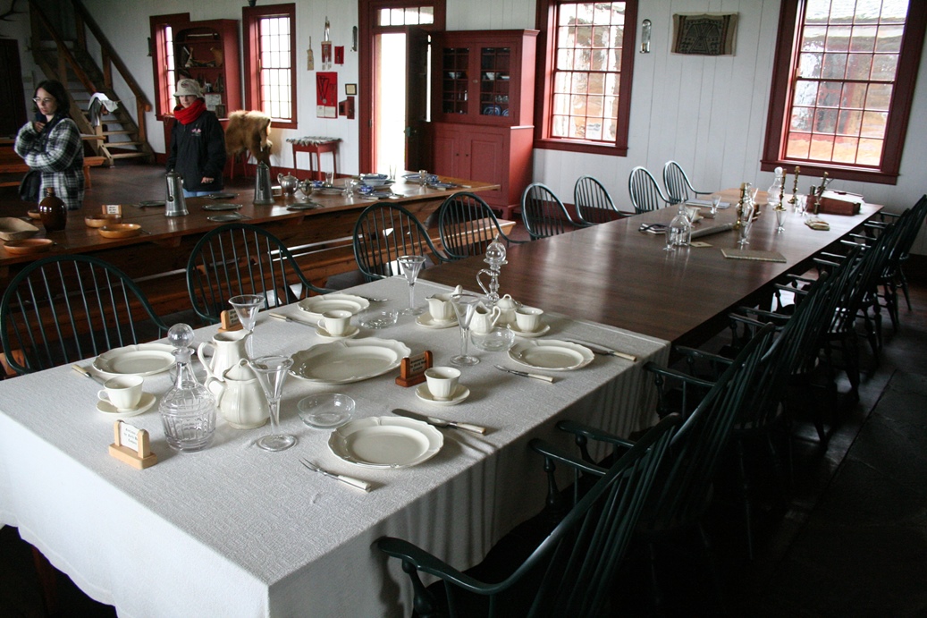
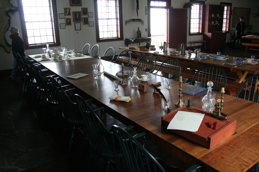
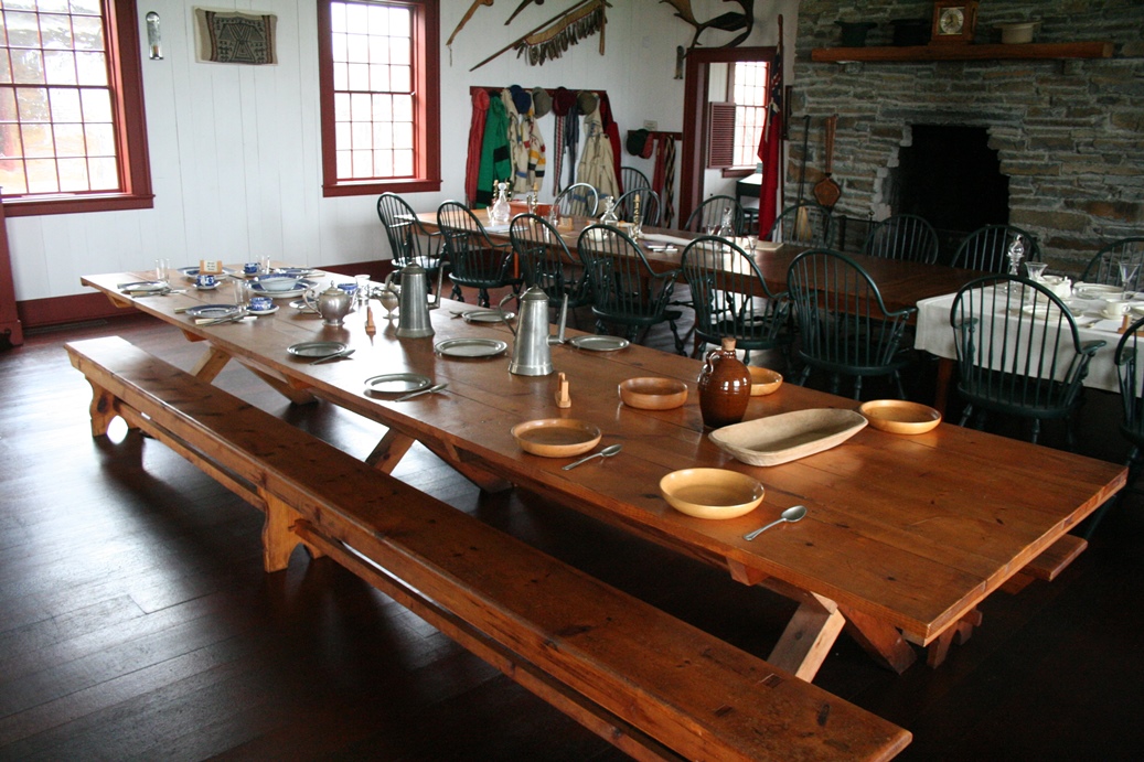
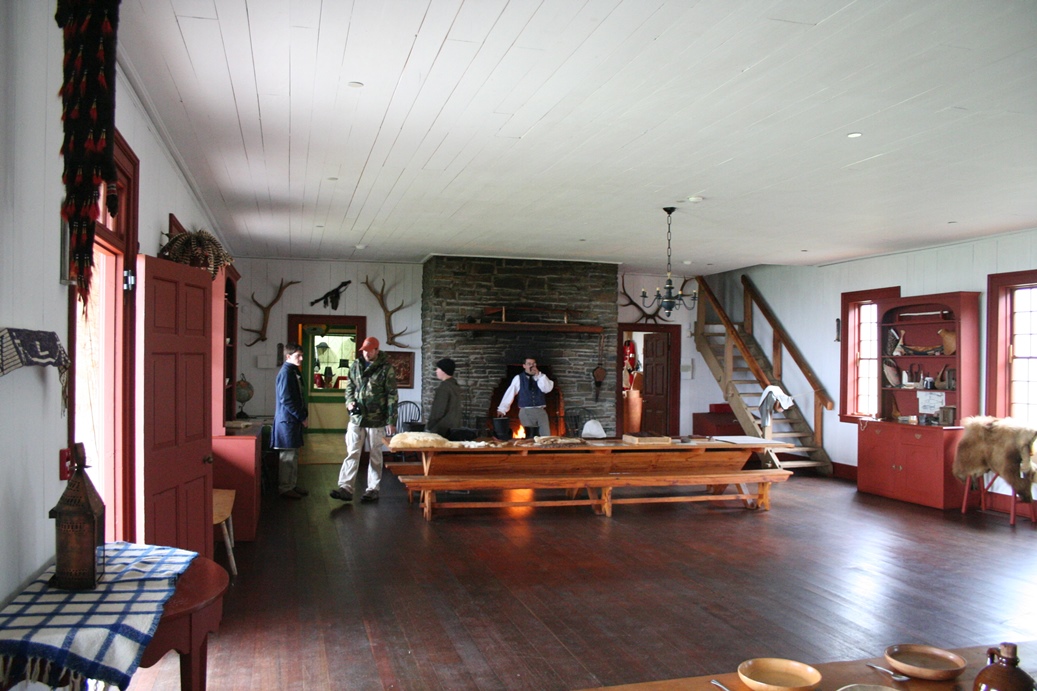
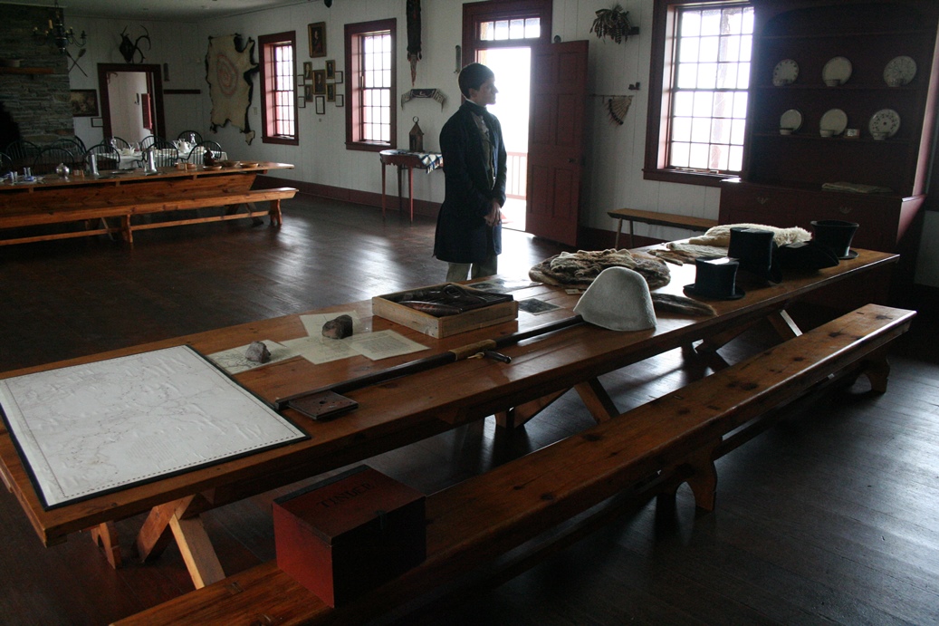
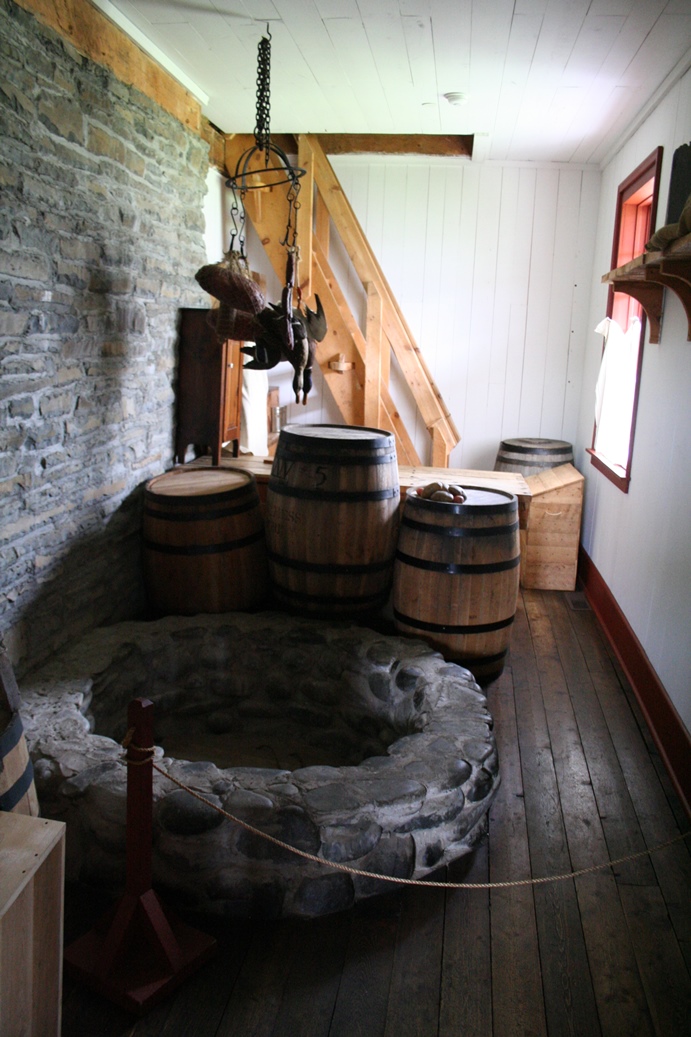
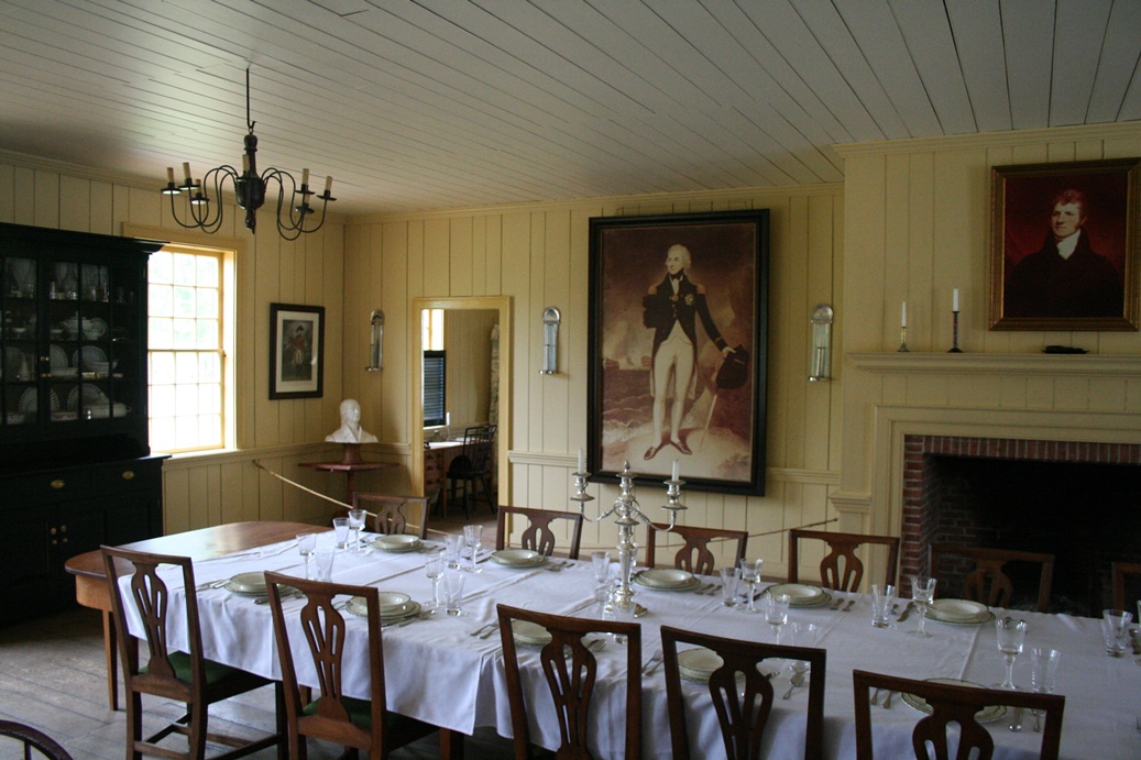
The
last time we were here, I did not take the
opportunity to get many photos of the interior of
the Great Hall. This time, I did try to get
more detailed photos, as well as photos that I could
use to make panoramic photos. The panoramic
photos are shown below and did come out rather well.
Unfortunately, when doing panoramic photos of
interiors, they can come out looking rather
distorted. But despite that problem, I still
believe the photos below will give you a good
impression of what it would look like if you were
there.
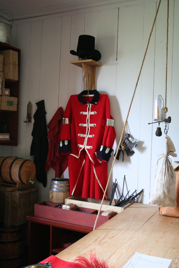
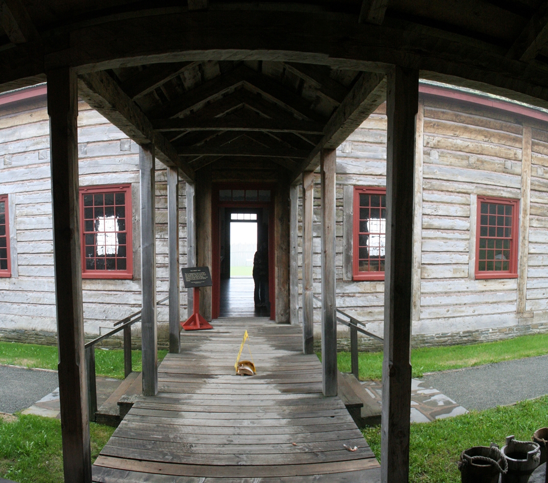
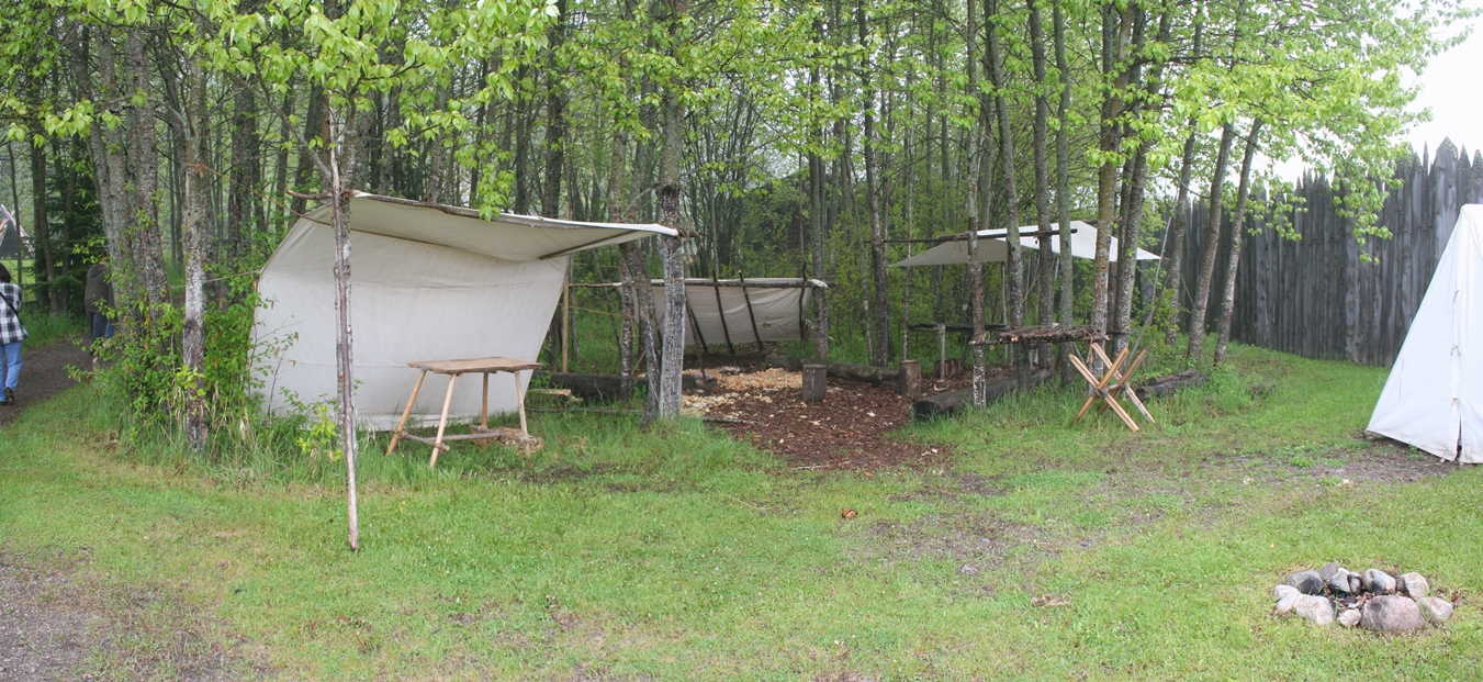
I
would like to point out just a few things in the
photos below. The first two photos are of the
building where canoes are built, repaired and
maintained. The next two rows are of the
kitchen for the Grand Hall, and the covered walk way
between them. The last several are of the
Grand Hall and some of the rooms within. The
last is of an outdoor display/work area that I am
assuming would be staffed by re-enactors during the
summer season.
|
Panoramic
(Click on Images for Larger Picture)
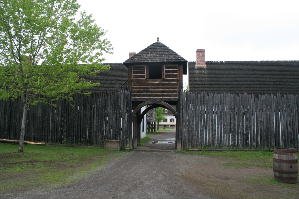
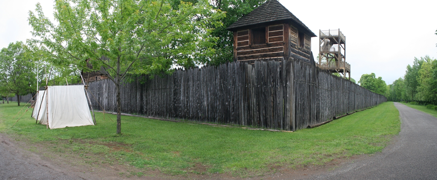
Fort William Historical Park
(Click on Images for Larger Picture)
|
|
|
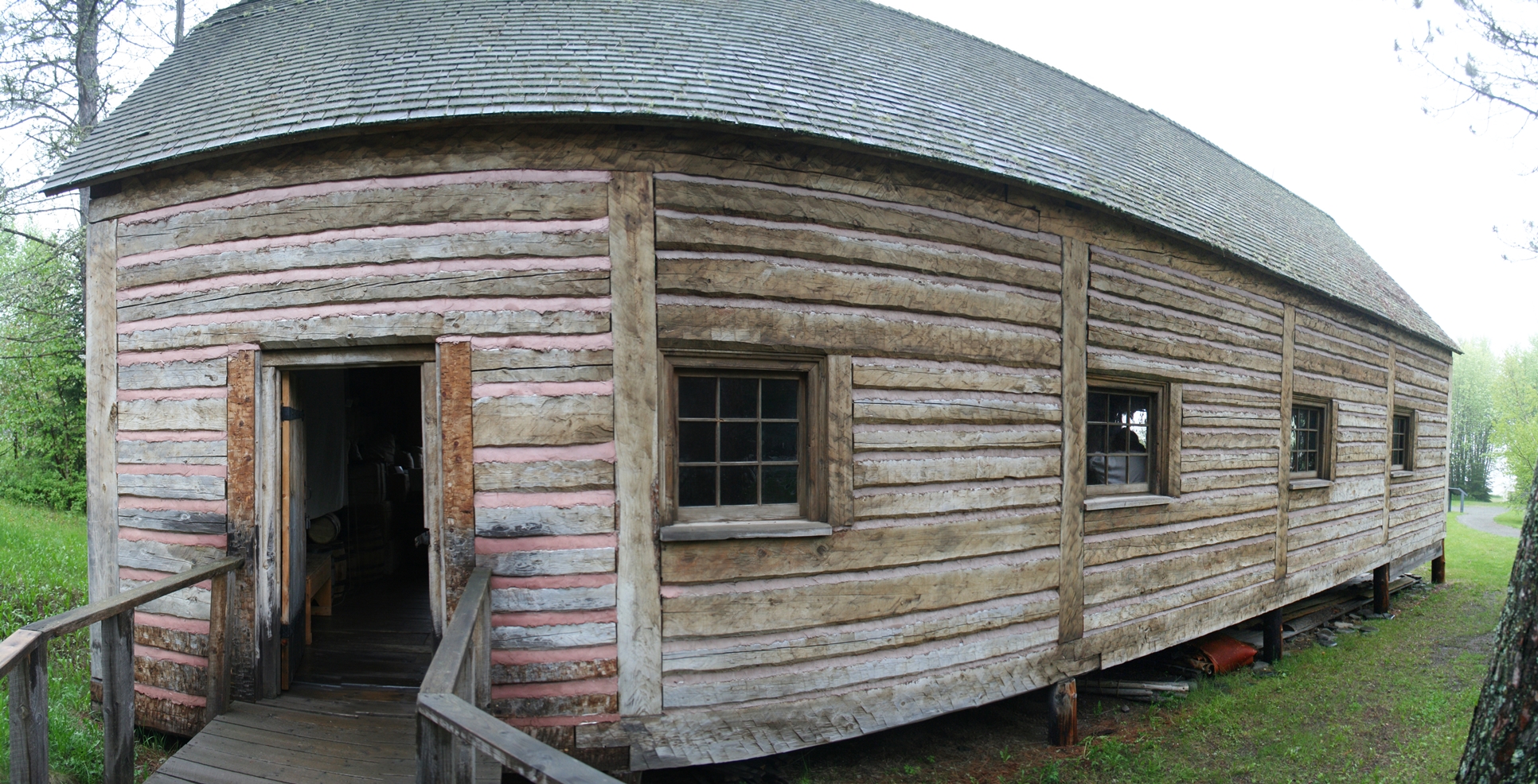
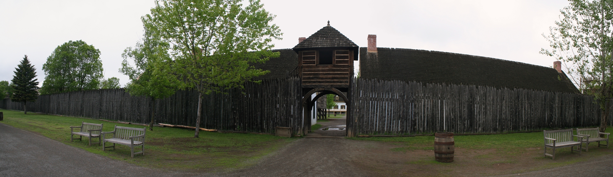
The
Fort William Historical Park is the counterpart
to the Grand Portage Trading Post. After the
war of 1812, the territory that the Grand Portage
Trading Post was located, became part of the United
States of America. Since the company that
owned and operated it was British, they were forced
to relocate north to Canada. This is how Fort
William came about. The visitor's center,
shown above, is the main entrance to the fort.
Here, there are presentations about the fort, a gift
shop, as well as information about guided tours.
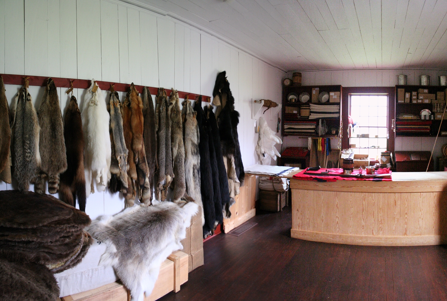
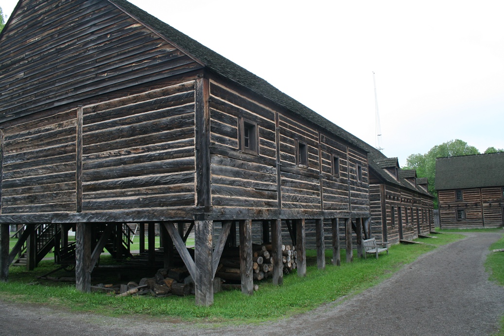
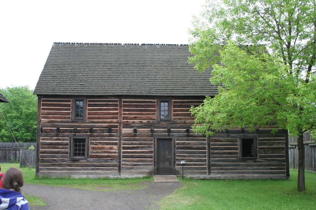
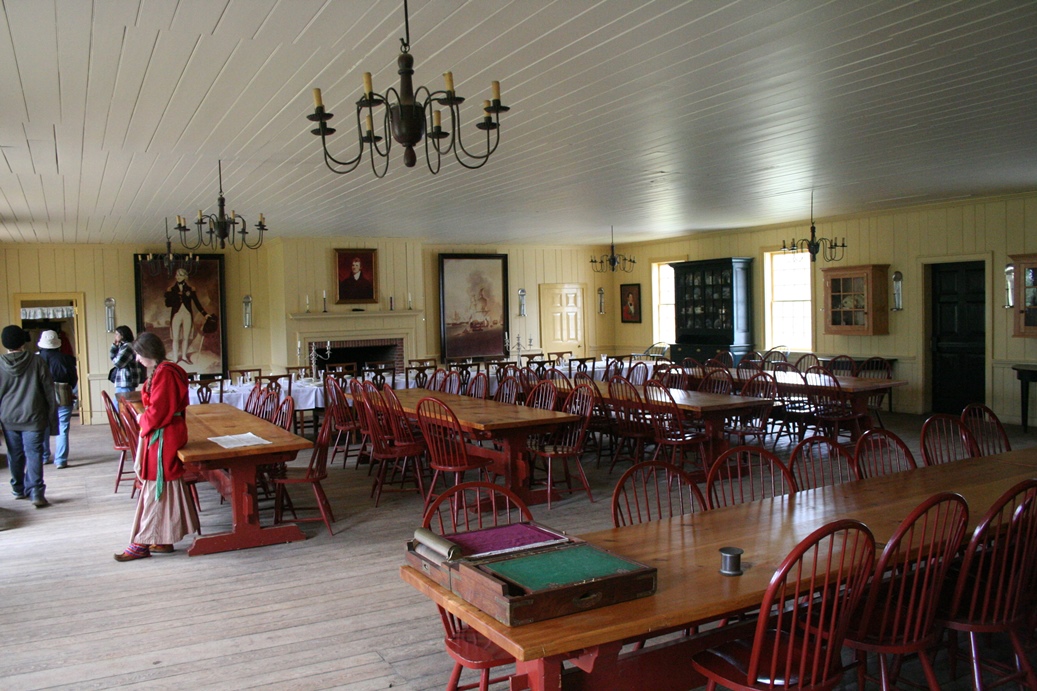
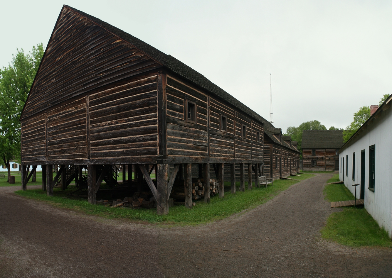
For
our tour this day, our guide presented the fort in a
first person tour. All of the re-enactors we
met stayed in era persona for most of the tour and I
found it gave a really interesting flavor to the
experience. We toured a good portion of the
grounds, and were shown a few buildings, mostly key
buildings to the fort's operations. We visited
the living quarters of the commanding officer in
charge, the medical facilities, a general and
trading store of sorts, as well as the Grand Hall.
One thing you will notice that is similar to the
Grand Portage Trading Post is the general
operations, but Fort William was on a much grander
scale.
|
|
The
general grounds and buildings are quite an
impressive site. I am not sure how much of the
fort is a reproduction, and how much is original,
but I would assume most, if not all are
reproductions build to their approximate location.
|
|
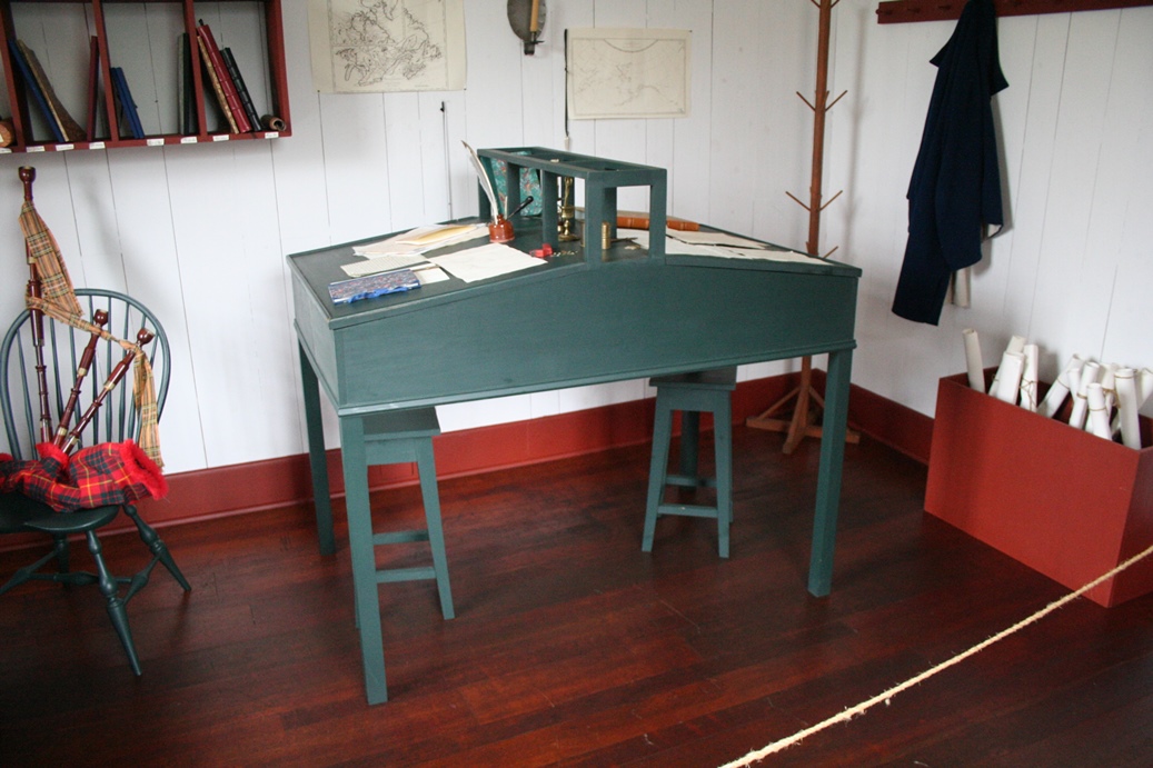
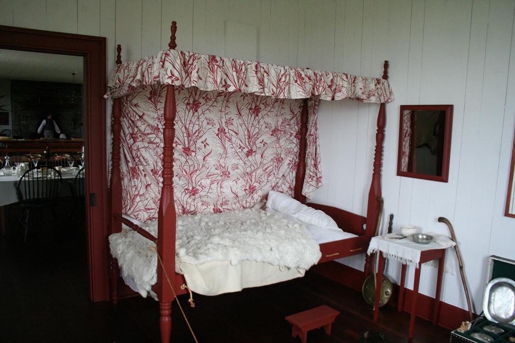
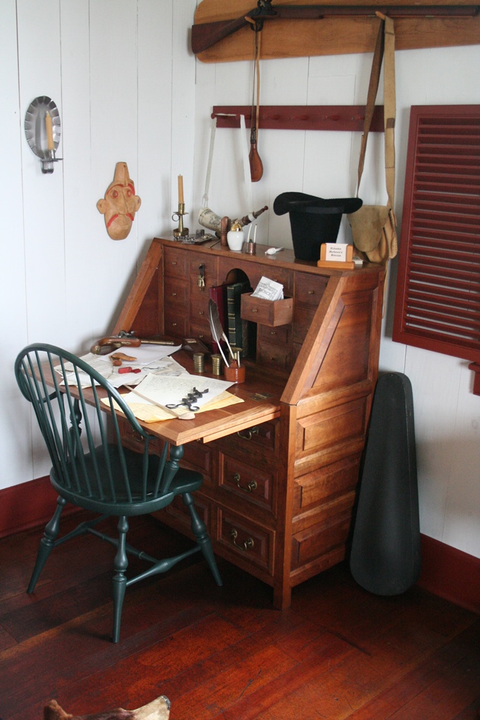
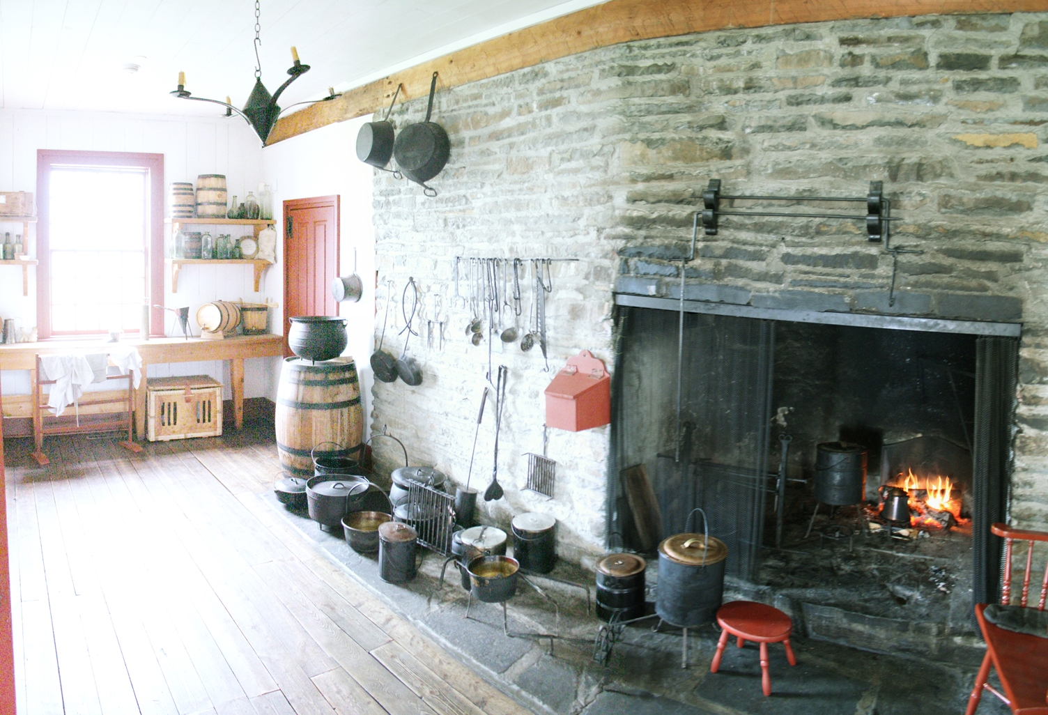
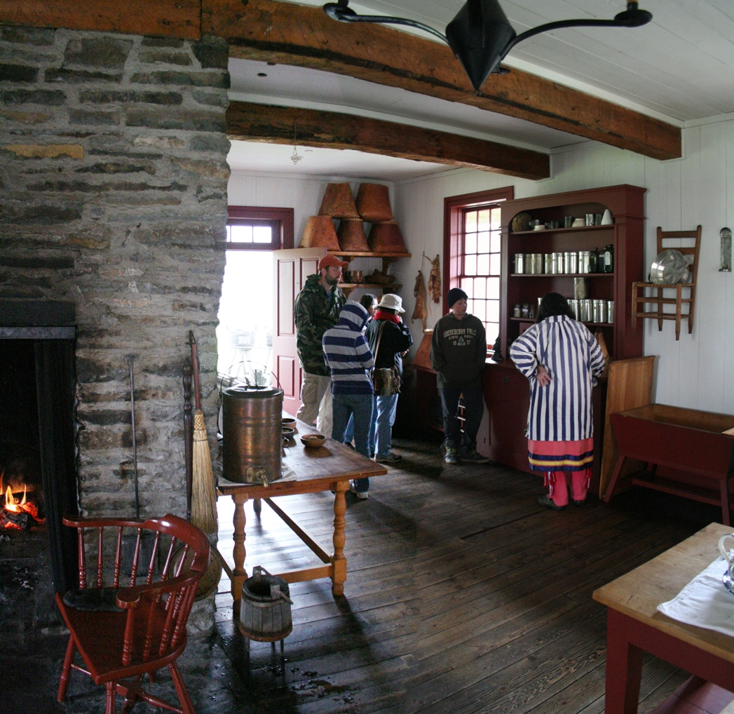
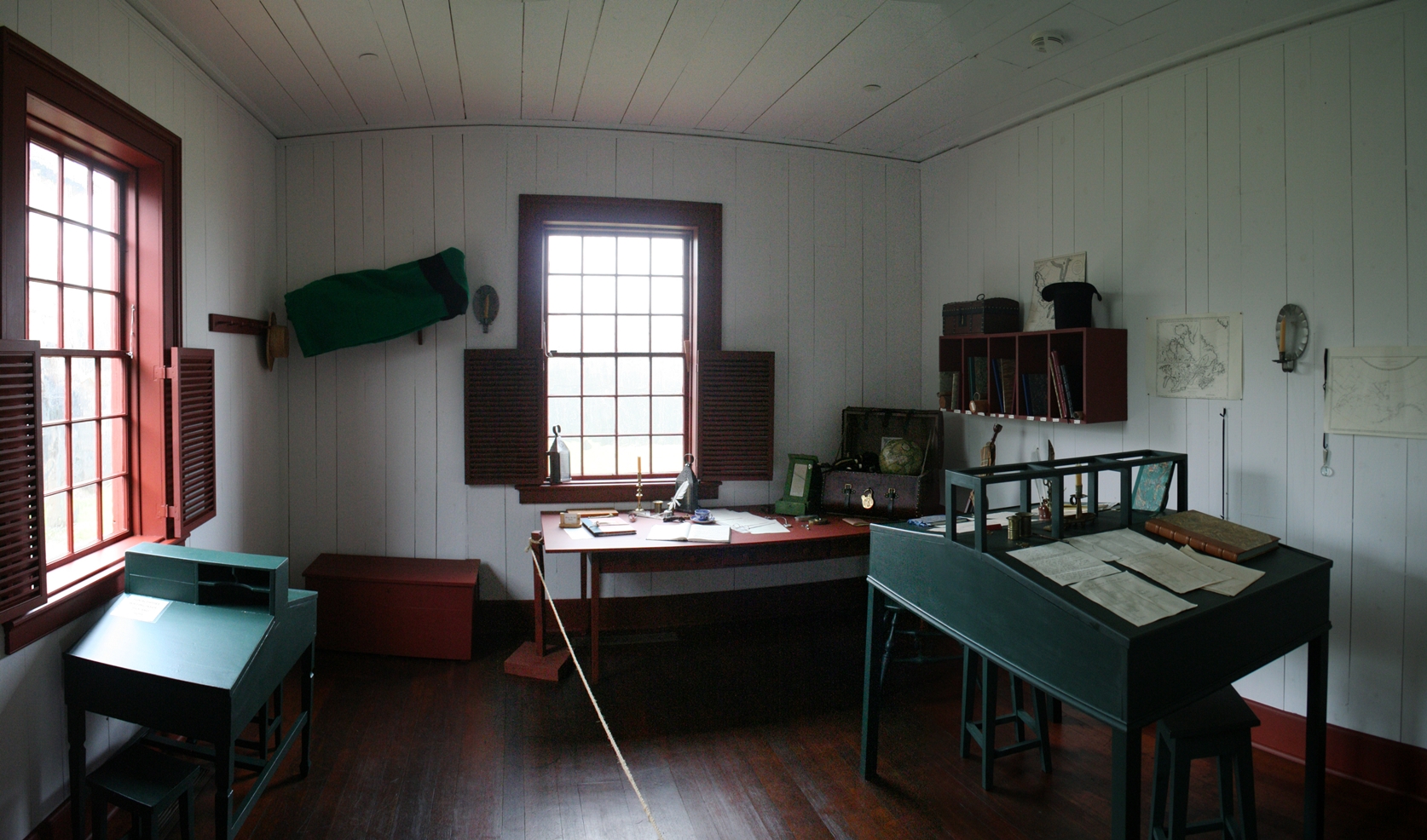
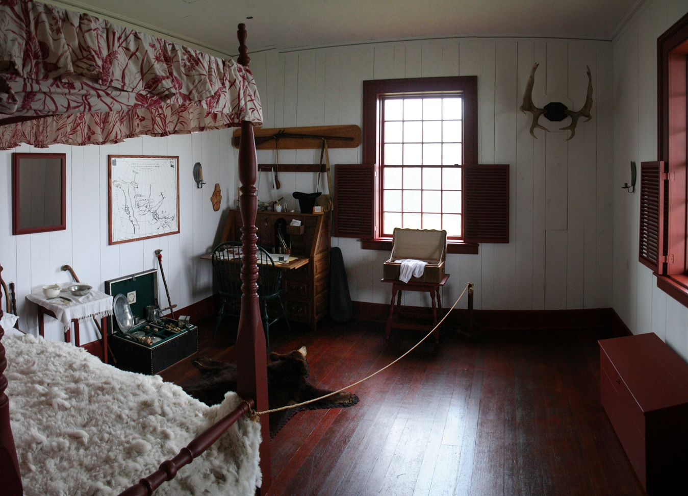
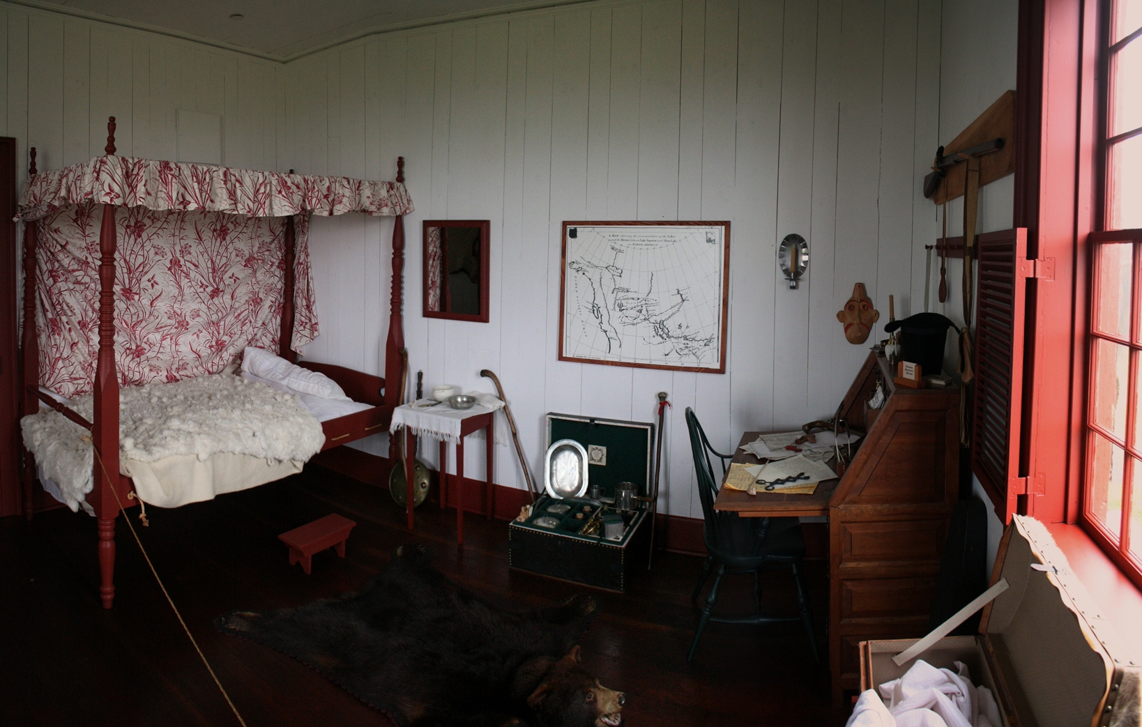
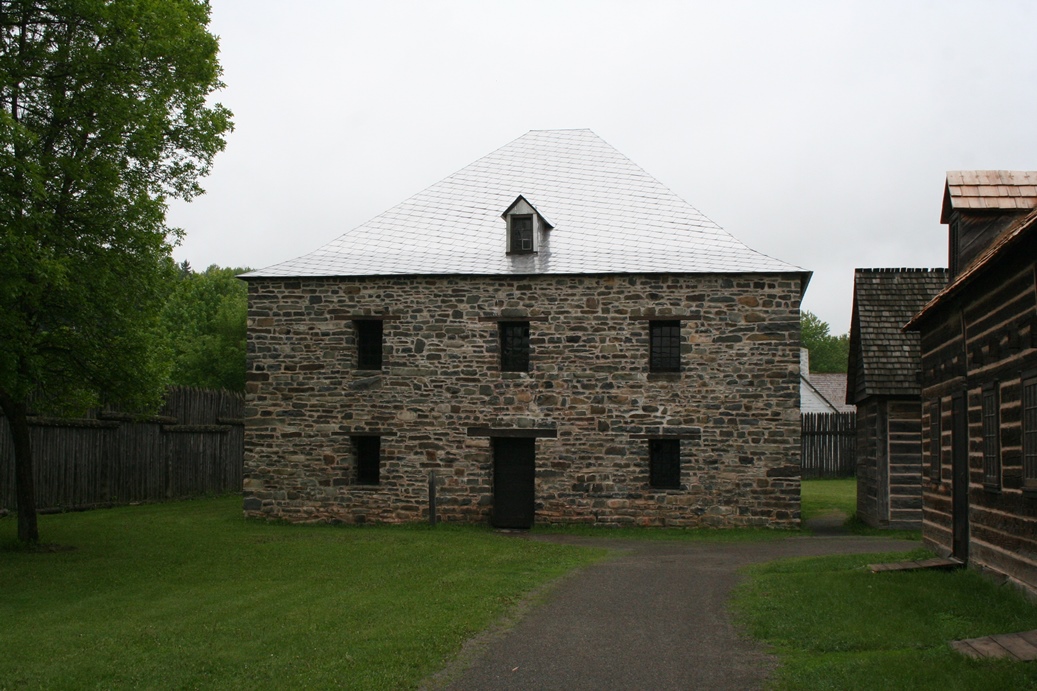
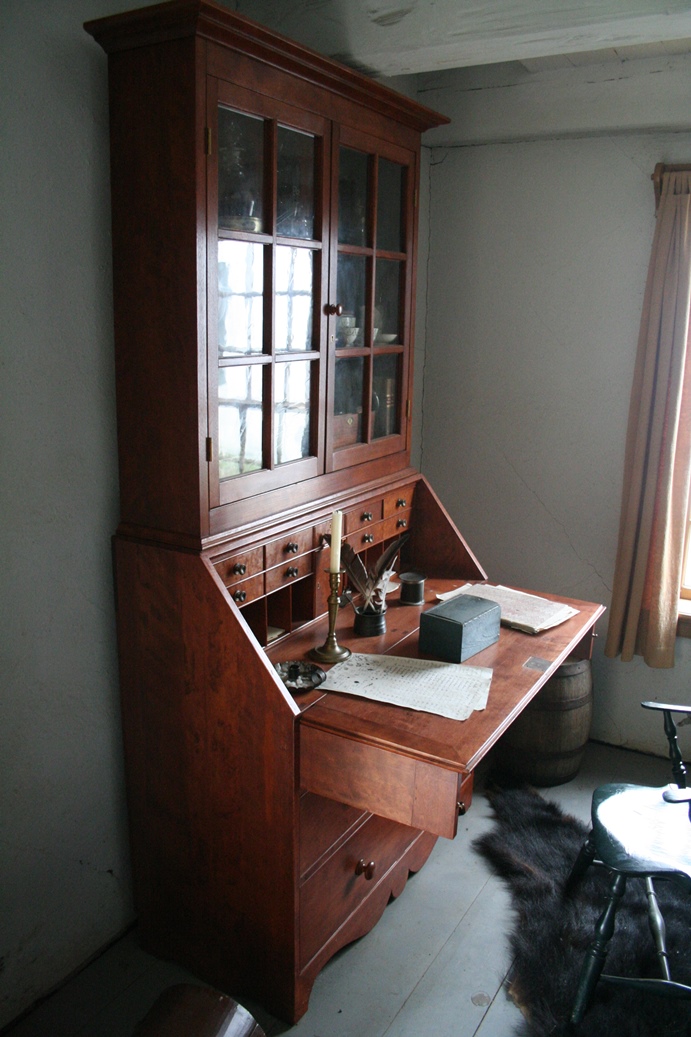
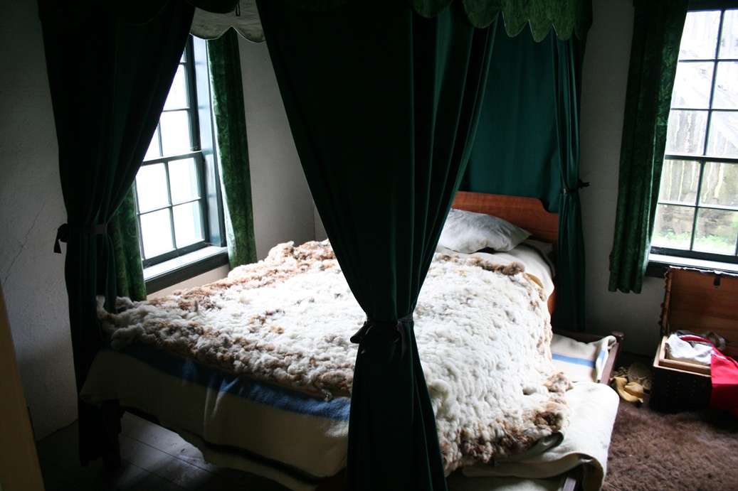
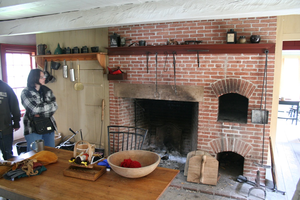
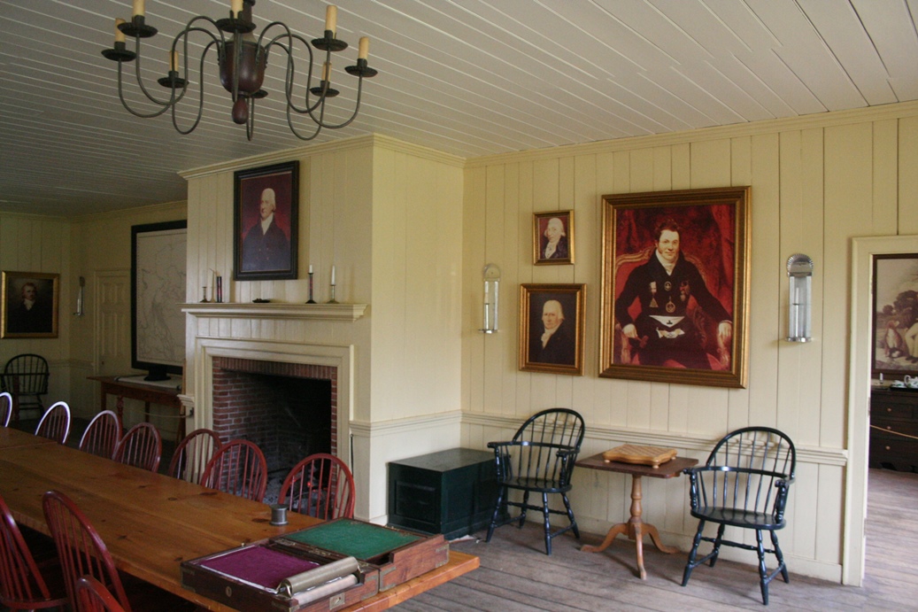
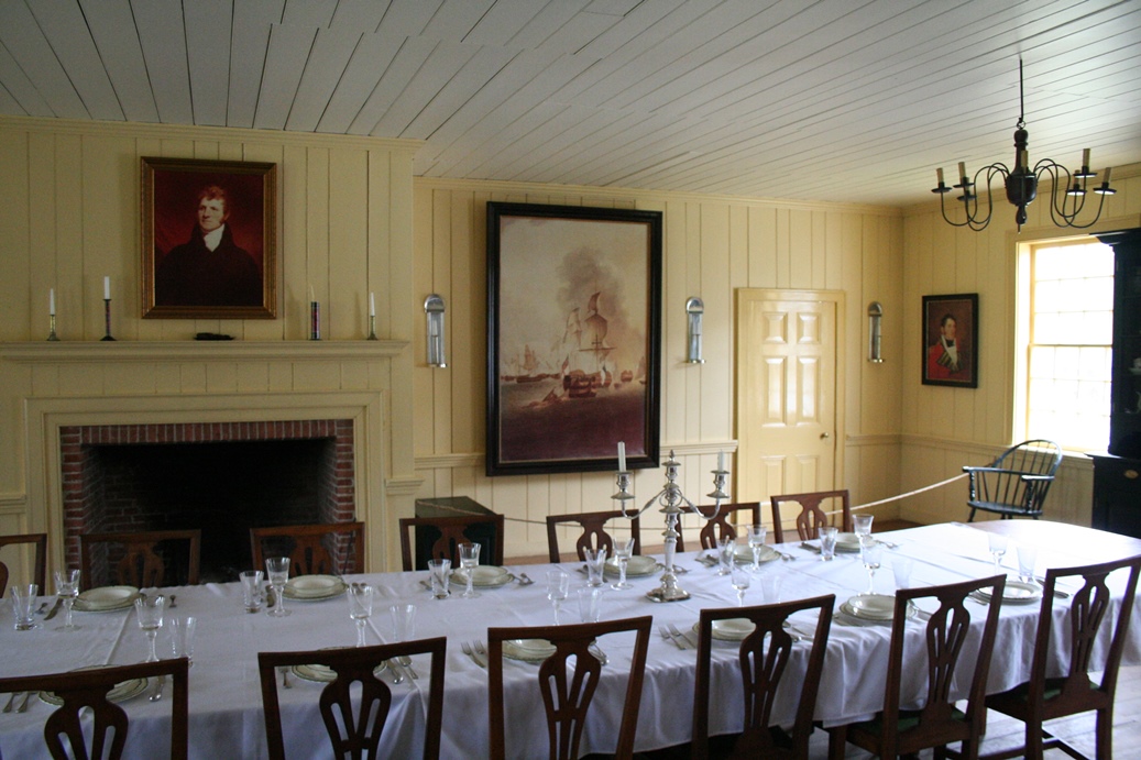
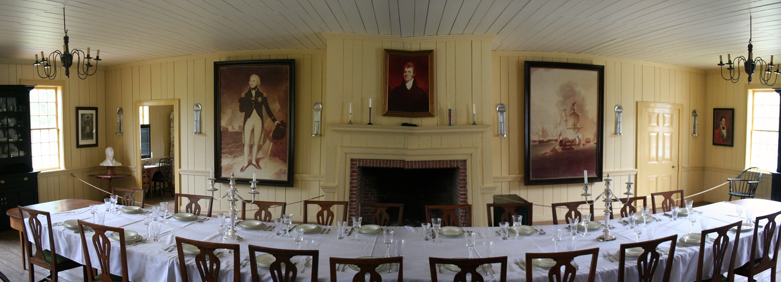
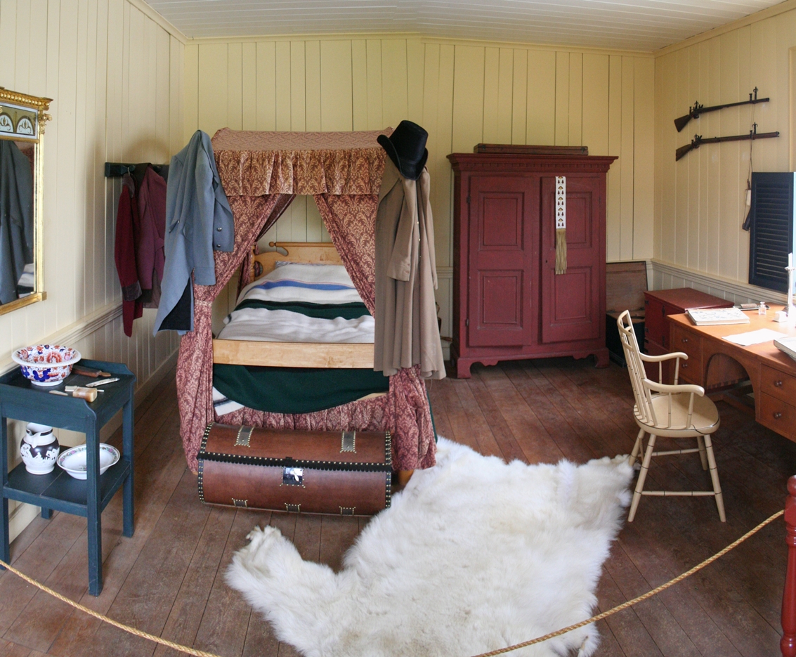
The
desk, the bedroom, and the hearth in the first four
pictures are of the Commanding Officer's quarters.
There was a re-enactor working here, portraying the
wife of the Commanding Officer, that would give you
a tour of the quarters. The last five photos
are of the Grand Hall which would have been the
focal point of the trade business here, just as it
was down at the Grand Portage Trading Post.
Down
below I have included more panoramic images of this
site, and some of the photos do have the distortions
again, but it still gives you a good look and feel
for the layout. I have also included a 360
degree view from the center of the fort.
|
Panoramic
(Click on Images for Larger Picture)
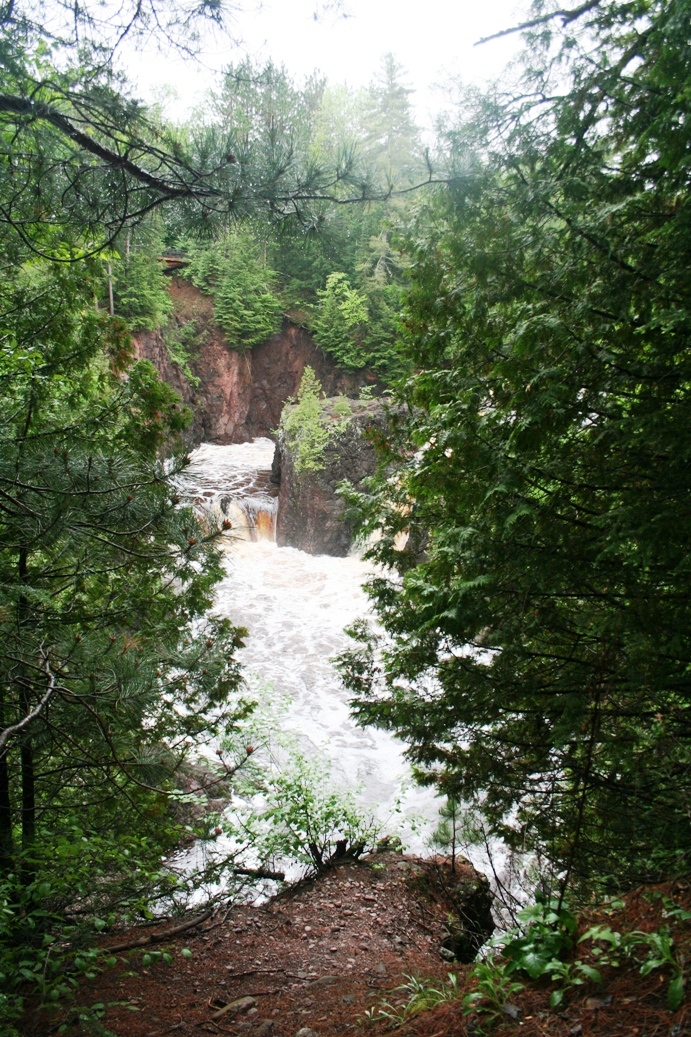
Grand Portage State Park High Falls
(Click on Images for Larger Picture)
|
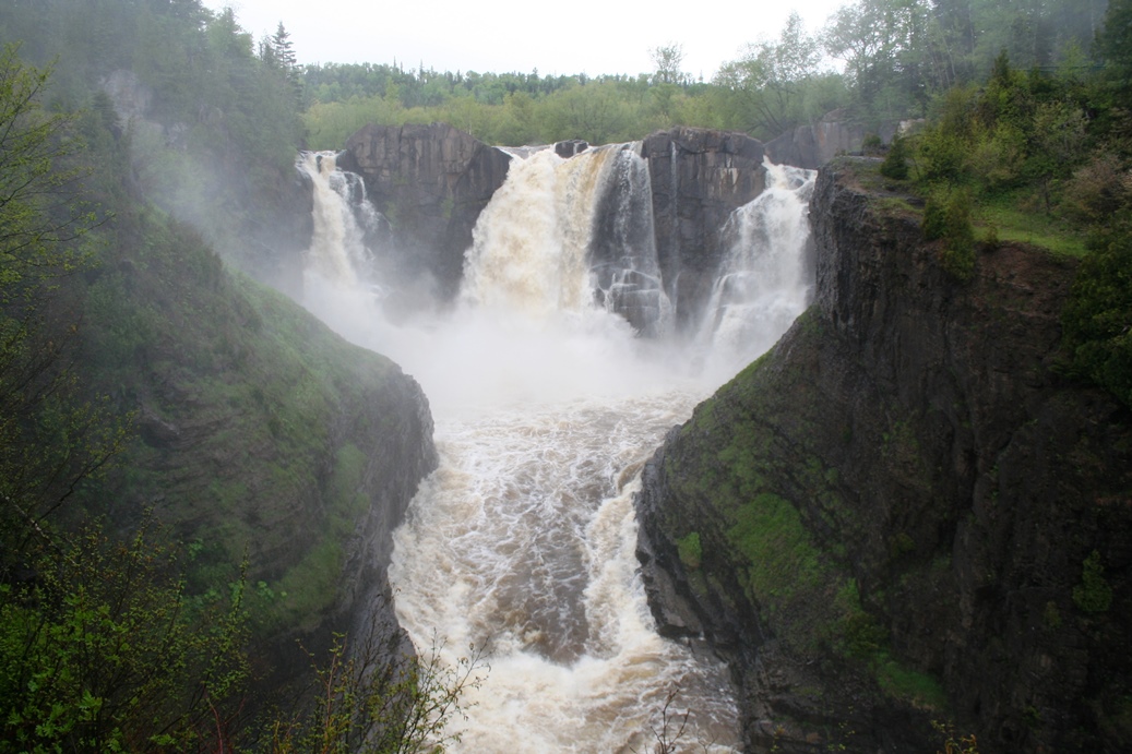
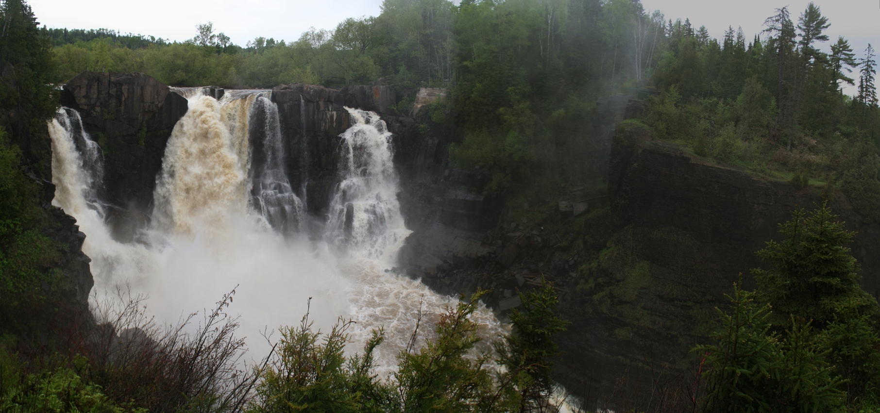
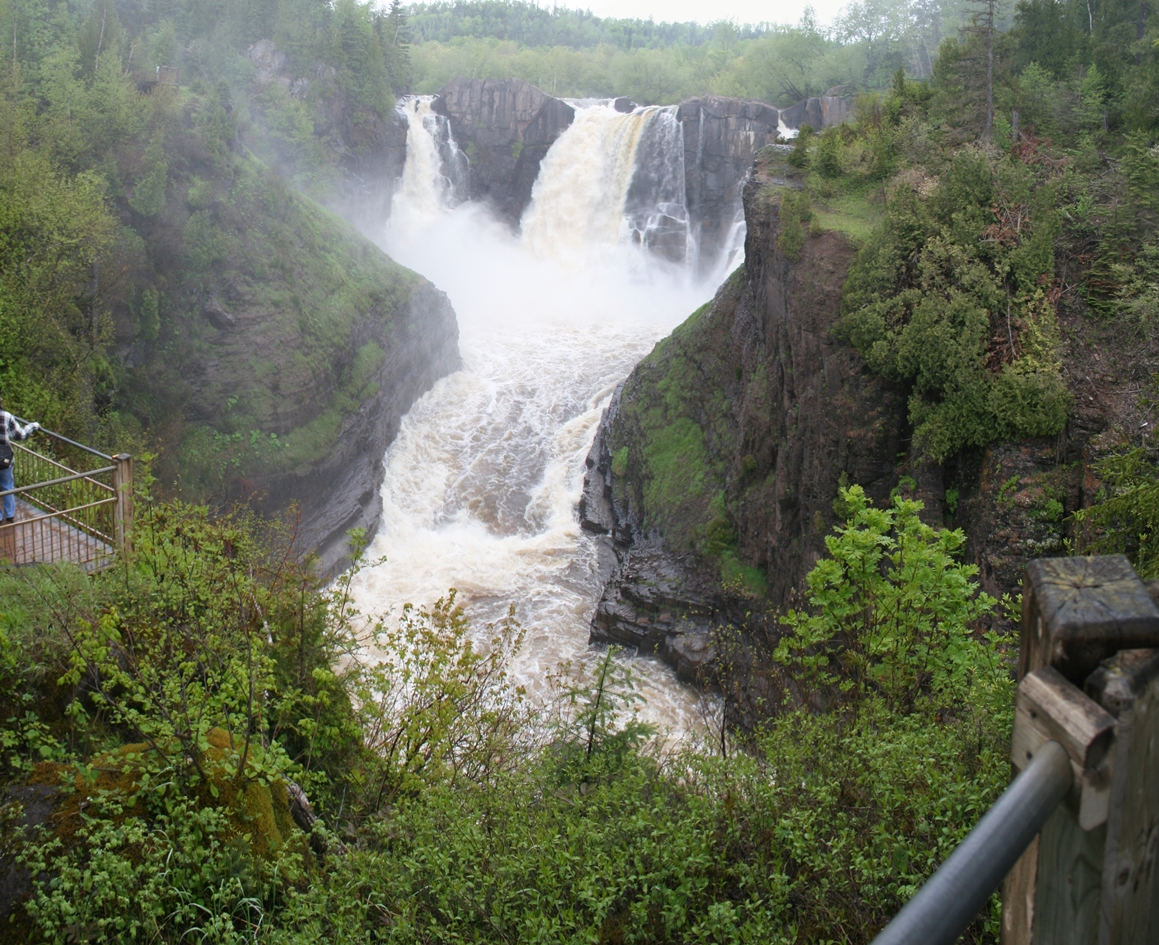
On
the way back down the North Shore of Lake Superior
from Canada, we decided to stop in at the
Grand Portage State Park Visitor's Center and
hike up the short path to the High Falls in the
Pigeon River; the river that separates the United
States from Canada. Unfortunately, the weather
was a bit overcast to get really good photos, but
these did turn out a bit better than I expected.
|
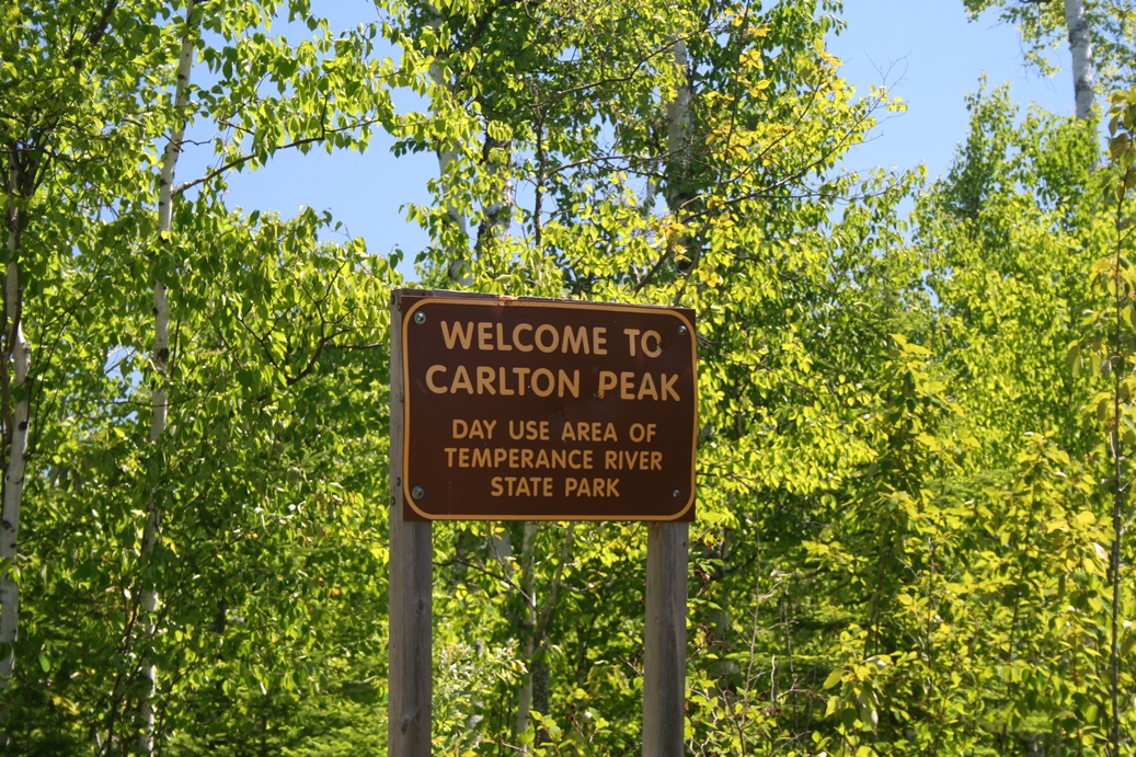
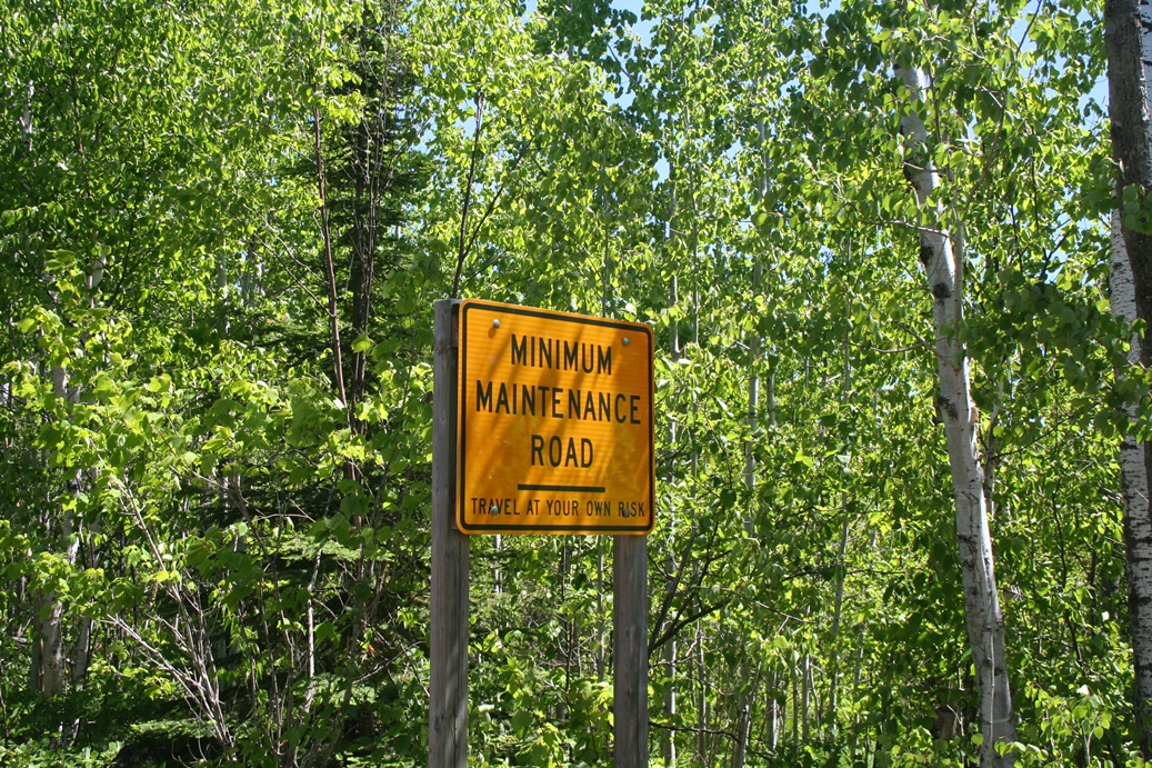
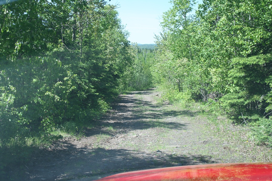
Carlton Peak
(Click on Images for Larger Picture)

|
|
|
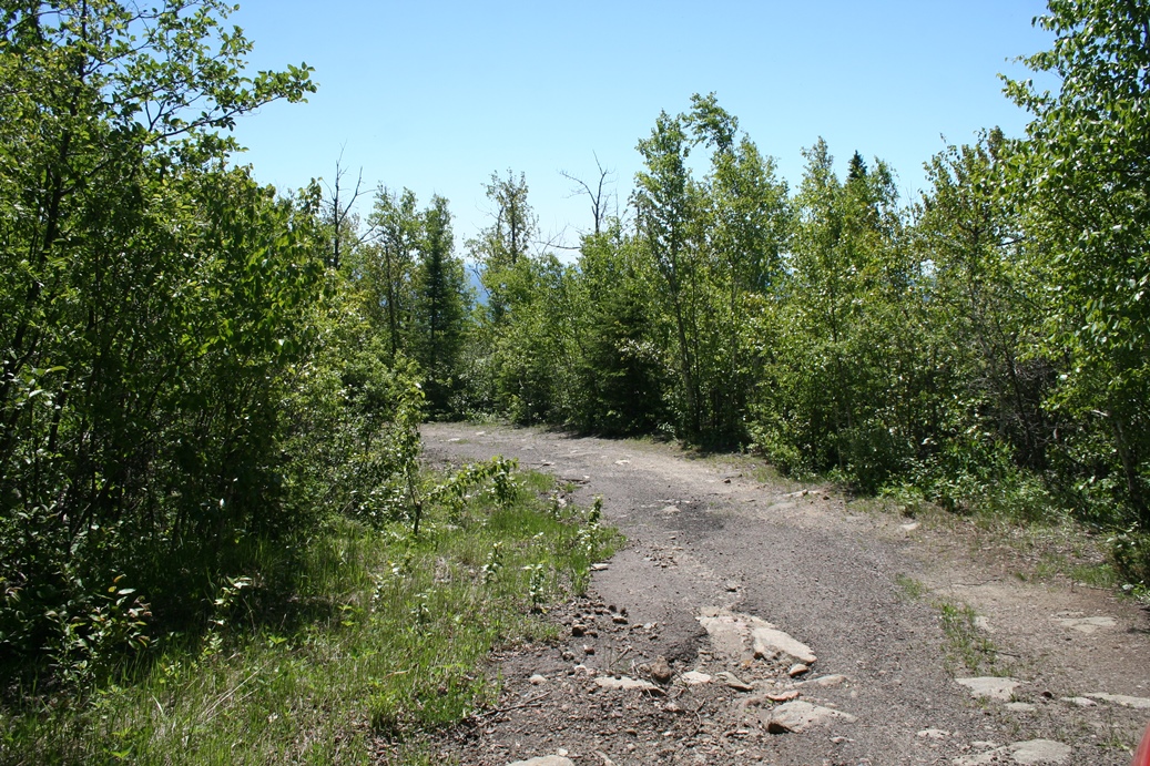
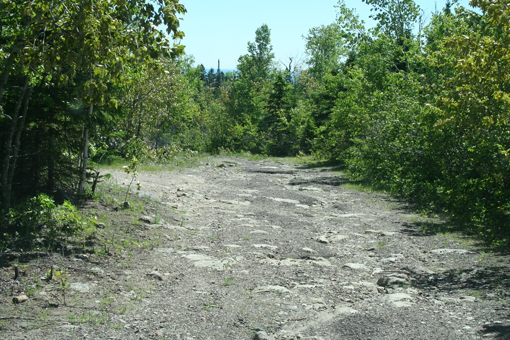
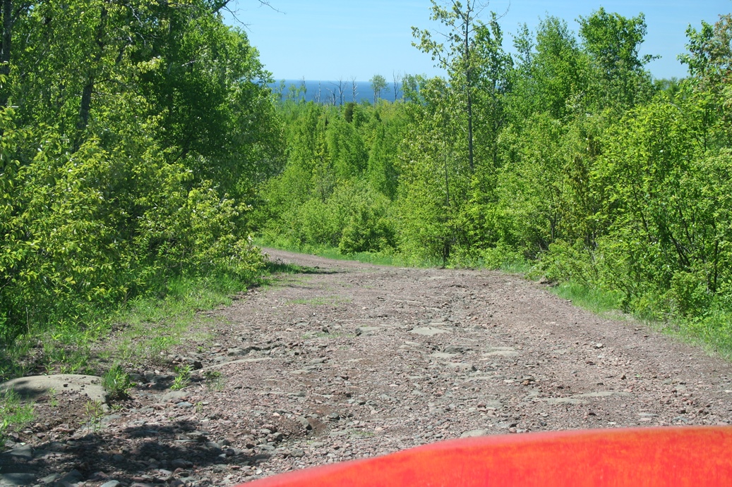
The
trip up to Carlton Peak from Temperance River State
Park was a bit better this time. We knew where
we were going, the road conditions, and it was a
beautifully clear day. I still like the signs
posted along the way. You do not come across
the sign letting you know that you are on the
correct road to the peak, until just a little below
the summit. Shortly after that sign is the
minimum maintenance road warning sign. You get
an idea of what the road looks like in the third
through seventh photos in the series, but this was
on the way down, and you do not get the feel for how
steep the road really is, or the rough surface.
I would not travel this road in a car, especially
not without four wheel, or all wheel drive.
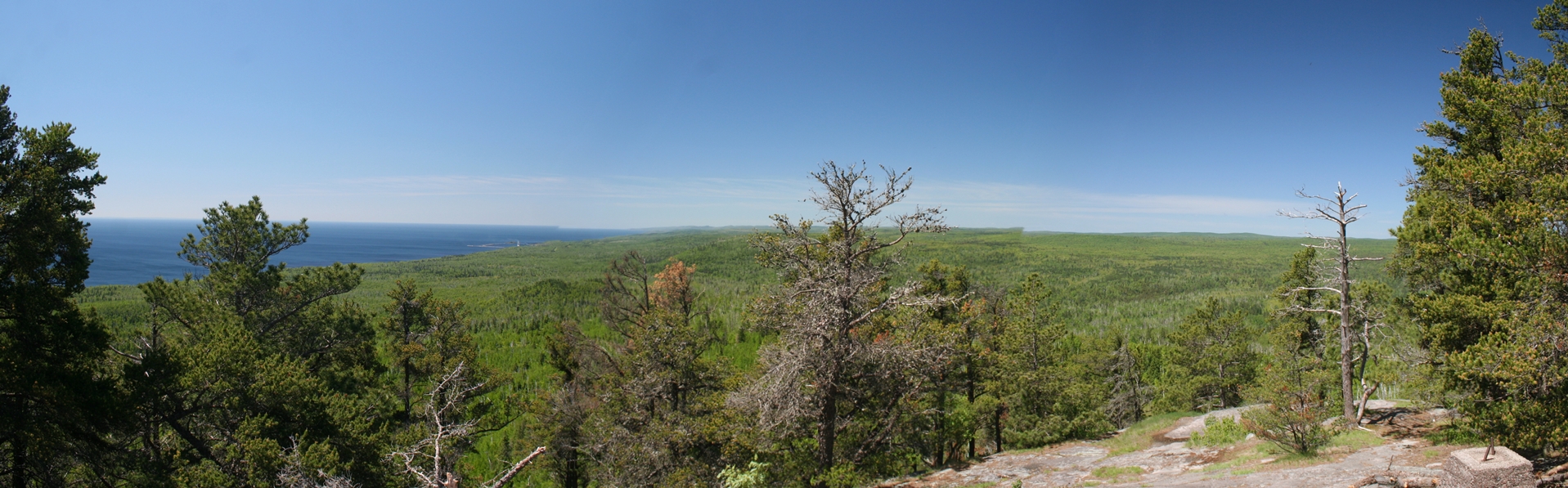
I
will say that the view from the top is worth the
trip though, as shown in the last two photos.
If you do go here, please be prepared to hike with
good footwear and maybe take a little rain cover
just in case. It is a bit of a hike, after you
park, to reach the summit.
|
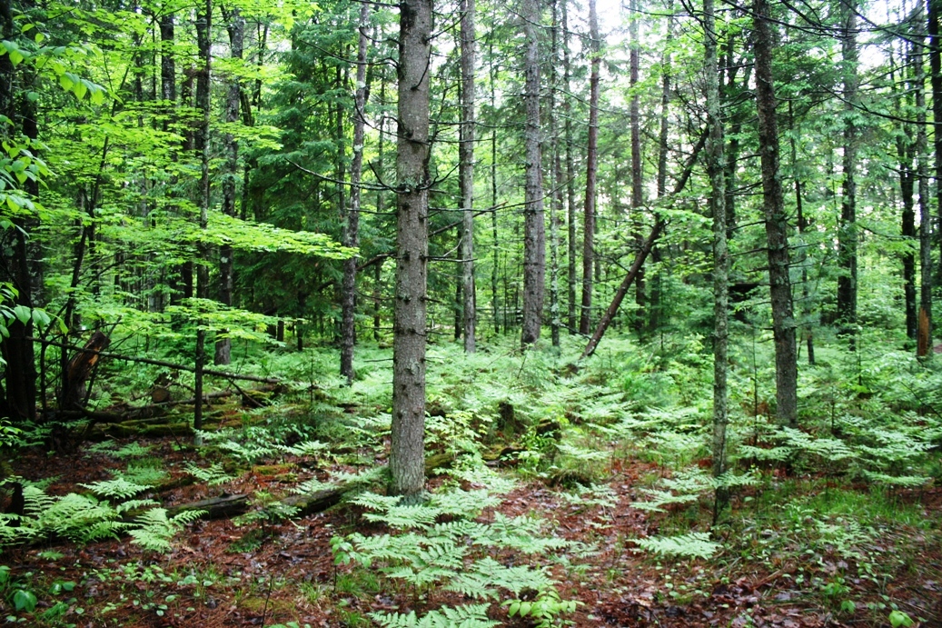
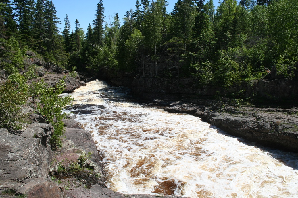
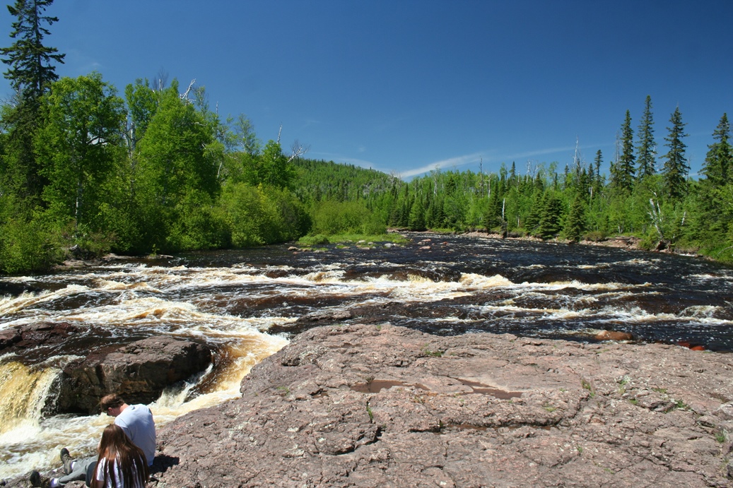
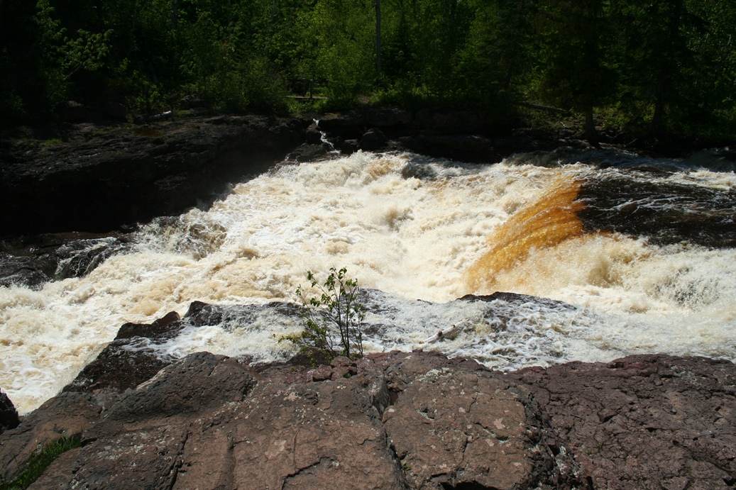
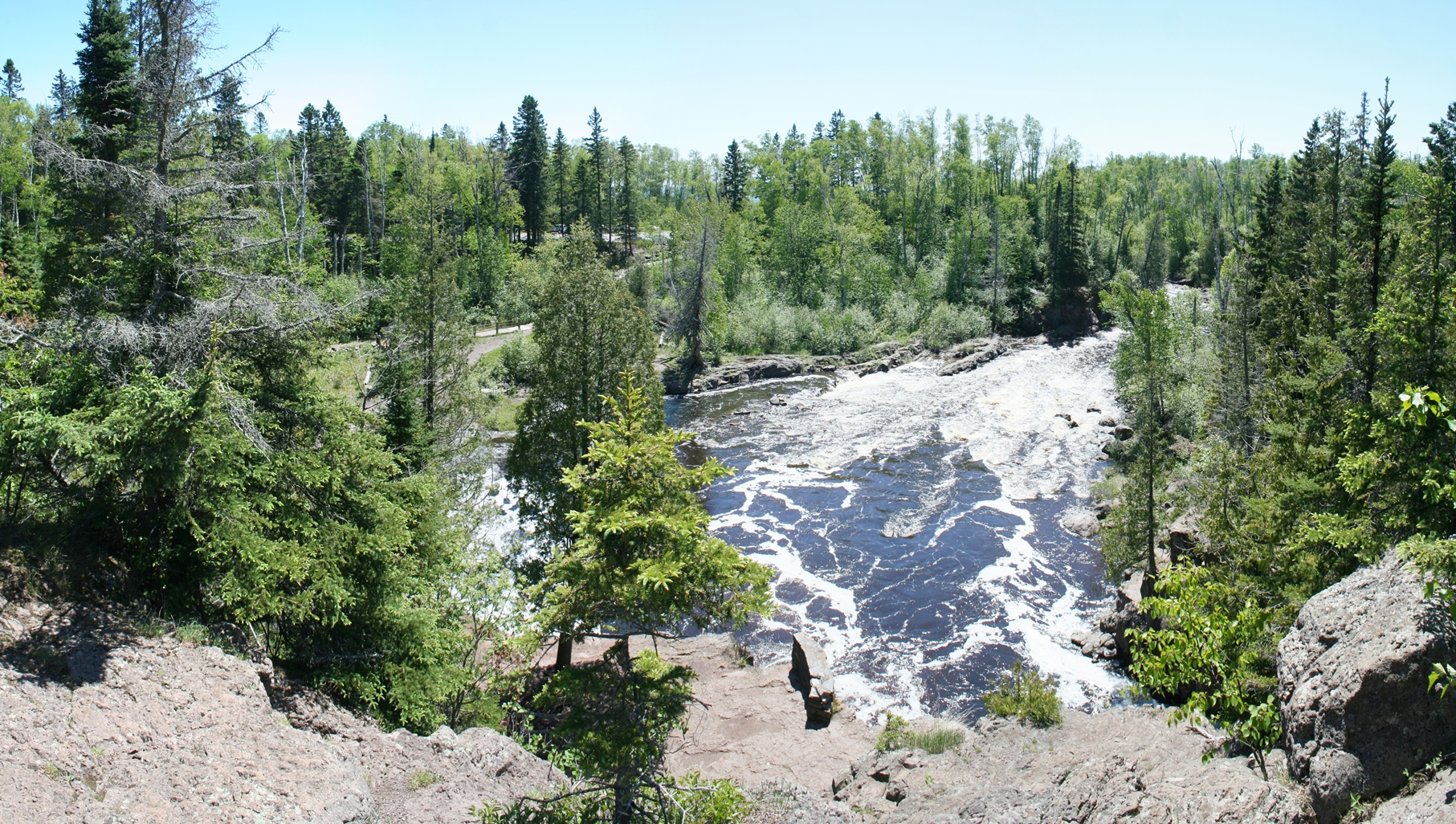
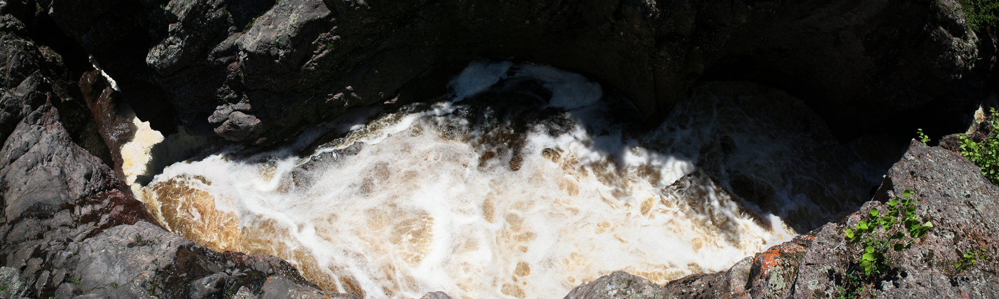
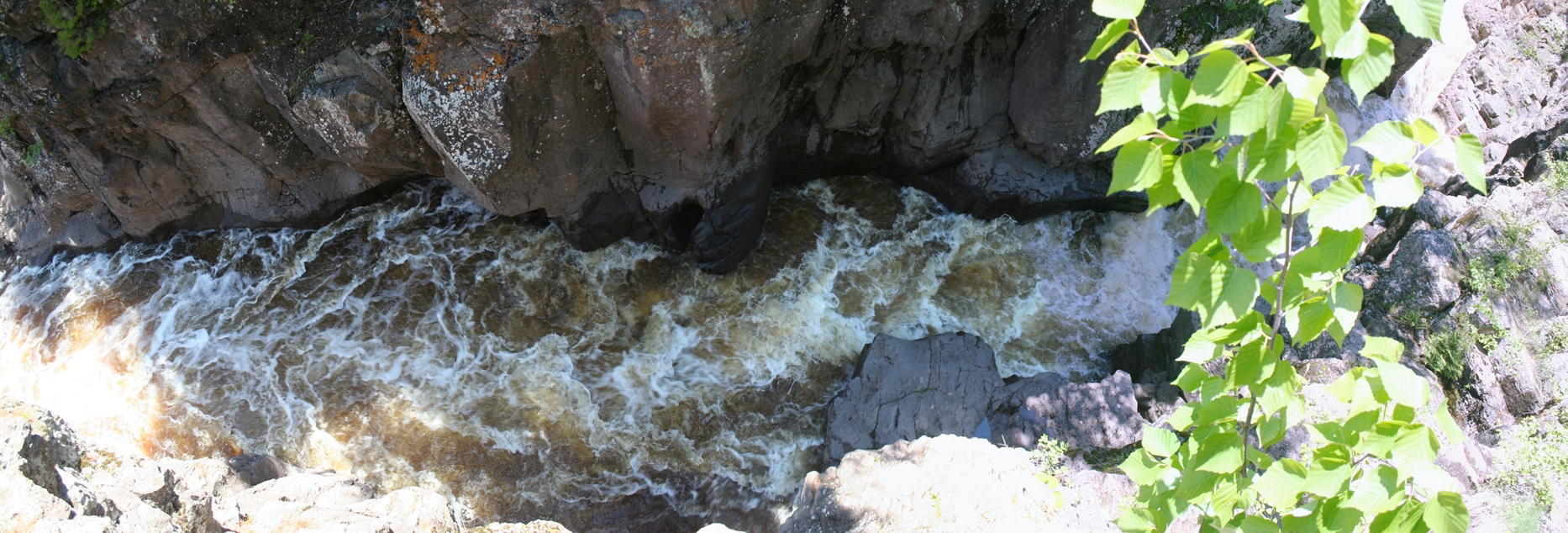
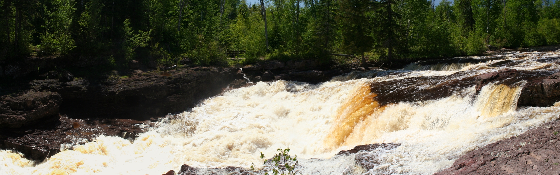
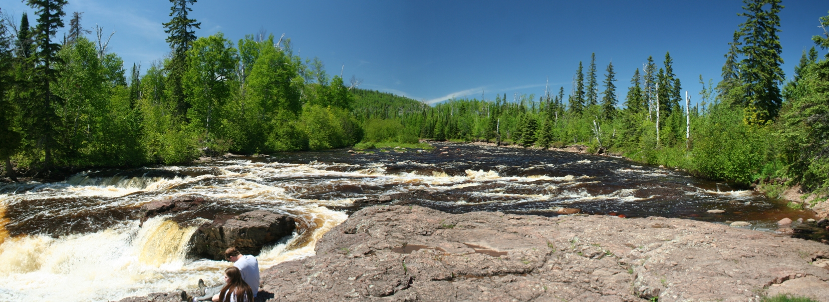
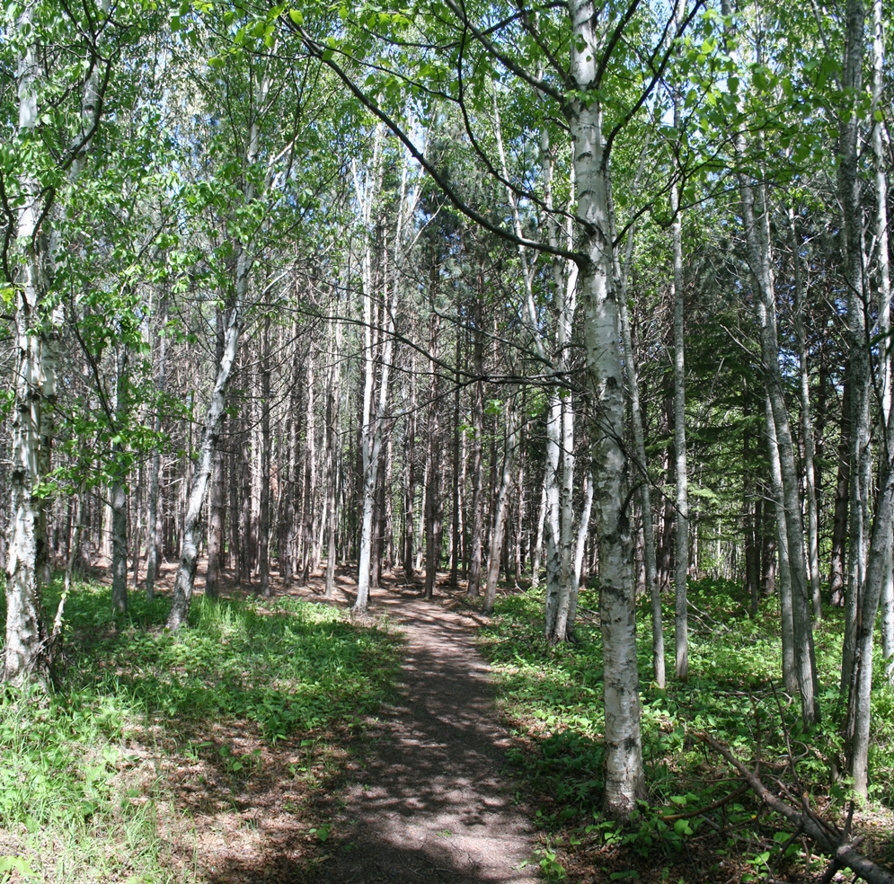
Temperance River State Park Hike
(Click on Images for Larger Picture)
|
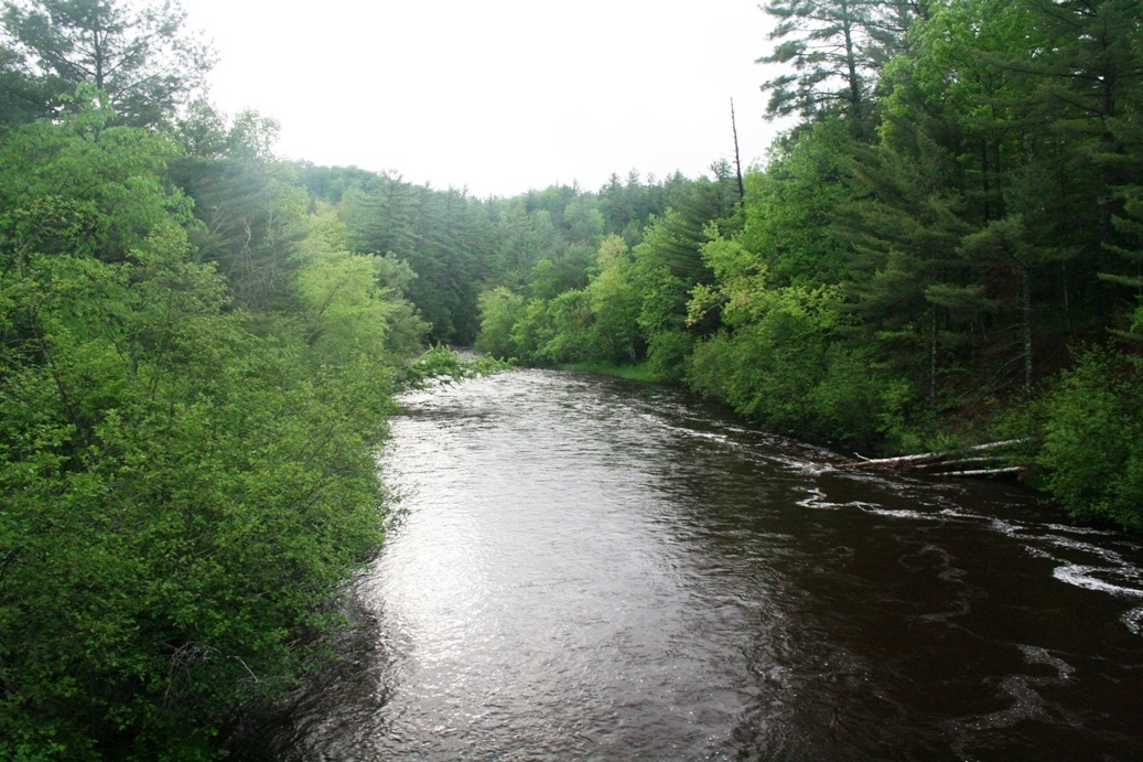
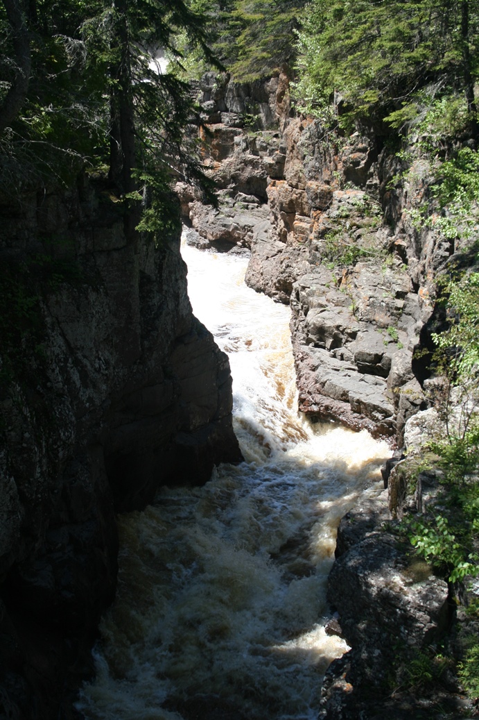
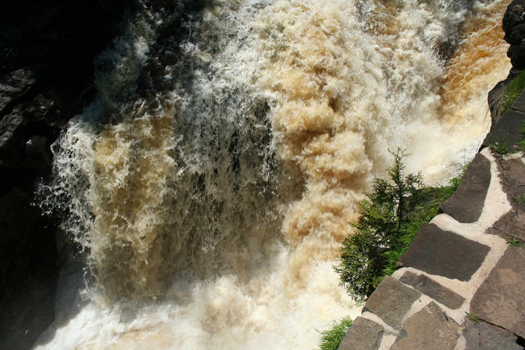
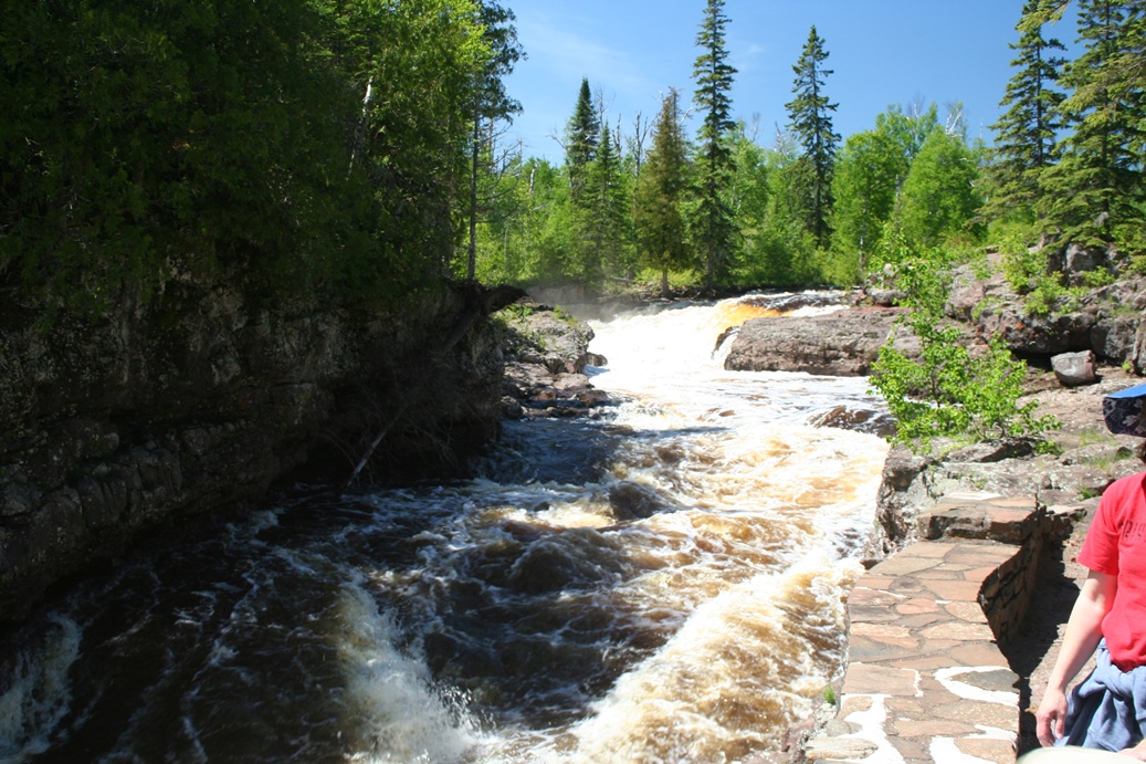
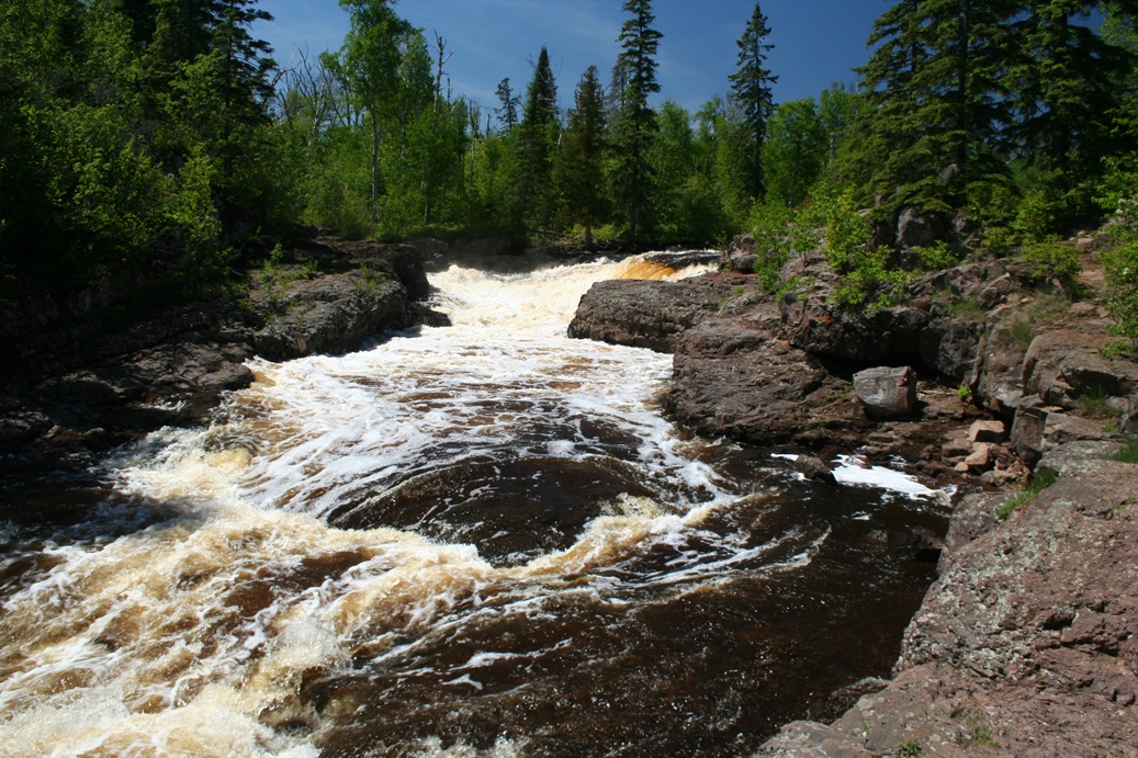
I
have mentioned this on the other photo page of our
hike up this river in previous years, Temperance
River State Park has some really nice hiking trails
that follow the Temperance River upstream. We
took the trail on the north side of the river, as we
did the previous year, but we did not go up as far
on the trail. This trail will eventually lead
you to Carlton Peak if you are so inclined to hike
that far. I would also like to see about
hiking the other side of the river next time, for a
different perspective.
|
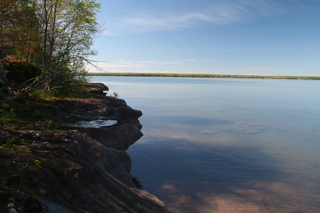
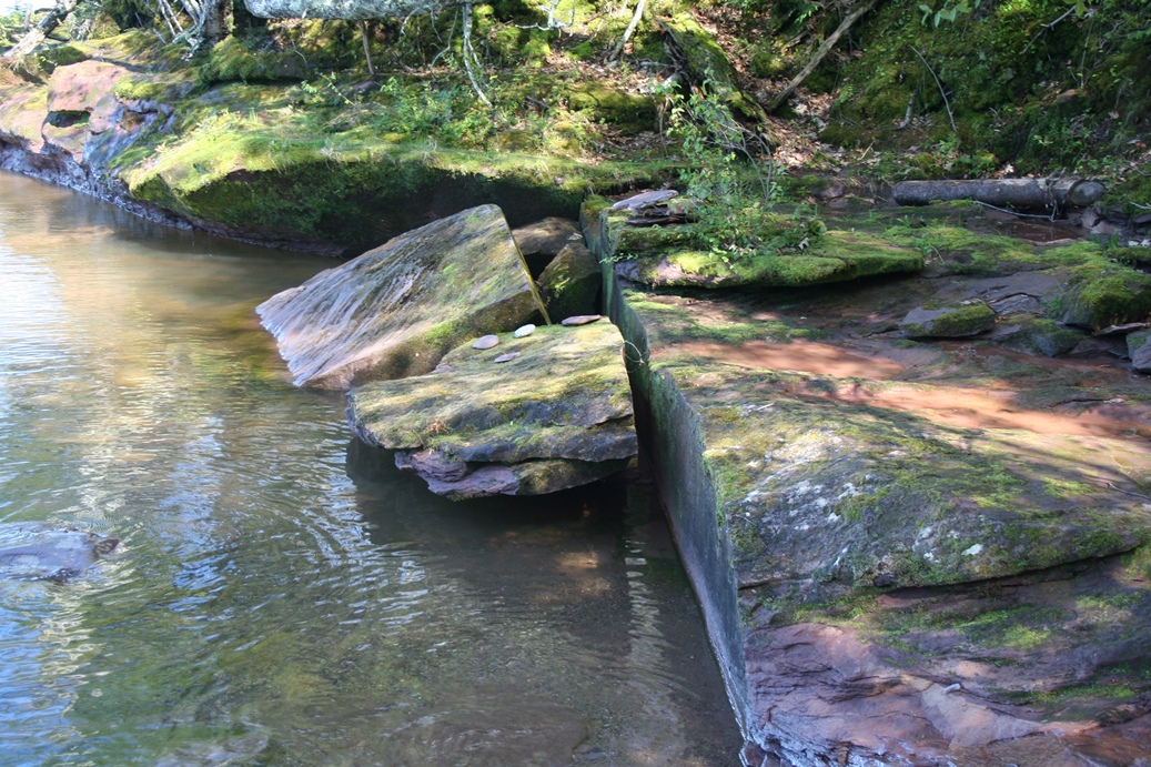
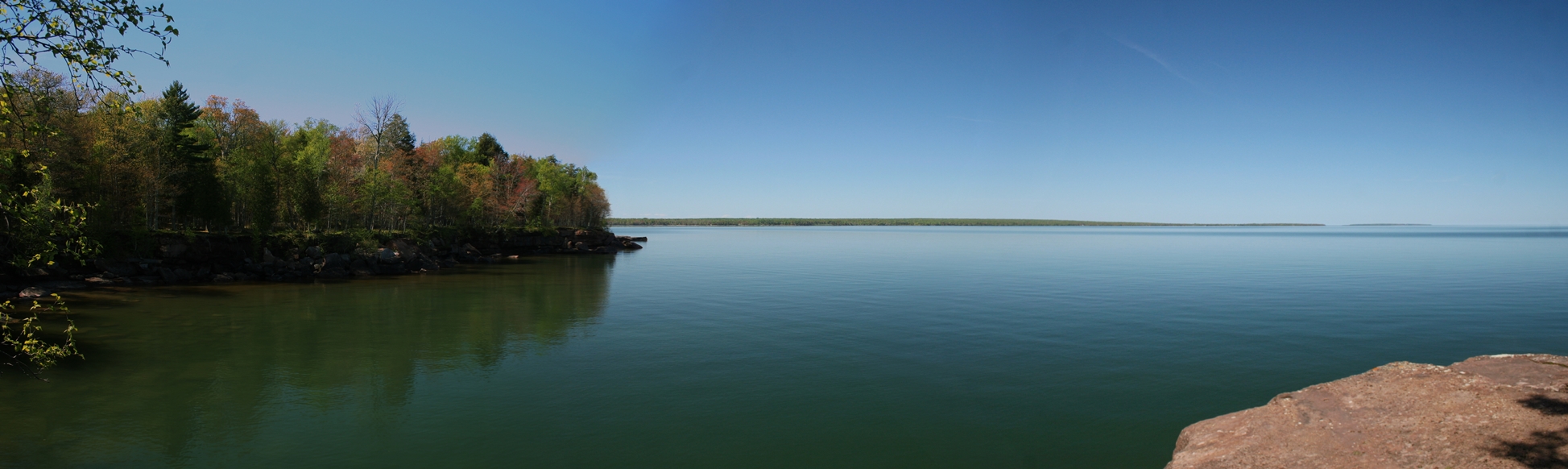
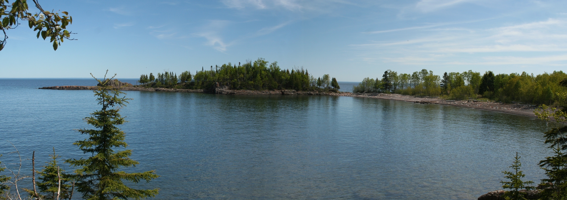
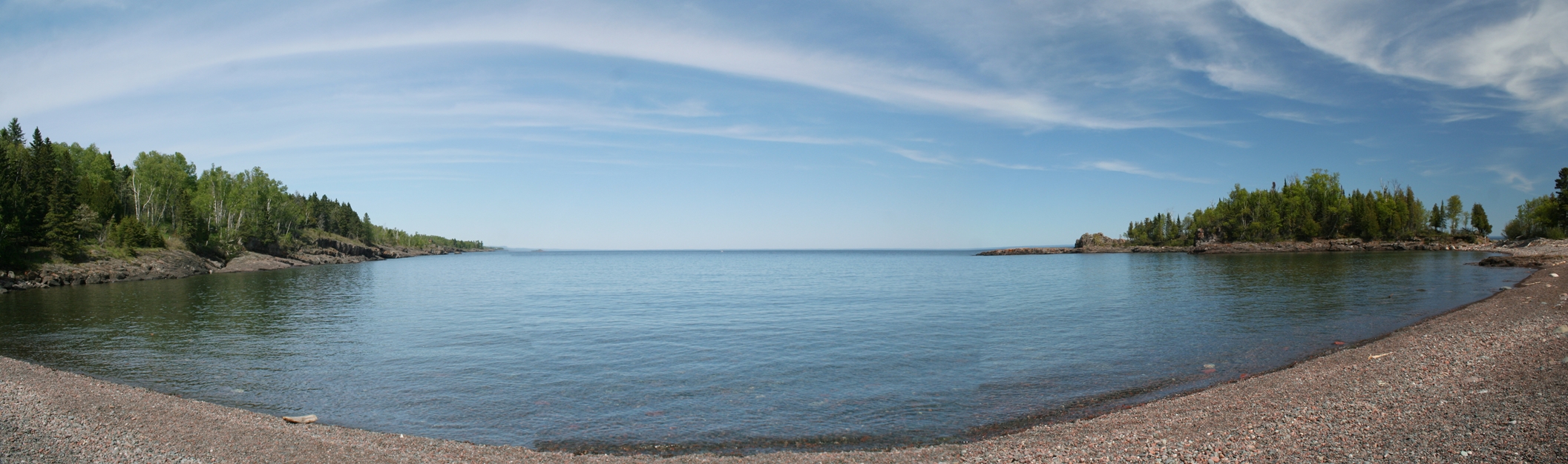
Sugar Loaf Cove
(Click on Images for Larger Picture)
|
We
visited Sugar Loaf Cove again this trip, and it
turned out to be a much better day, weather wise.
Last time we visited, a heavy fog rolled in just as
we got to the cove itself. I did cover a bit
more history and a few more pictures on the previous
Sugar Love Cove visit and you can find that by going
to the
Sugar Loaf Cove 2013 Photo Album.
|
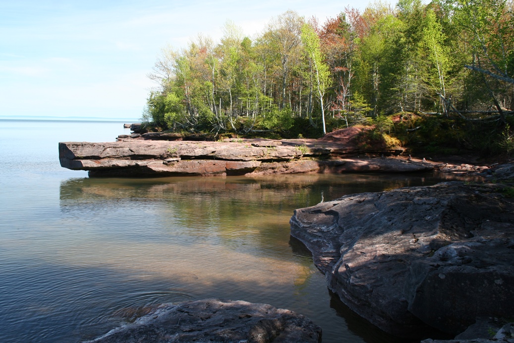
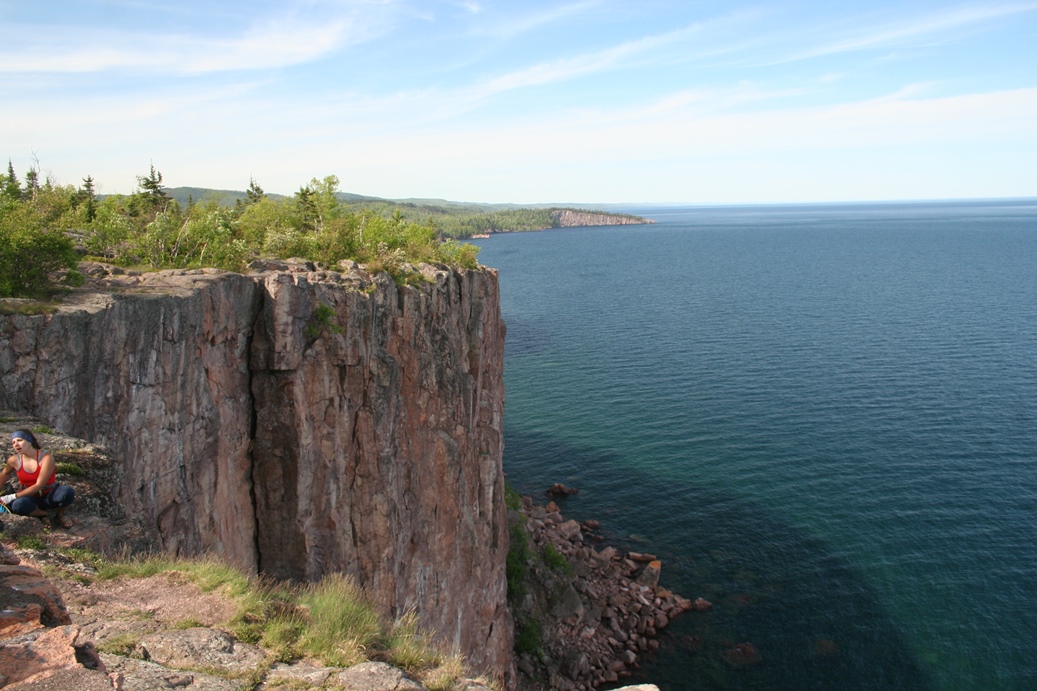
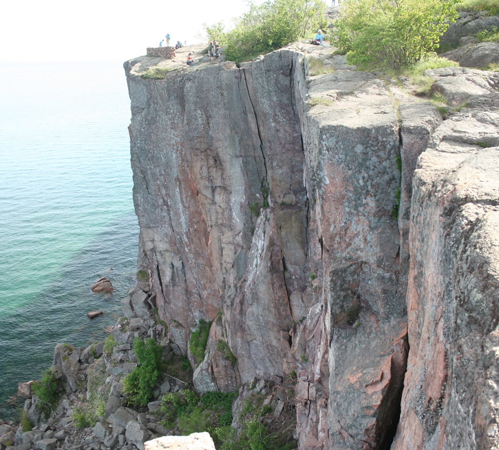
Palisade Head
(Click on Images for Larger Picture)
|
Palisade Head was another wonderful photo
opportunity; however, we missed the best part.
There was a group of climbers packing up their
equipment and if we had shown up just a little
sooner, I could have taken some excellent photos of
them climbing.
|
|